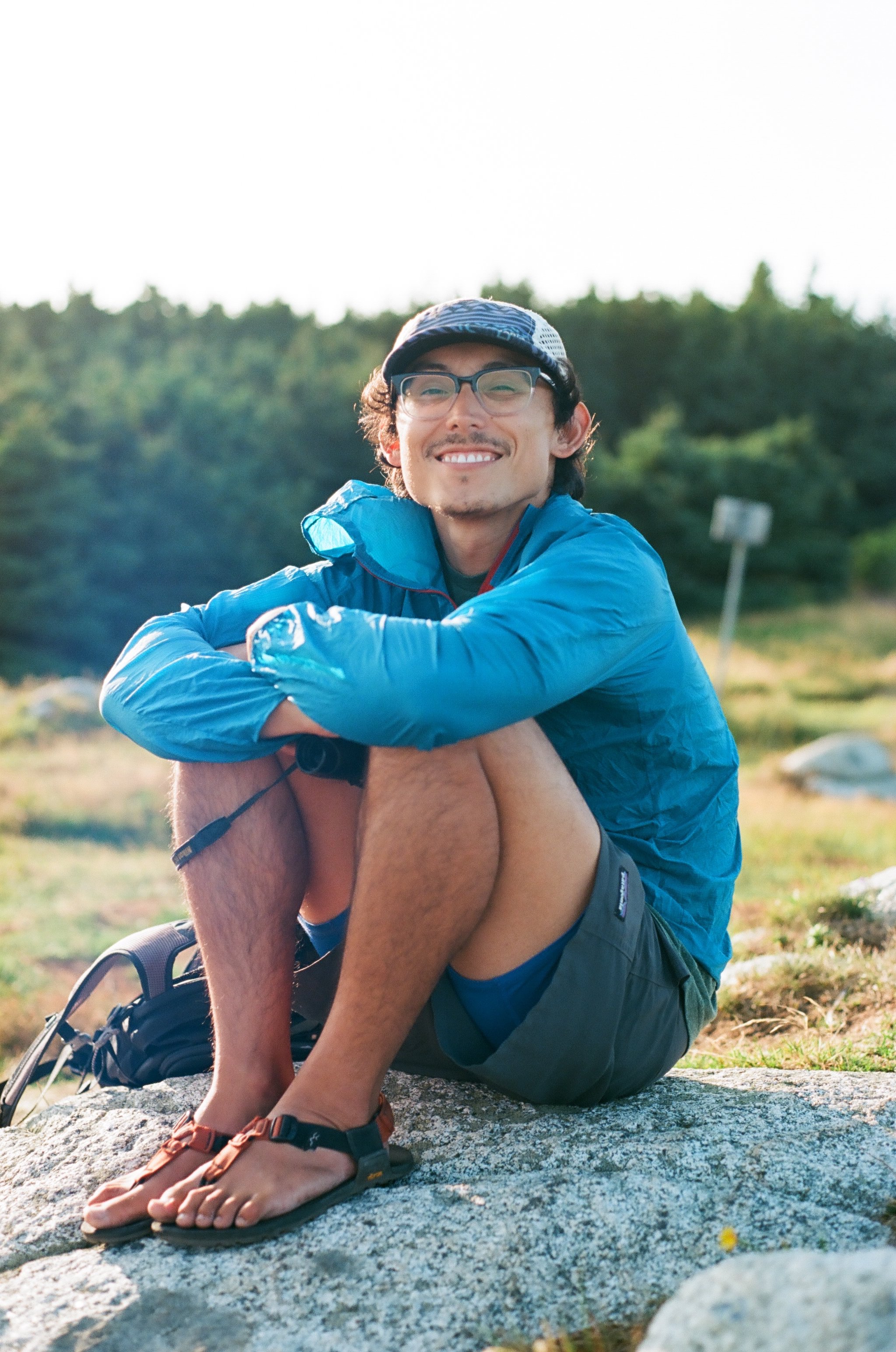
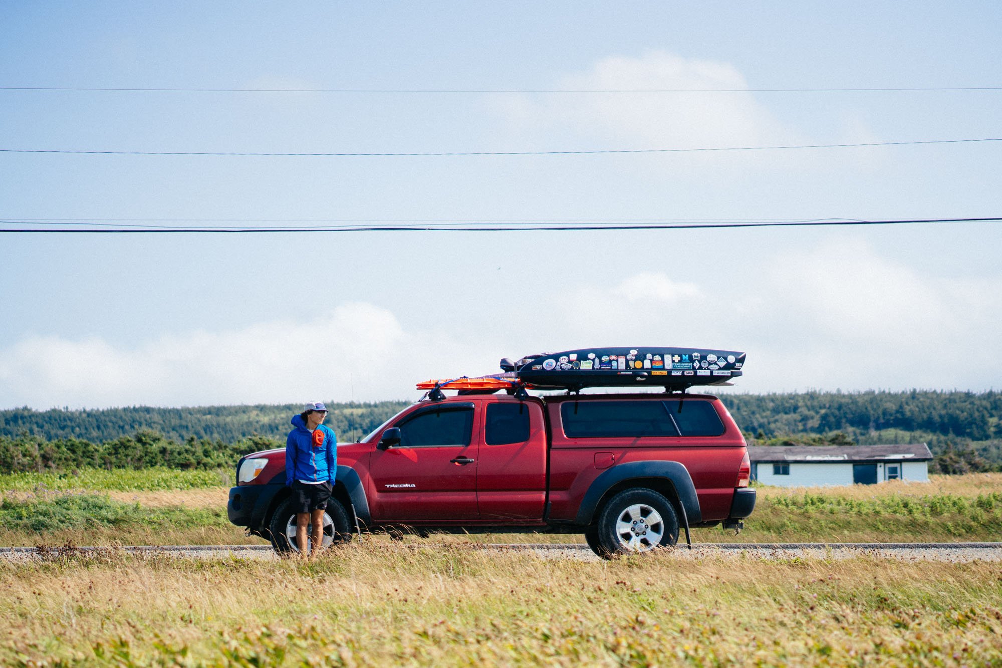
August 2018 Recap Part 2
Hey guys! Last we left off we were outside of Halifax, Nova Scotia. When we wrapped up there we hastily made our way to Cape Breton Highlands National Park!

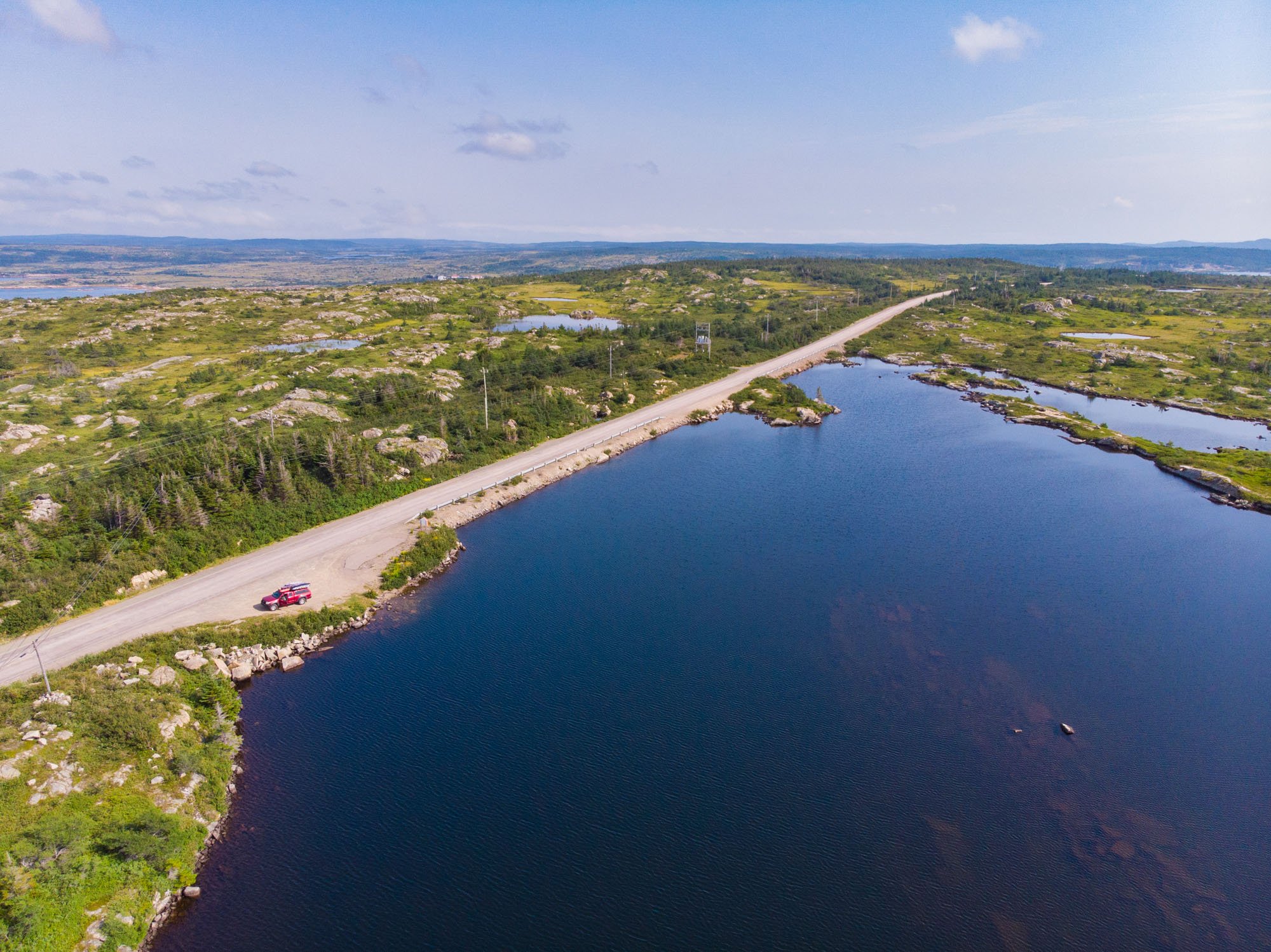
First flight for our new drone
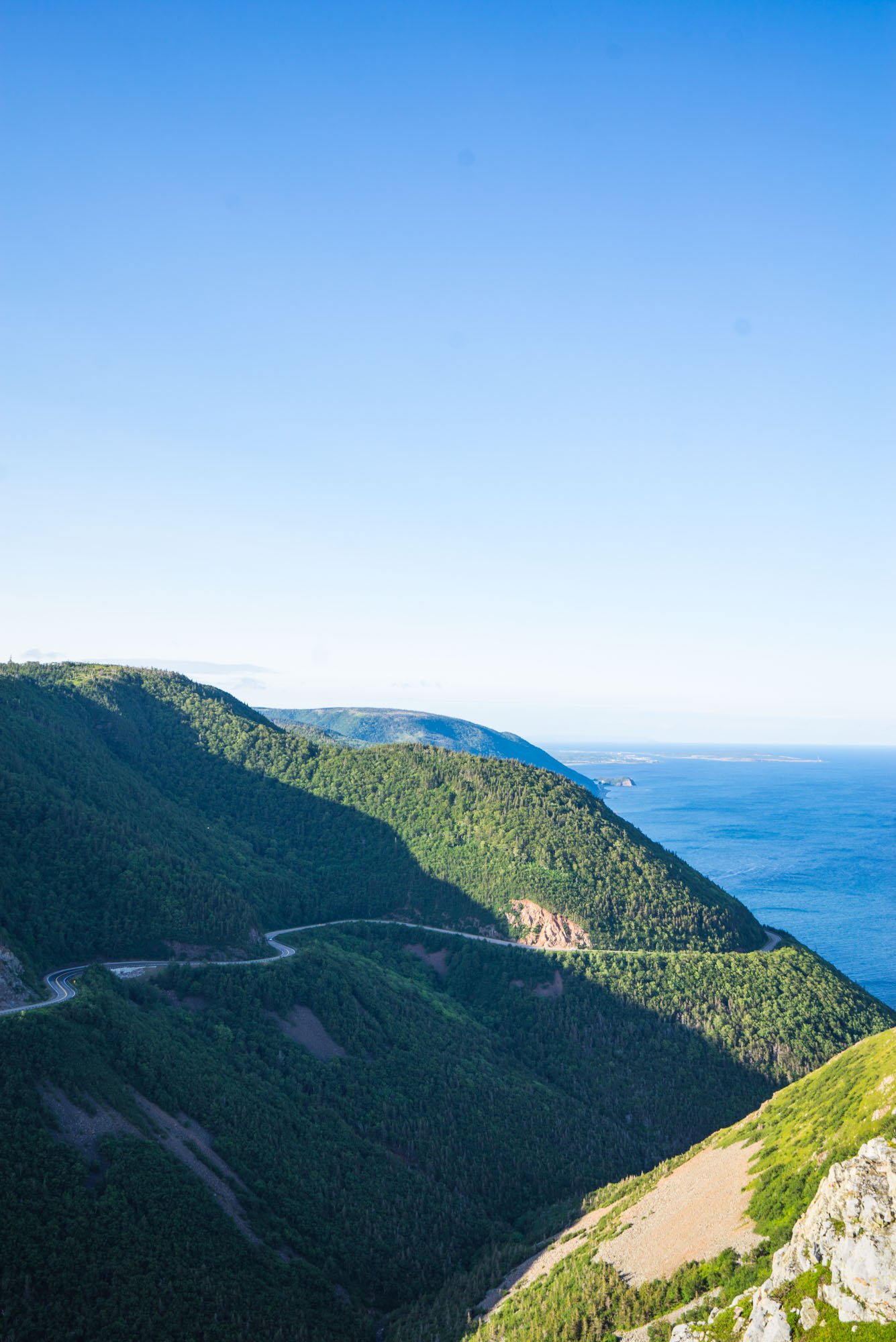
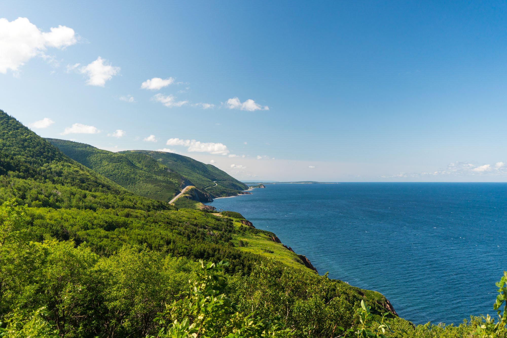
Cape Breton Highlands, Nova Scotia

Pre-sunset from camp

Sunset from camp
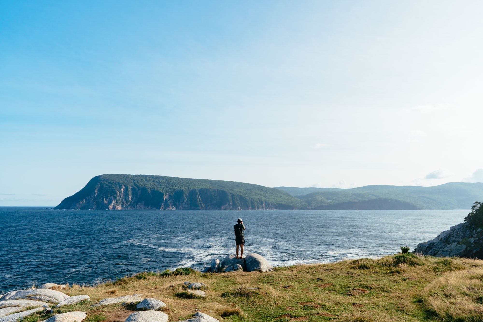
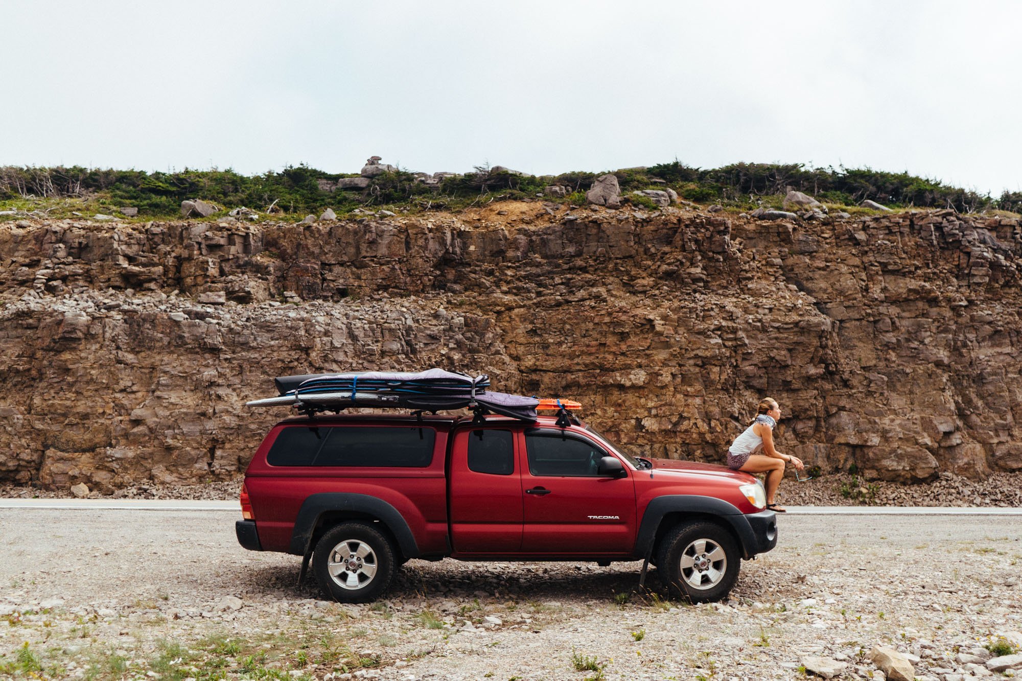
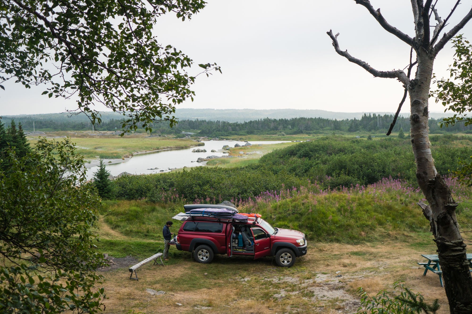
We made our way to the southwestern entrance of Cape Breton NP after our workday on a Friday. We decided to stop short of the park to camp at one particular spot we had found on the map a few days earlier. We knew it was going to be right on the water so naturally, we were bound to have a decent view. After a month of wonderful camp spots, you would think we’d stop being blown away by a good camp spot, but there was much rejoicing when we rolled into camp and saw this view (above).
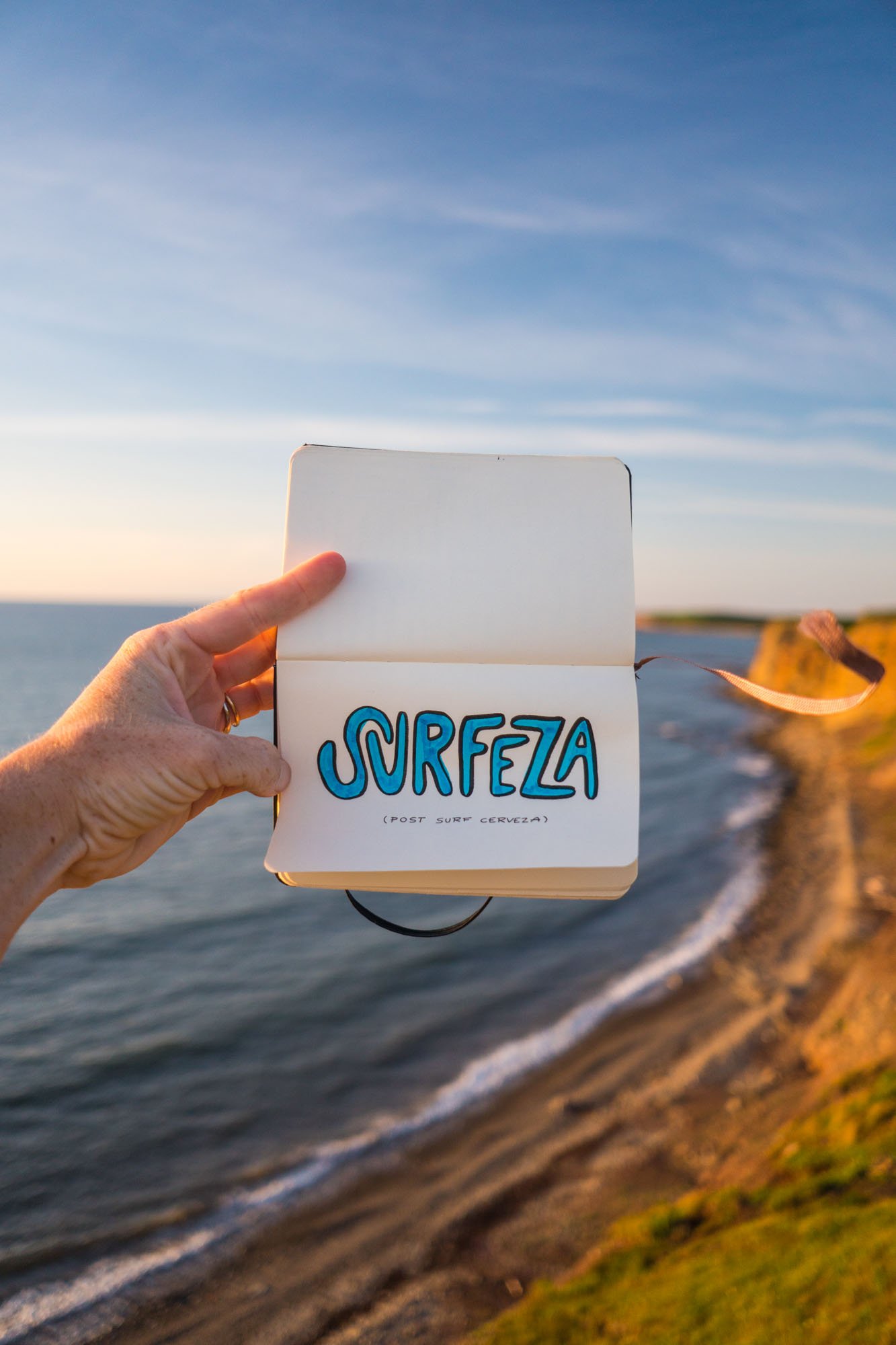
We used this amazing spot to try out our anniversary present to ourselves, a new drone! It was absolutely terrifying to fly the drone over the water for the first time, but it was so cool to see the landscape from a new perspective. From now on you should fully expect to see some amazing drone shots. You're welcome ;)
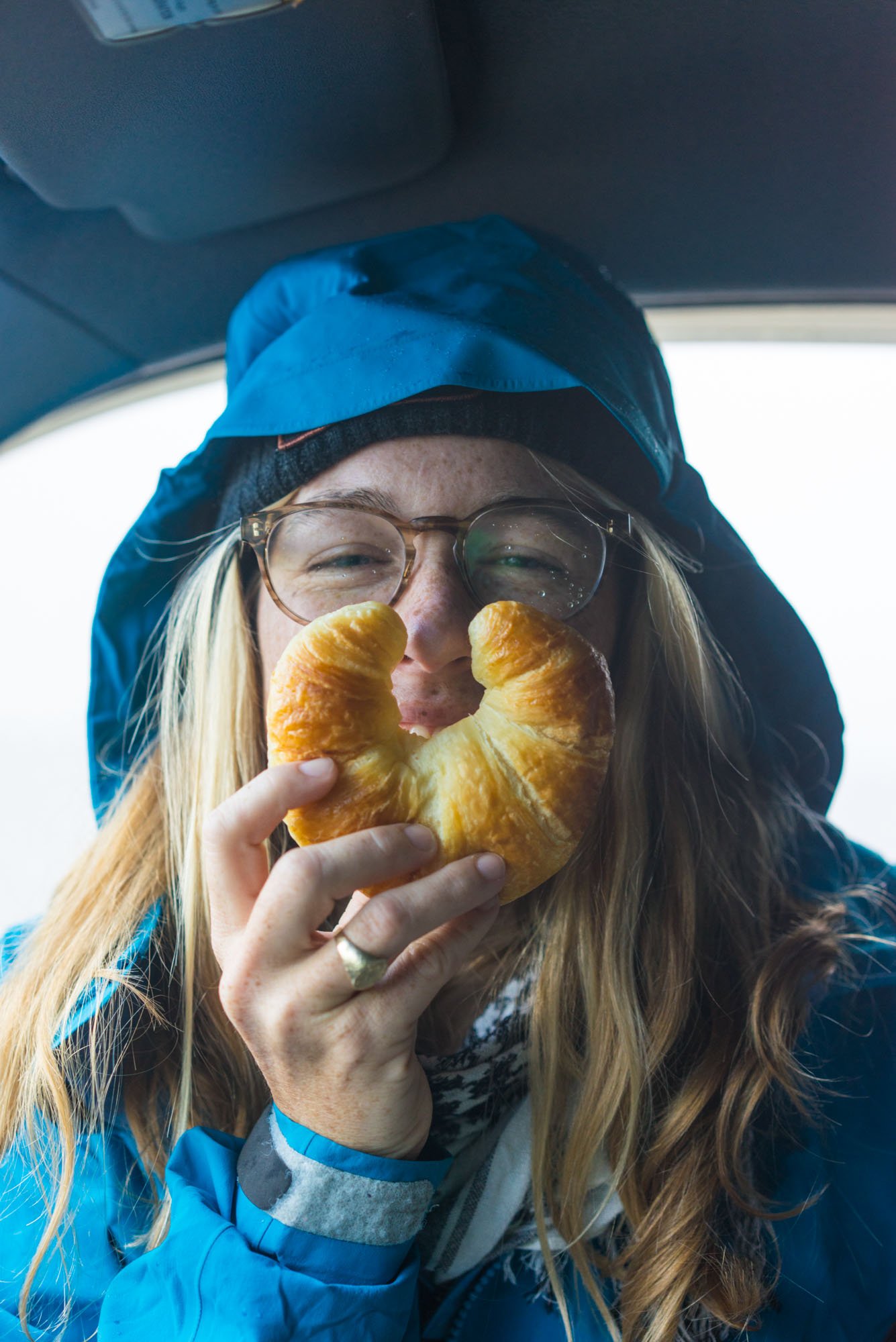
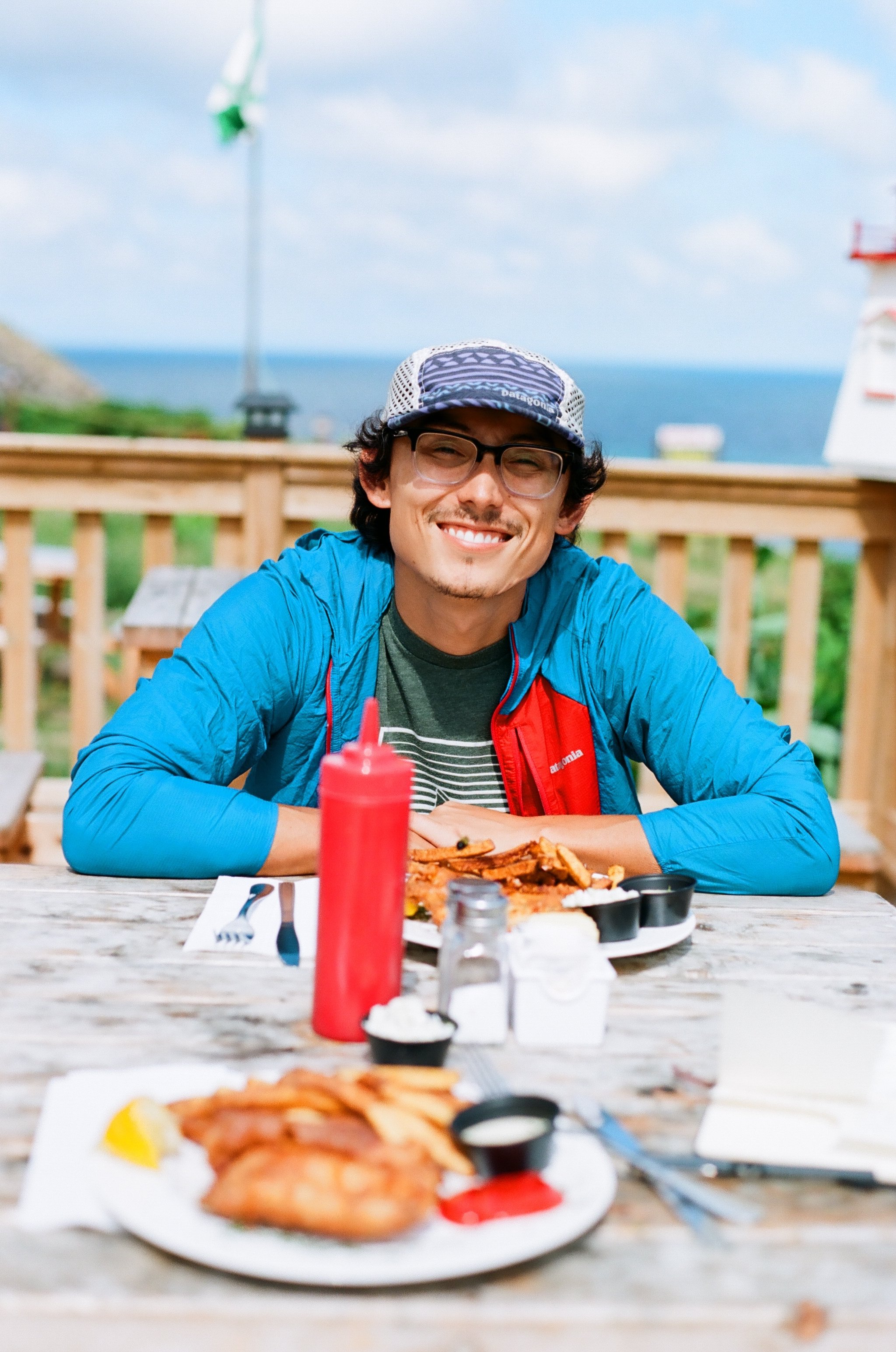
The next morning we headed into the French town of Petit Étang. Our friend Nick told us that we needed to hunt down a small shop that sold fresh croissants. Turns out this town is mostly populated by French Canadians that are direct descendants from the original French people to settle this area. They’re proud of their French heritage and thus their town has great croissants and other delicious french goodies. We made sure to test for their deliciousness as we passed through town!
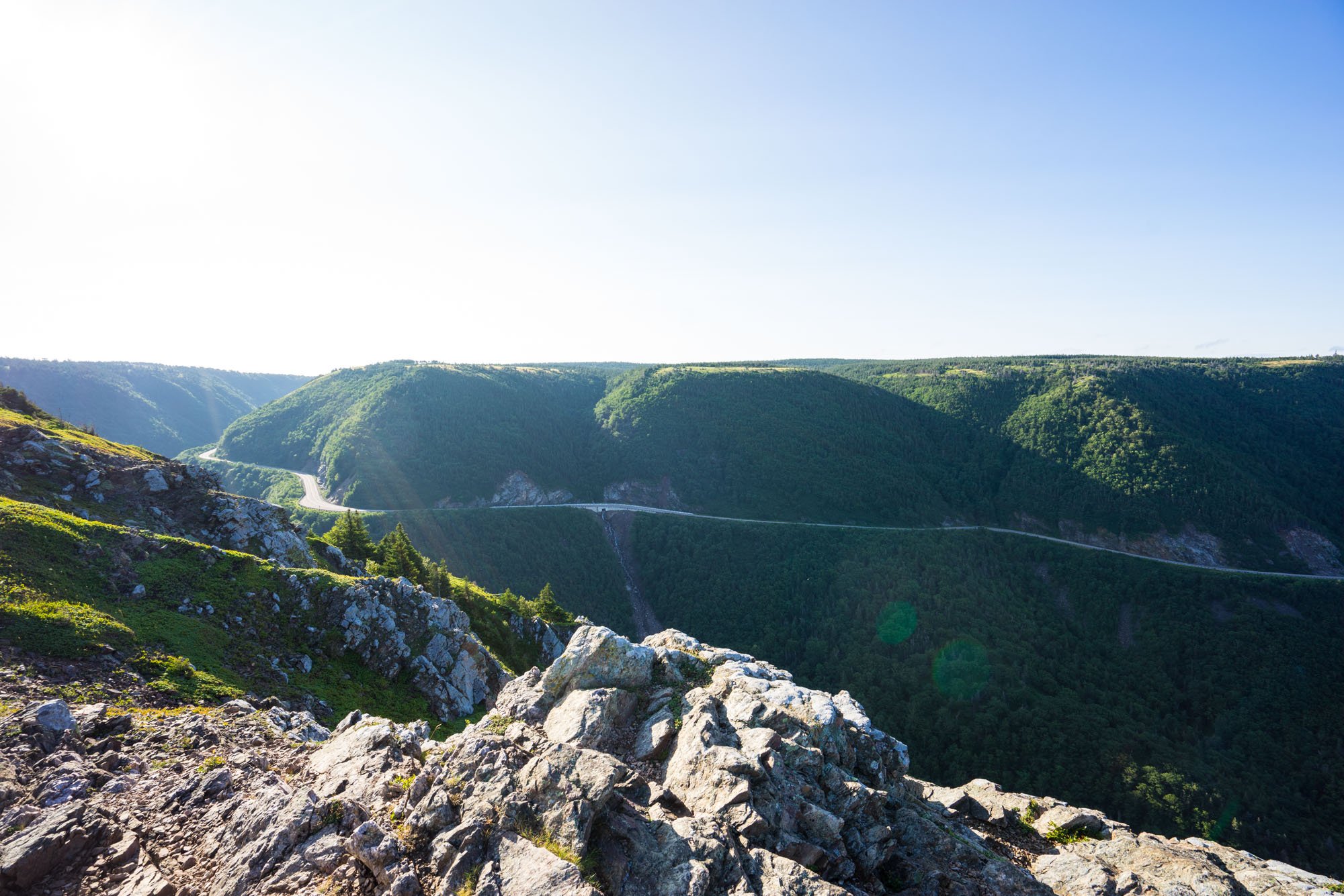
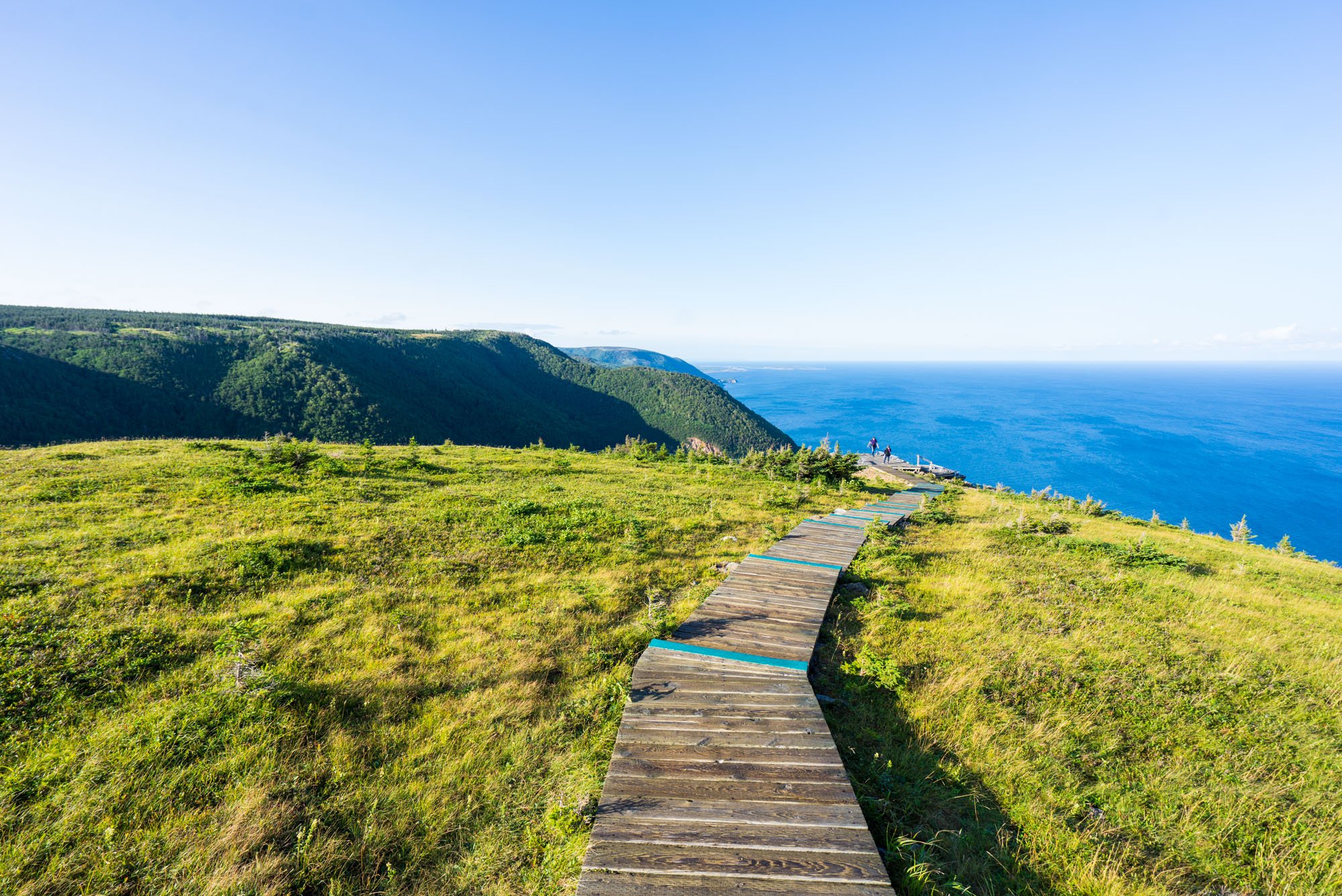
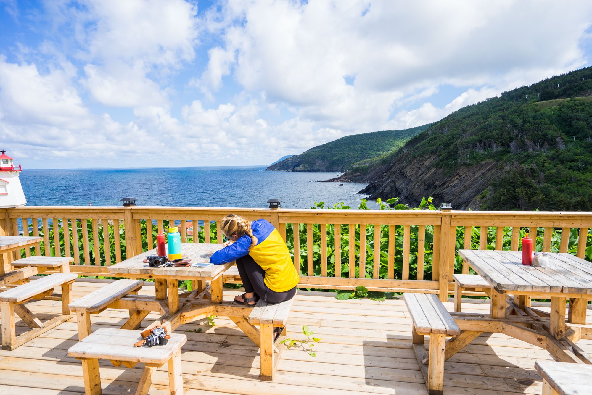
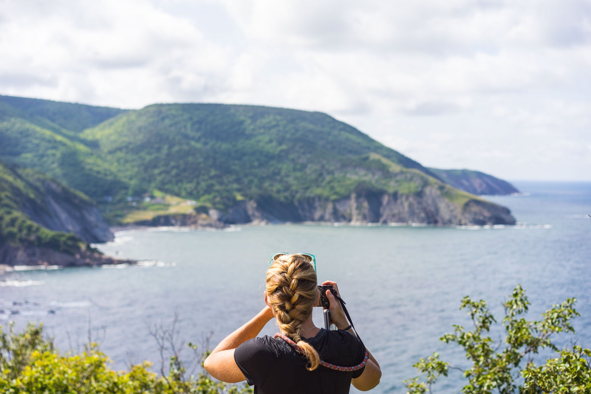
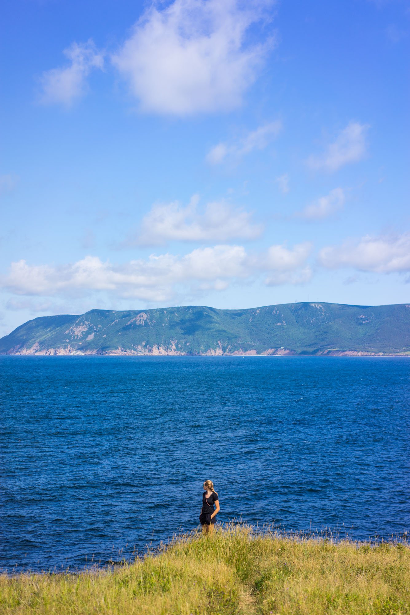
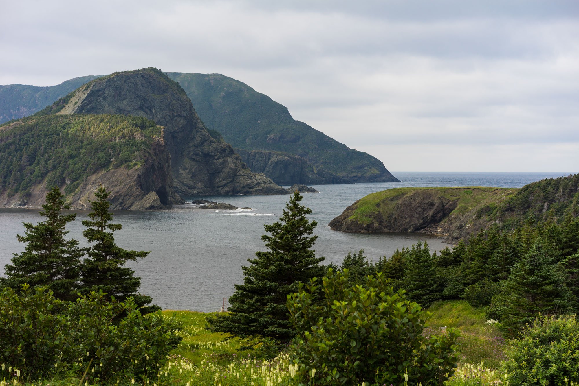
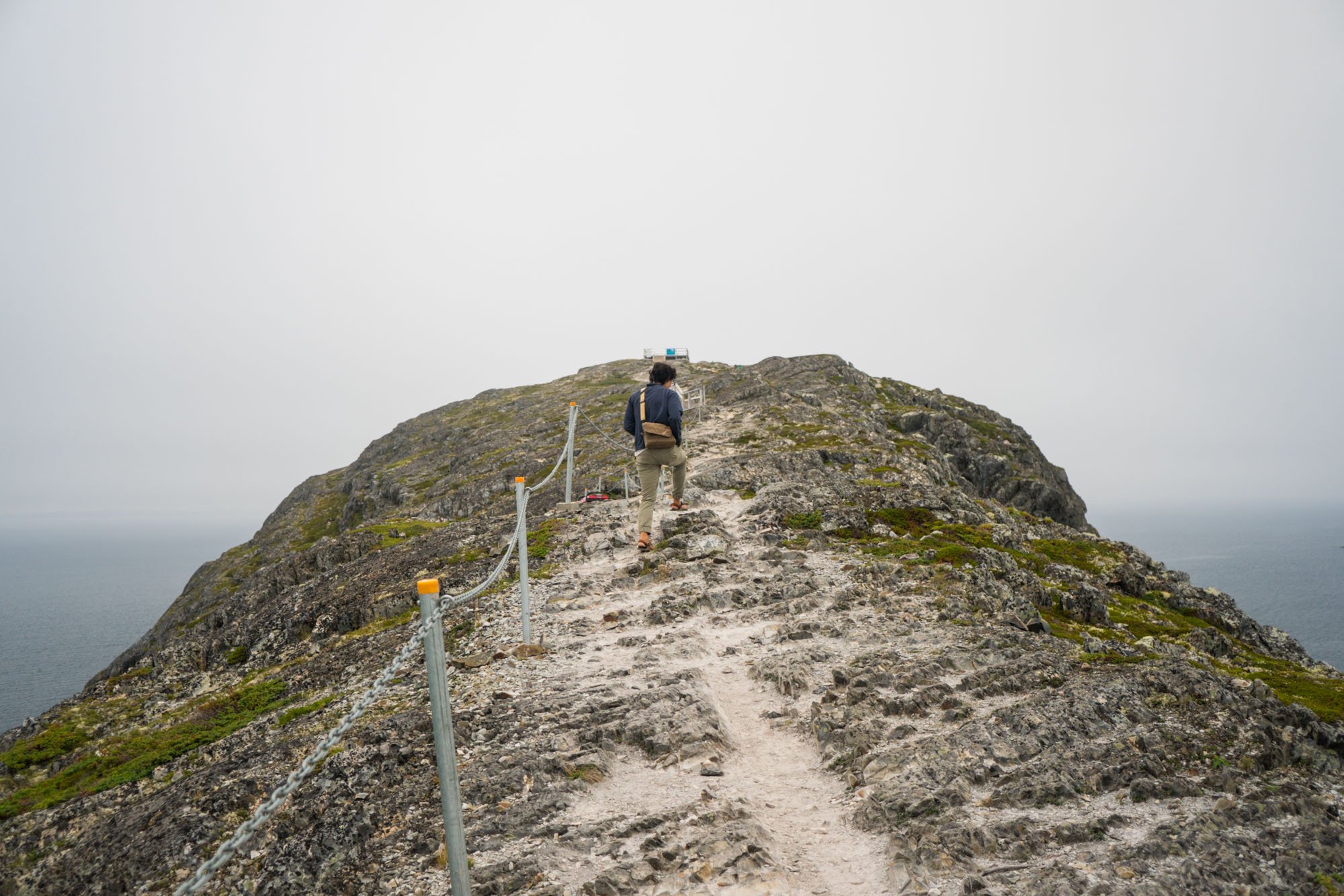
Once we were in the park we made a beeline to the Skyline trail, which is a very popular and heavily trafficked hike of 7.3km. The pictures speak for themselves. There is a reason why this place is so popular, amazing 360 views of the Cape Breton coastline and coastal highway. We were happy to beat the crowd and enjoy the clear morning!

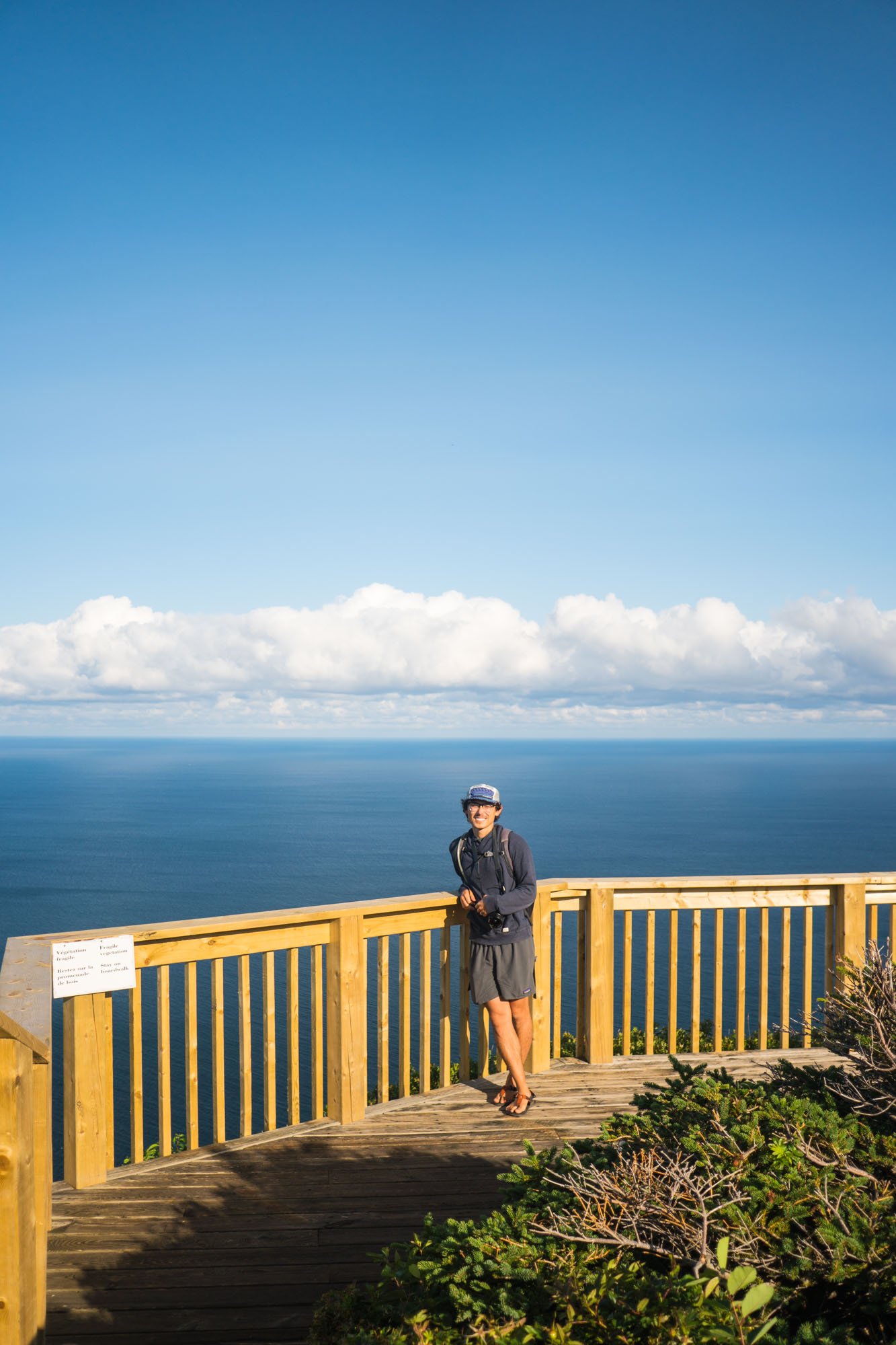
MAK on the Skyline Trail
We took the entire weekend stopping at nearly every small trail in the park. The entirety of Cape Breton’s trails and attractions are along the circumference of the park because the interior is left completely undisturbed for wildlife. It’s always nice to find places that are protected and mostly unreachable. It’s a cool feeling to stare off into the woods and know that there is nothing but wilderness left untouched. I honestly wish that more places were like this.

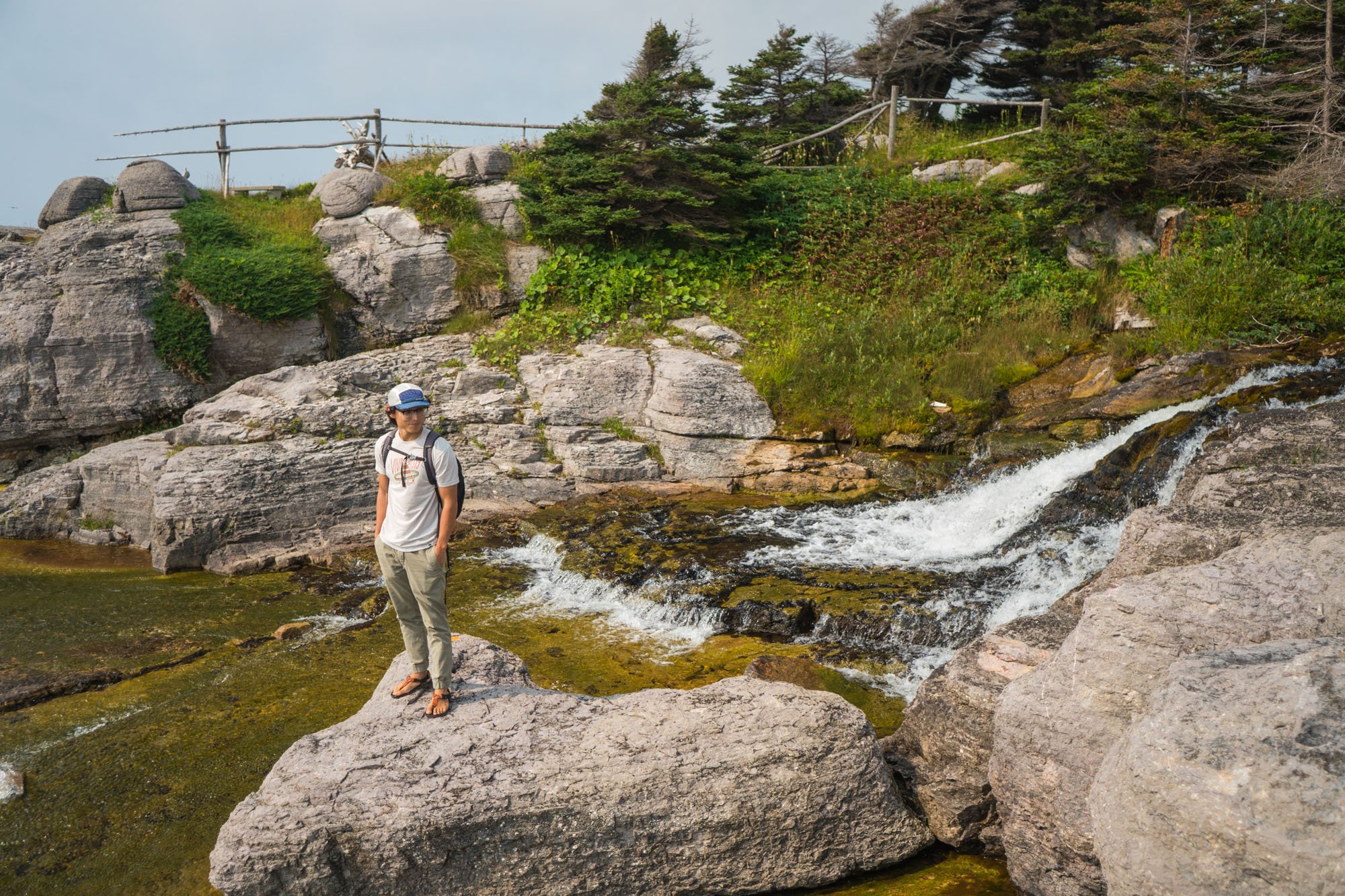
Owen exploring a waterfall in Cape Breton NP

Trail out to Steering Island, Cape Breton NP
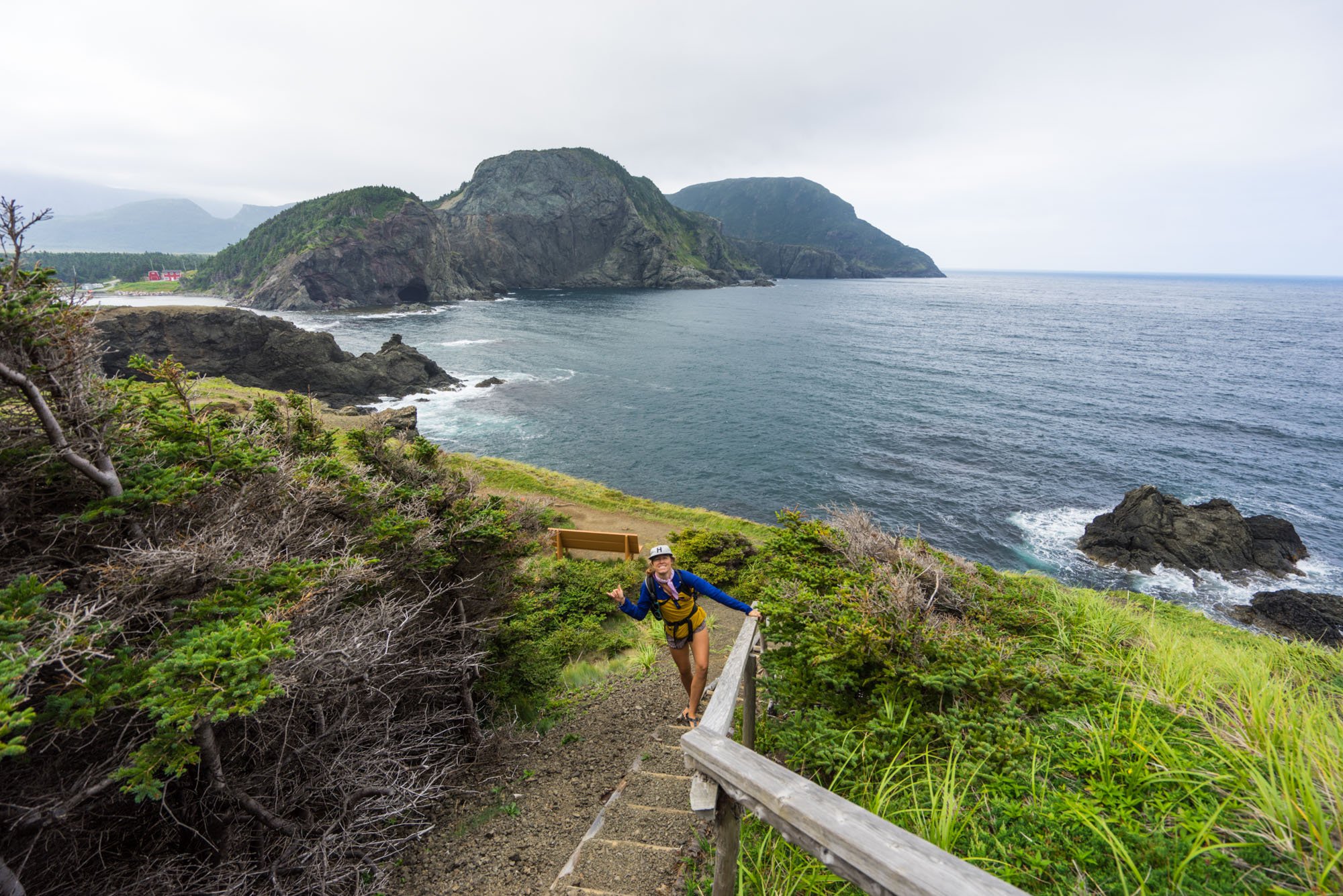
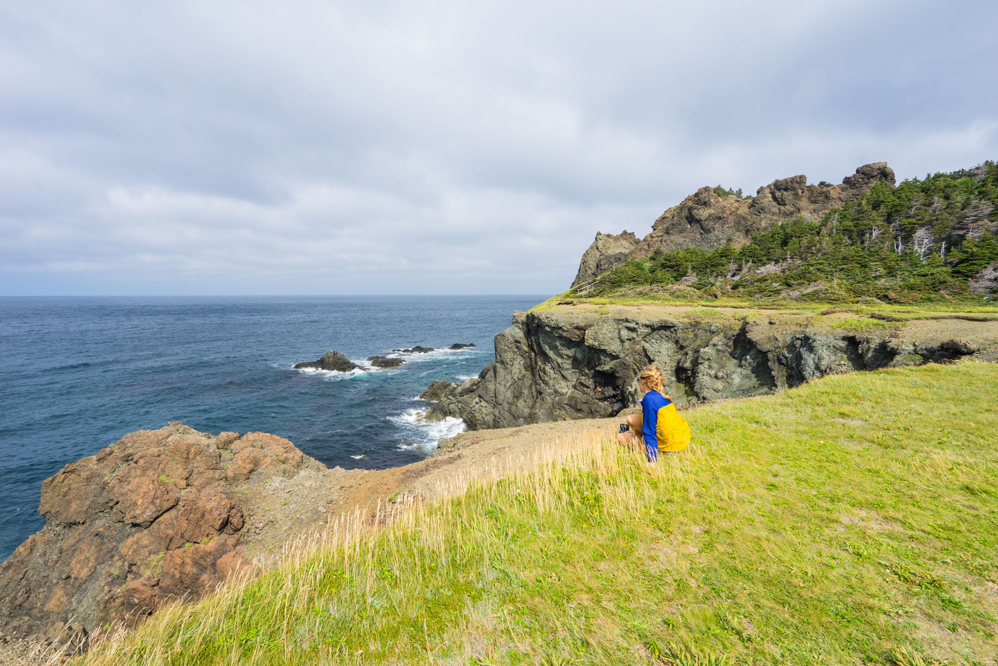
We then worked our way to the eastern coast of Cape Breton to hike the Middle Head Trail that starts behind the famous Celtic Lodge. The trail goes out to Steering Island for a 3.8 km loop to a beautiful view of the crystal clear Atlantic ocean.
If you ever find your way to this area, this is an easy and beautiful trail that we highly recommend. We went at dusk, the light was incredible, the ocean had a pretty big swell, and we ended up sitting on the edge just watching the waves roll in and crash against the cliffs. You could even feel the ground shake!
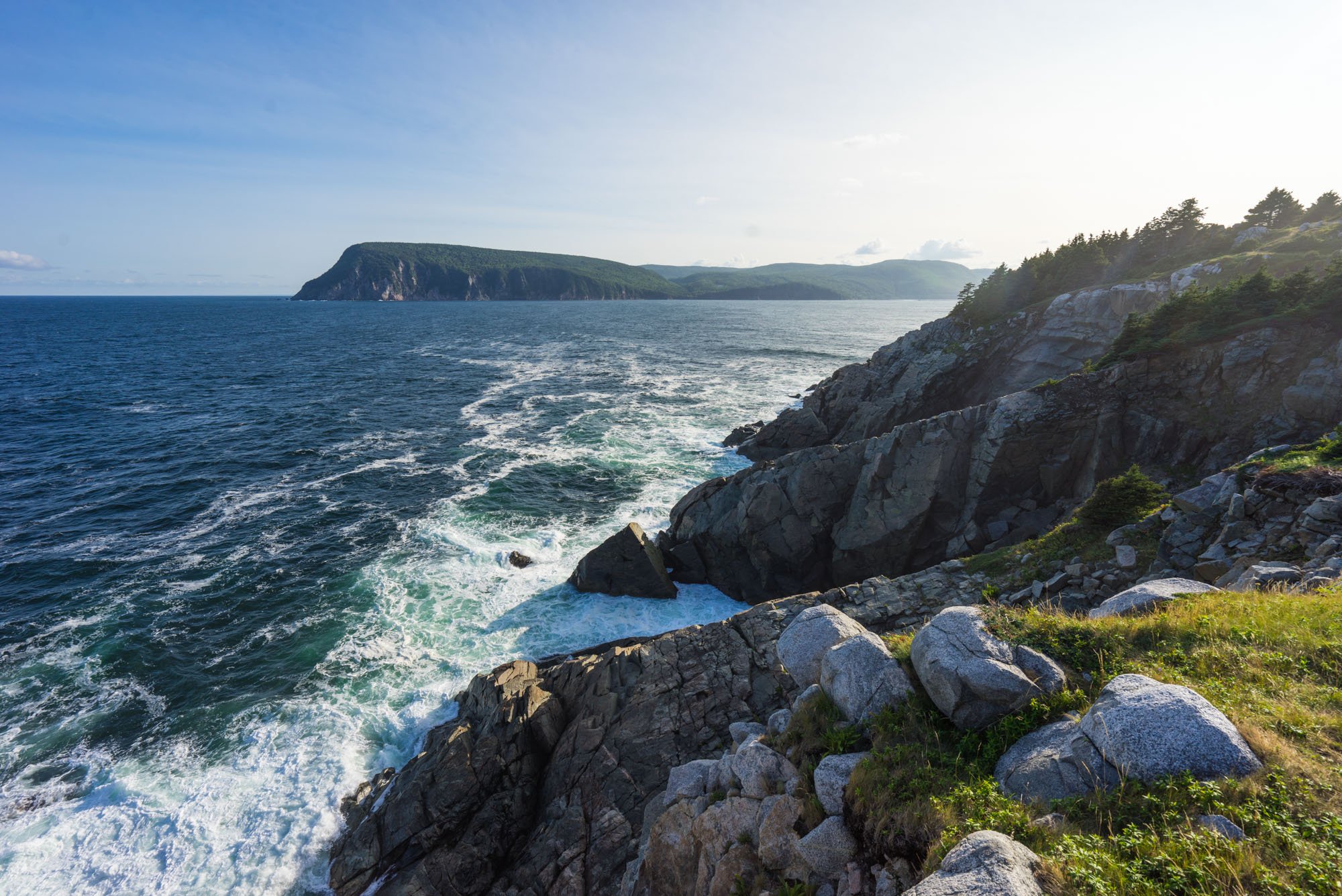
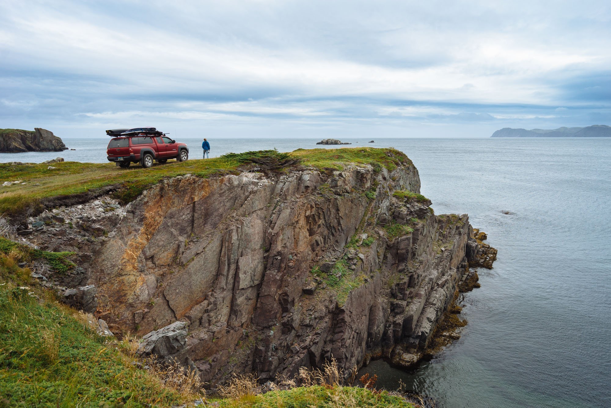
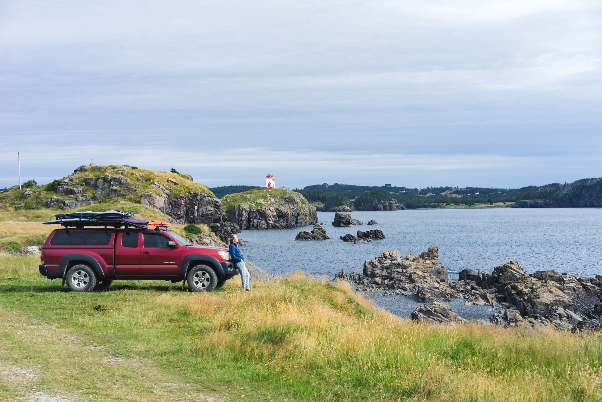
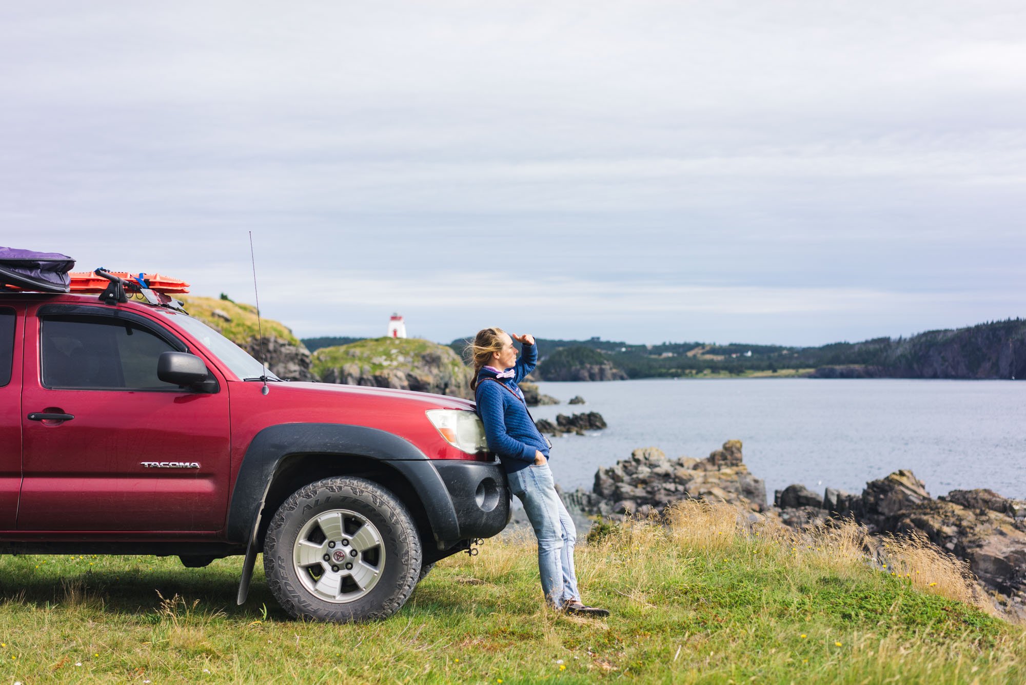
Meat Cove, Nova Scotia

End of the road in Meat Cove, Nova Scotia
As we entered the Cape Breton Highlands area we started to have people reach out telling us how much we needed to go to Meat Cove. When you hear of a place called Meat Cove… you turn the car around and you head to Meat Cove. As we drew closer we started to hear stories of what this place is known for other than its outstanding beauty. Until very recently this part of Nova Scotia was inaccessible by land, and the small town of people who lived here were an incestuous community. Due to their lack of options obviously!
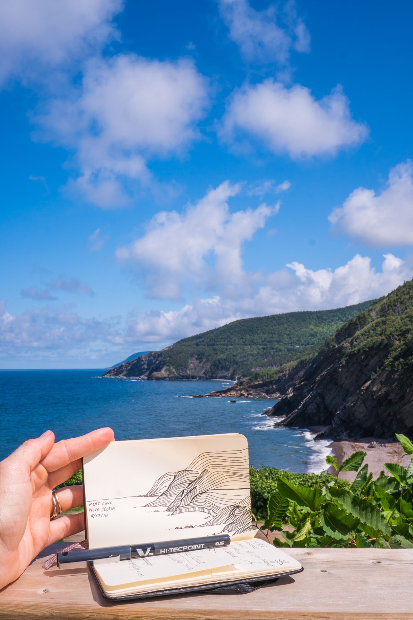
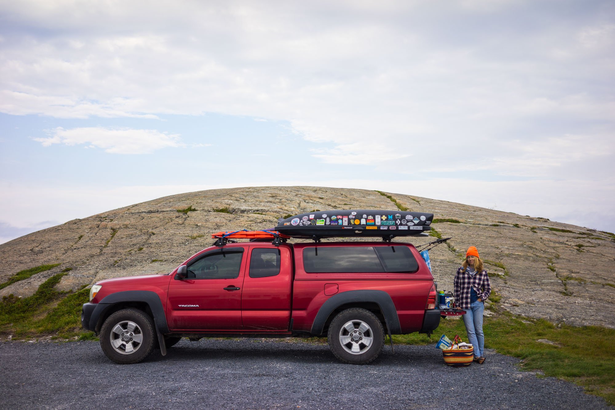
The long winding road into Meat Cove was rough, mostly unpaved, and totally worth the detour! The views were non stop in and around Meat Cove, however, the road just dead ends at a campground and small restaurant. We’re sad to say that we didn’t get a chance to stay at the campground because each site had a better view than the last. We did, however, stop to enjoy a lunch of fish and chips at the restaurant before going out to explore the beach below where we put Lando to the test! The road down was easy, but the road up was severely washed out, steep, and made up of loose rocks. Yet again, Lando showed us he can do just about anything.

Areal view of the coast outside of Meat Cove
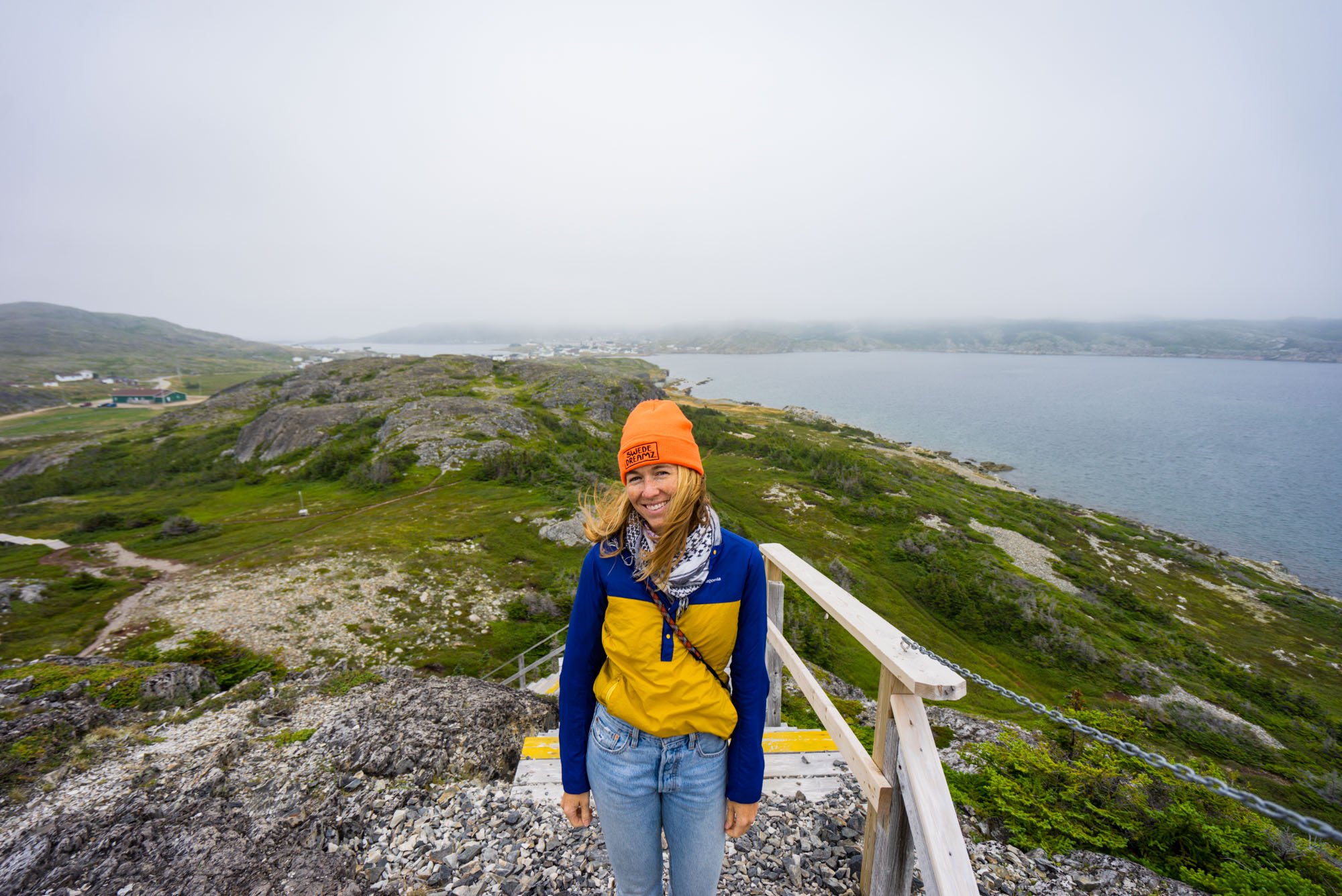
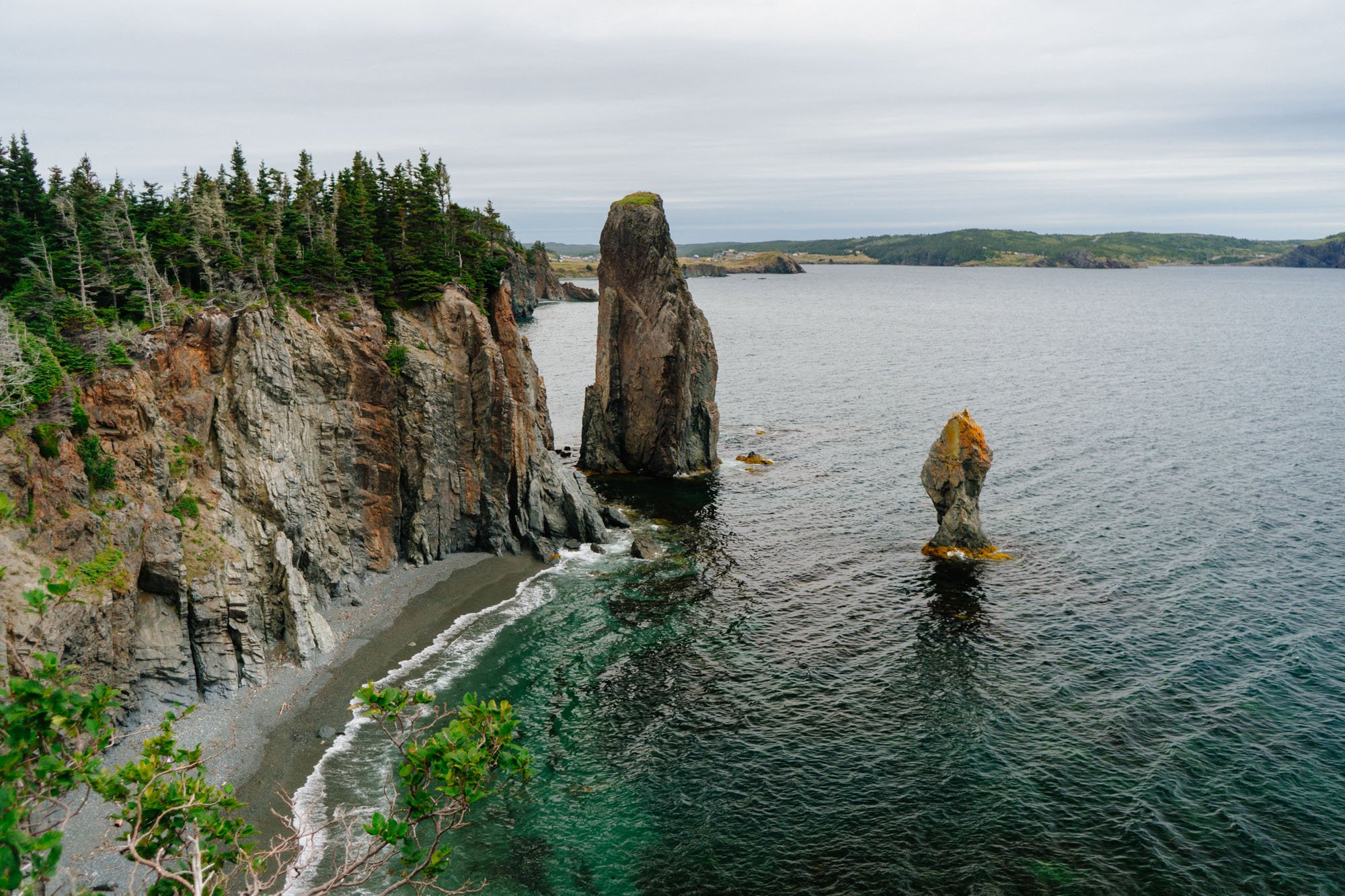
Cape St. George, Newfoundland

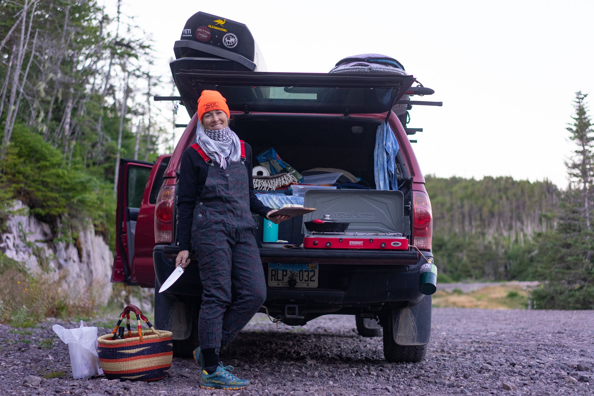
After leaving Meat Cove, we headed to Sydney, Nova Scotia for a few days of work before catching a ferry to Newfoundland. We don’t have any pictures of this time because it consisted of long days at Starbucks working, long nights at some of the loudest Walmarts we’ve ever stayed at because of the street racing car rallies that seemed to take place EVERY SINGLE NIGHT, the worst haircut I’ve ever had, and putting a deposit on our new rig that is yet to be revealed. More on that subject in Mid-January.

Two tickets to paradise (paradise = Newfoundland)
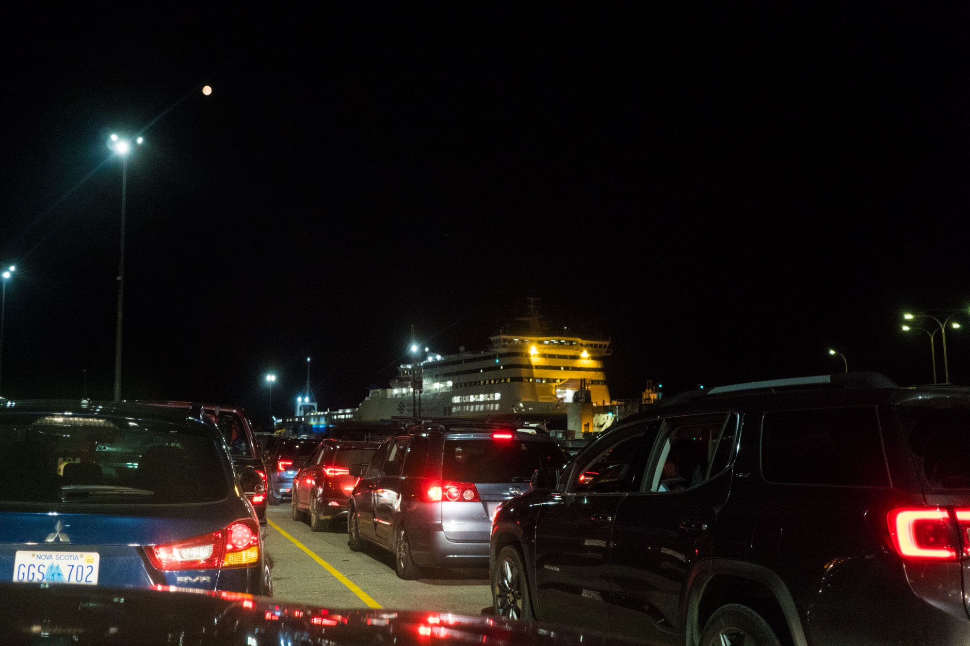
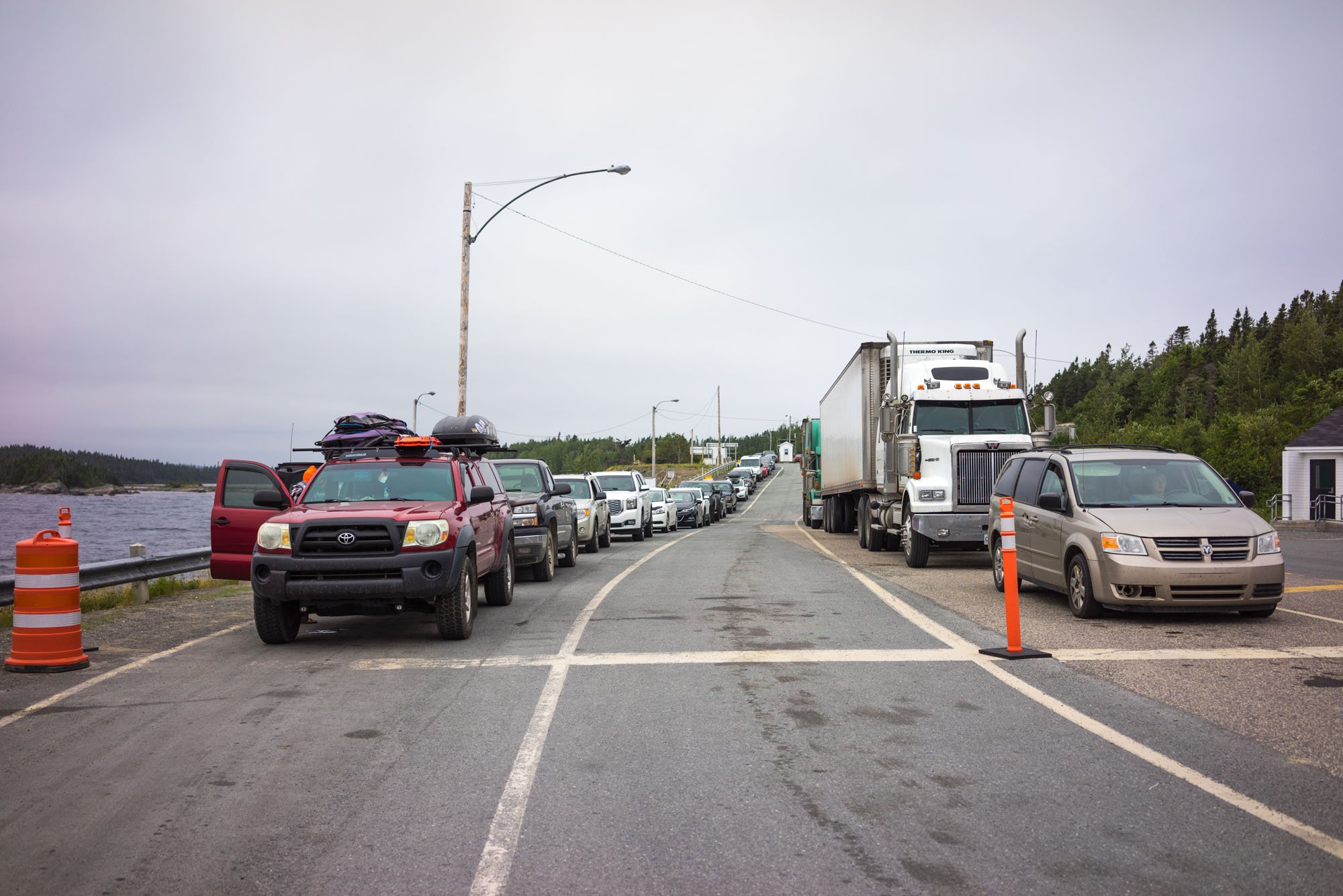
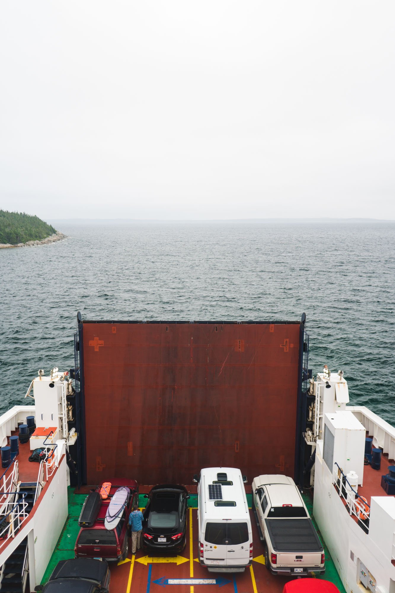
We were relieved when it finally came time for us to head to the port and catch our ferry to Newfoundland. Not only was Newfoundland high on our bucket list, we also decided to take two weeks off from work and just enjoy the journey. I have a hard time remembering the last time we took real time off from work, so the prospect of spending two whole weeks off was overwhelmingly exciting!
The ferry was a pretty wild experience! We purchased our tickets days in advance based on the recommendation from some locals. They told us that it fills up quick and to take the night ferry. We were glad we asked because we would have done the opposite. The ferry is 7 hours in total, so we had to queue up in the early evening for our 11:45 pm departure. We decided to spend an extra 30CAD per person to get cozy reclining seats in a quiet dark room facing the bow of the ship. After parking Lando deep in the ship we found our seats, put some music on, cuddled up, and passed out until we approached port in Port aux Basques, Newfoundland at around 6:30 am. ProTip: bring your own blanket, it gets really cold on the boat!
After reclaiming Lando and disembarking the boat we quickly started working our way up the coast to Cape St. George. We stopped at the visitor center in the area to get some info about the drive around the cape because we were coming in completely blind. After talking to a Canadian who claimed to have an American accent we were armed with maps and some great recommendations for our drive.
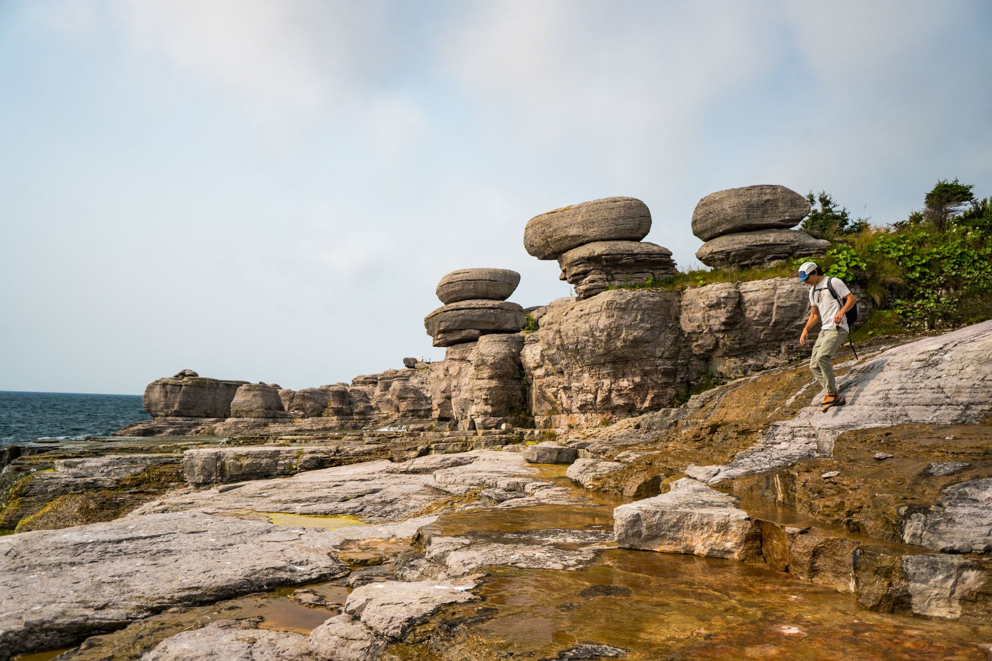
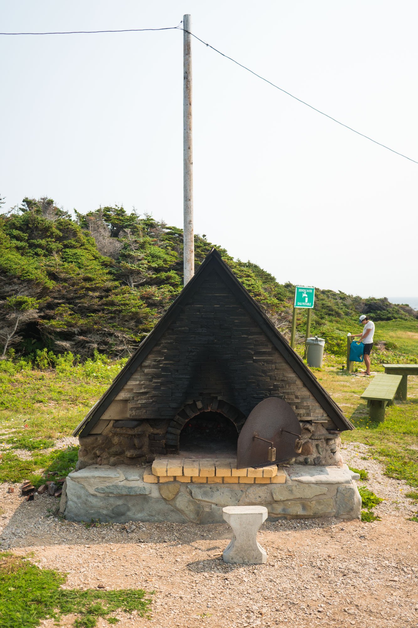
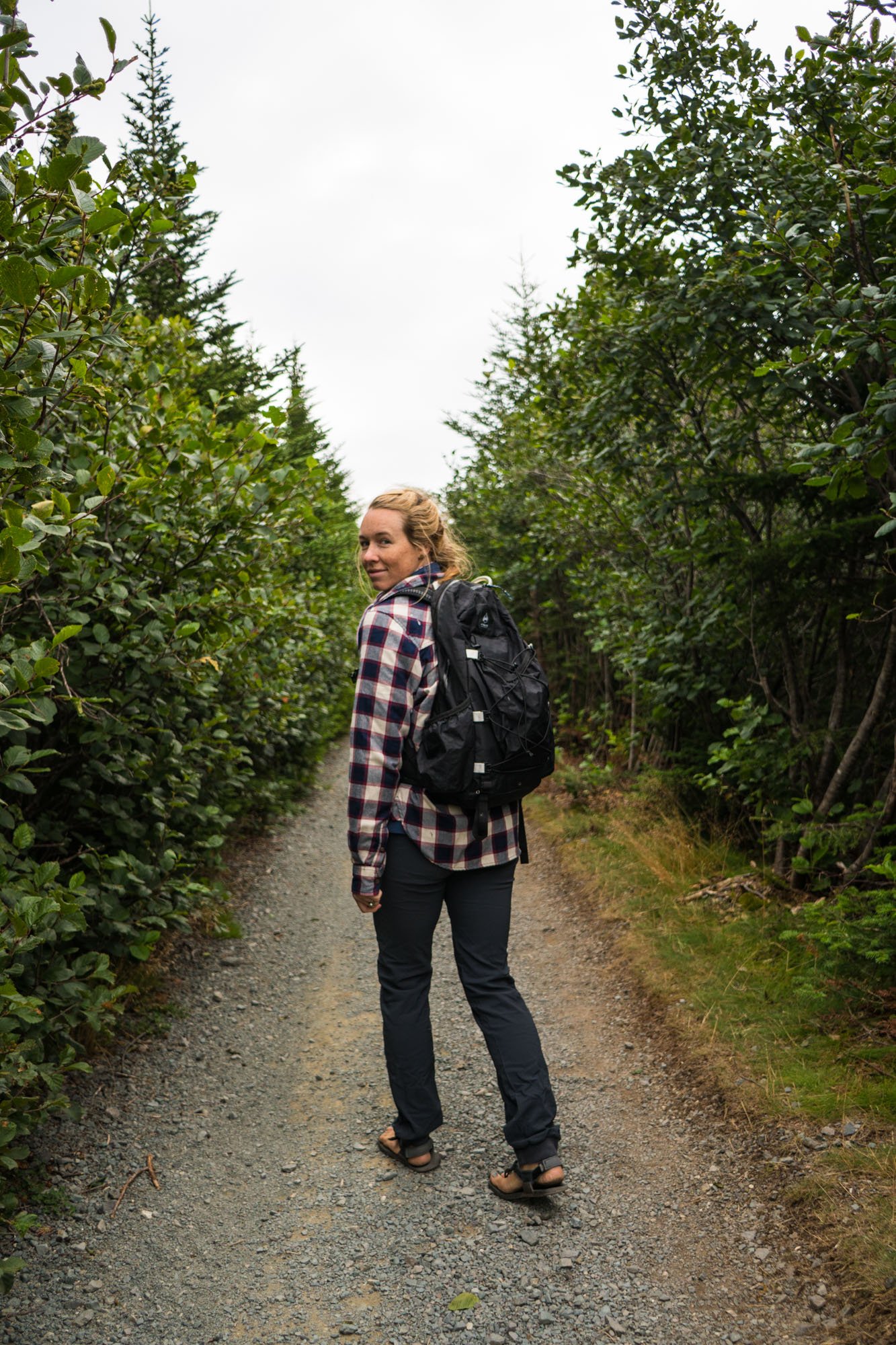
The coastal road was a fun way to spend our first day in Newfoundland. We stopped at Sheaves Cove to see some cool rock formations and waterfalls and then later at some old bread ovens where people still bake bread to this day. Apparently, they were built by French migrant fisherman and were left as a way of making food when they return to the area. If I recall correctly, these bread ovens have been in the area for over 400 years and are a cherished piece of history to this part of Newfoundland. If you head to this area, be sure to grab a roll and fill up your water jugs while you’re there. Owen can be spotted in the background filling up water after snacking on fresh bread!

The view behind the bread oven. Cape St. George, Newfoundland
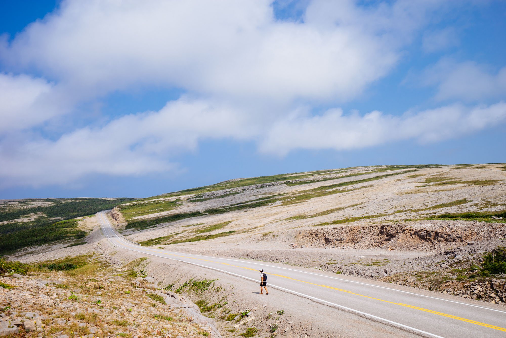
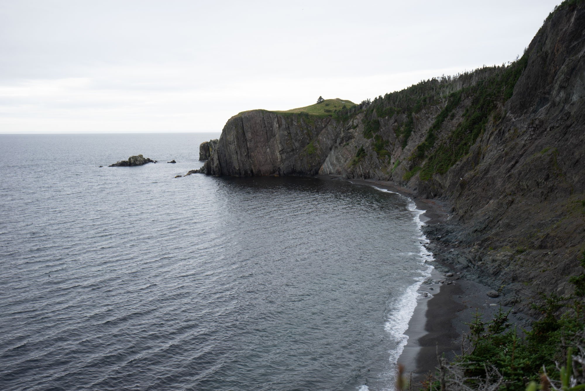
After leaving the bread ovens we started to turn to the north side of the Cape. The drive up until this point was lush, green, and had endless ocean views. The ocean views remained but the terrain turned to rock and low brush and honestly felt like a completely different planet.

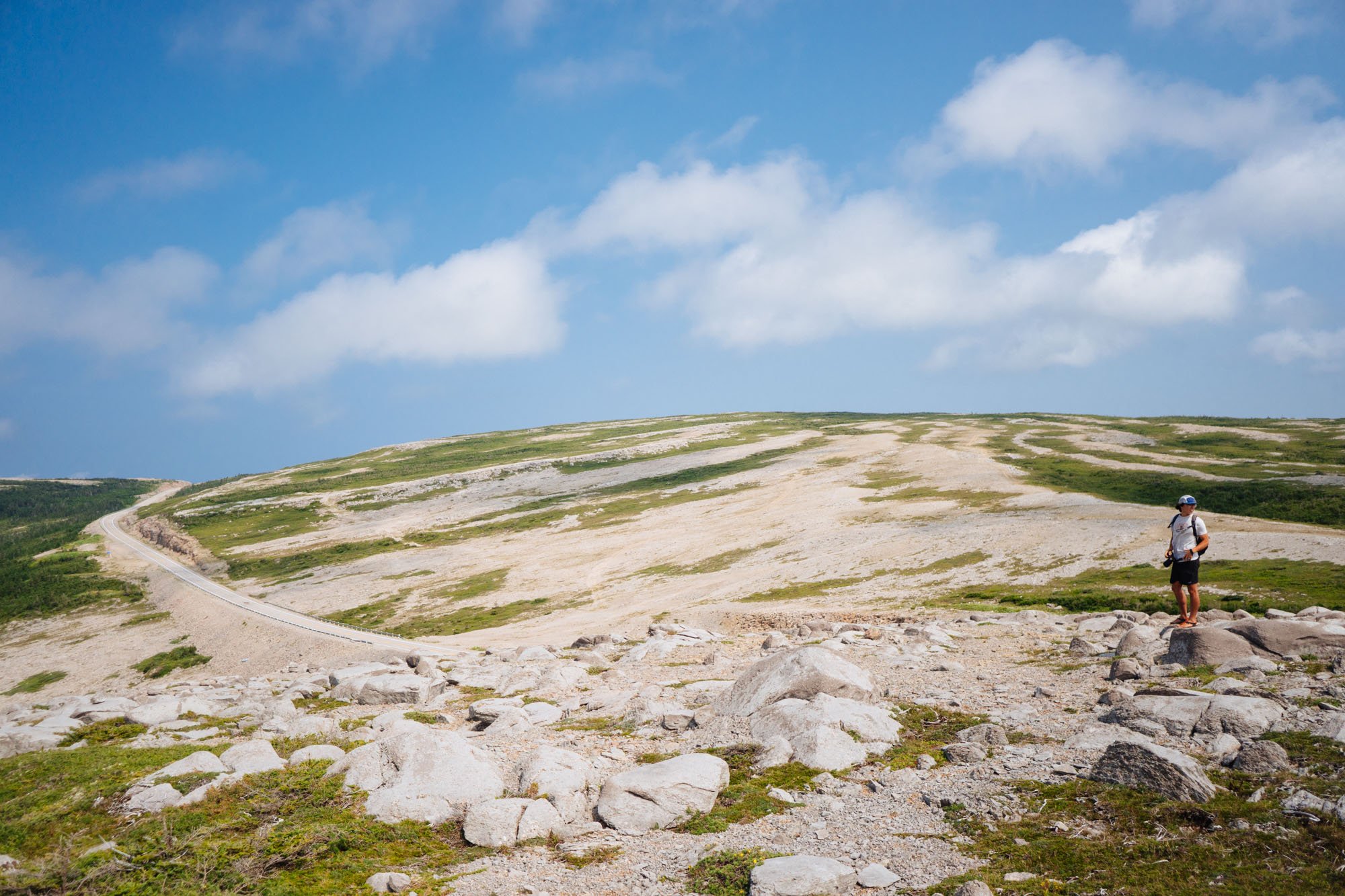
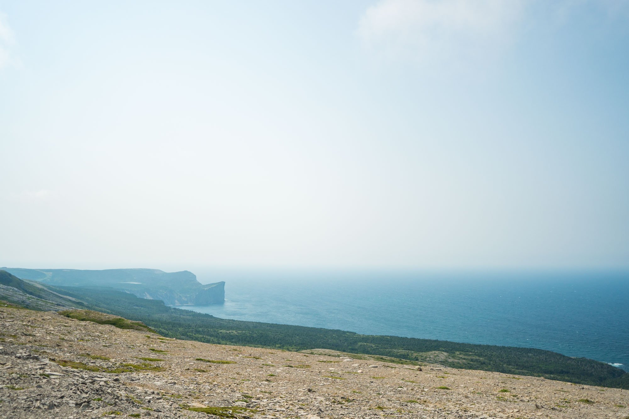
Despite the fact that this spot was not a point of interest on our marked map, we couldn’t resist stopping to explore it. We found a small pull off and just started walking. We got to the top of the hill on the water side and were hit with a breathtaking view and winds that threatened to push us over if we let our guard down. After scouring the hill we made our way back down to Lando and decided to drive up the opposing hill to find a high spot to eat lunch at. Lando once again was a complete stud and crawled his way up the steep face made entirely of loose rocks. There is a picture above of the spot where we ate lunch. It wasn’t a bad place to enjoy our first lunch in Newfoundland.

Narrow spit of land on the north side of Cape St. George
Continuing our journey north we found a small spit of land that was so narrow that we had water on both sides of us for miles. We turned onto the road not knowing what laid ahead but feeling that we needed to see it for ourselves. It was the perfect opportunity to bust out the new drone to get a cool perspective of the unique piece of land. In the end, we drove to the end to find some friendly locals drinking beer in the road and who seemed surprised that we drove all the way from Florida to a small fishing town clinging to the rocks.
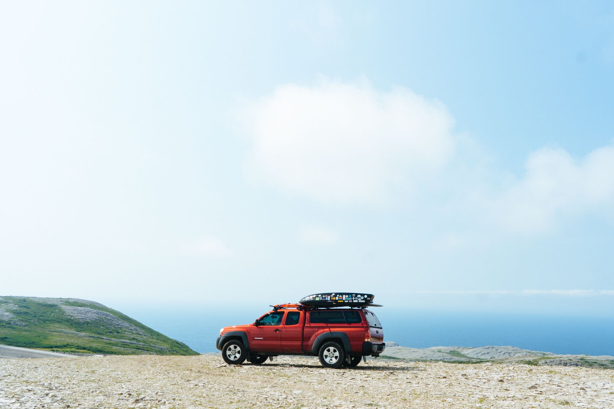
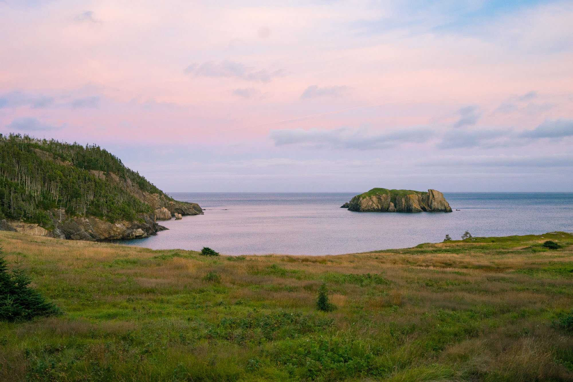
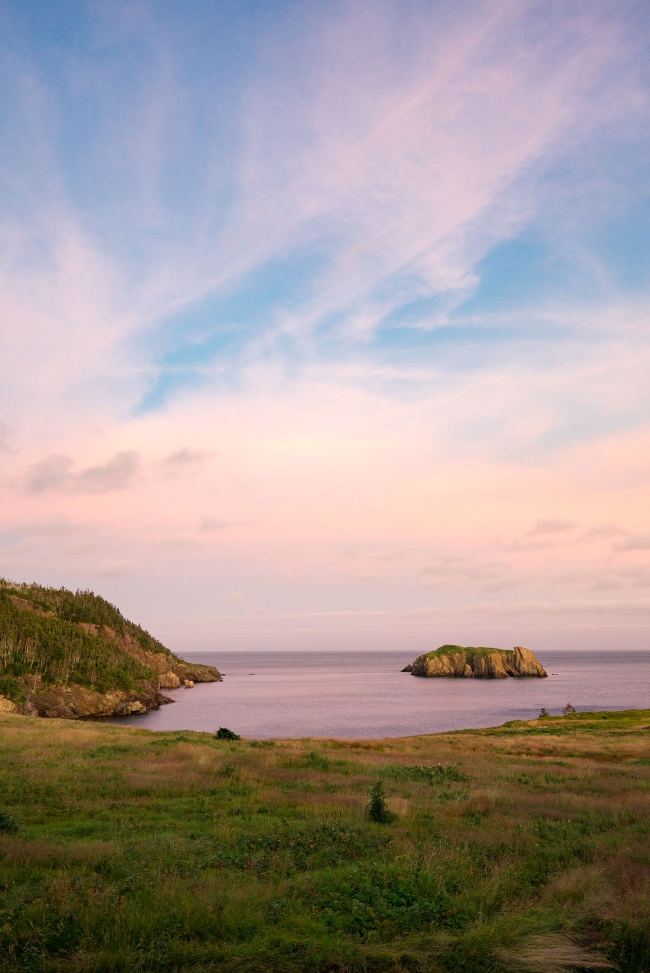
Bay of Islands, Newfoundland

Bottle Cove, Newfoundland
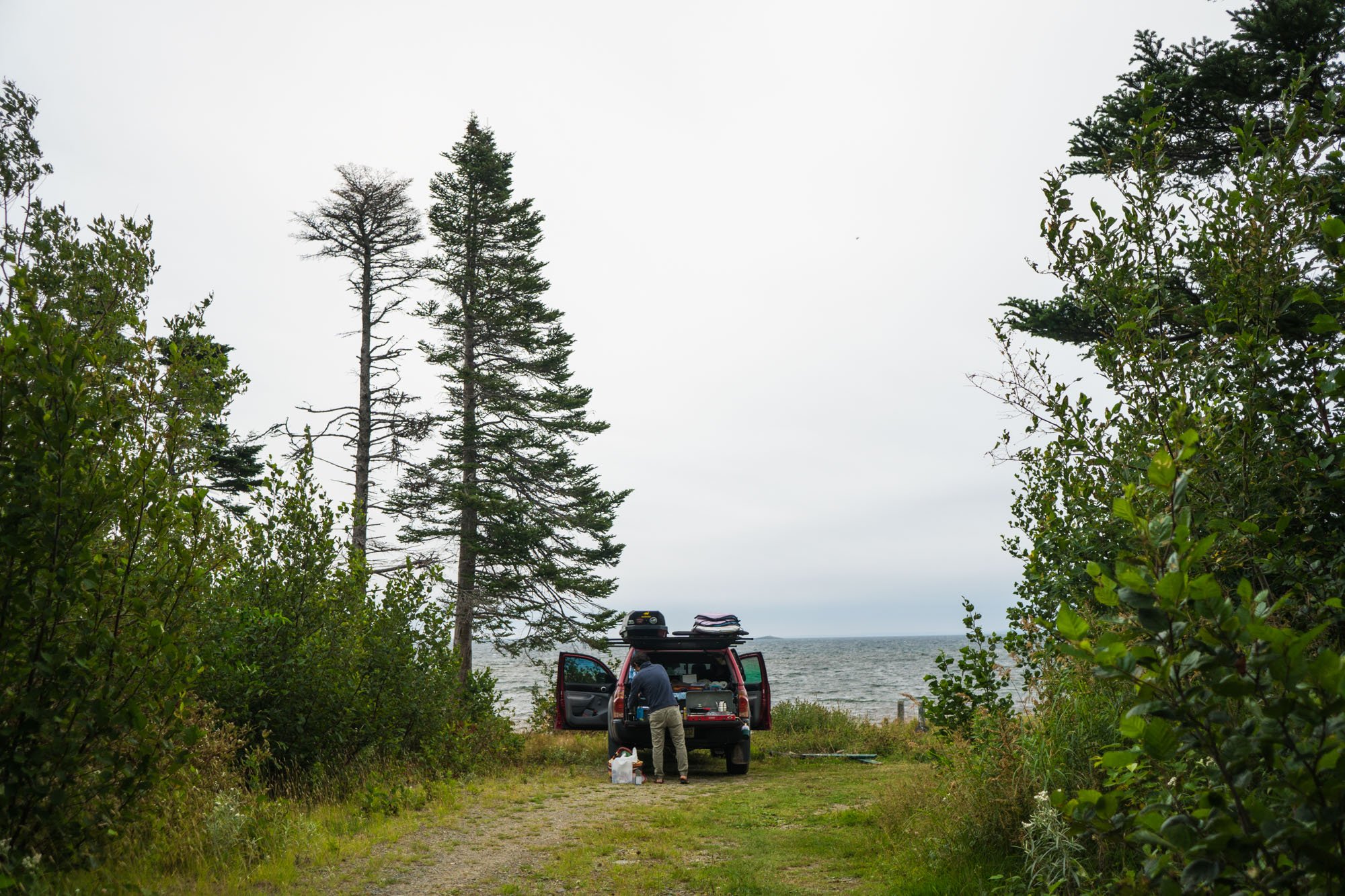
Our first night in Newfoundland was spent in the parking lot of a trailhead overlooking the Bay of Islands. It was a killer view and a nice spot even with the weird guy who was blasting 80’s electronic music at ALL hours of the night, and the couple who parked next to us and proceeded to have sex in their car and then loudly proclaim that no one knew that they were there doing it…
That spot was actually our backup spot after trying to camp near Bottle Cove where we found the road to be so severely washed out that it could have swallowed Lando whole. As we drove towards camp we decided to return the following day to explore the area, because it was too beautiful not to.

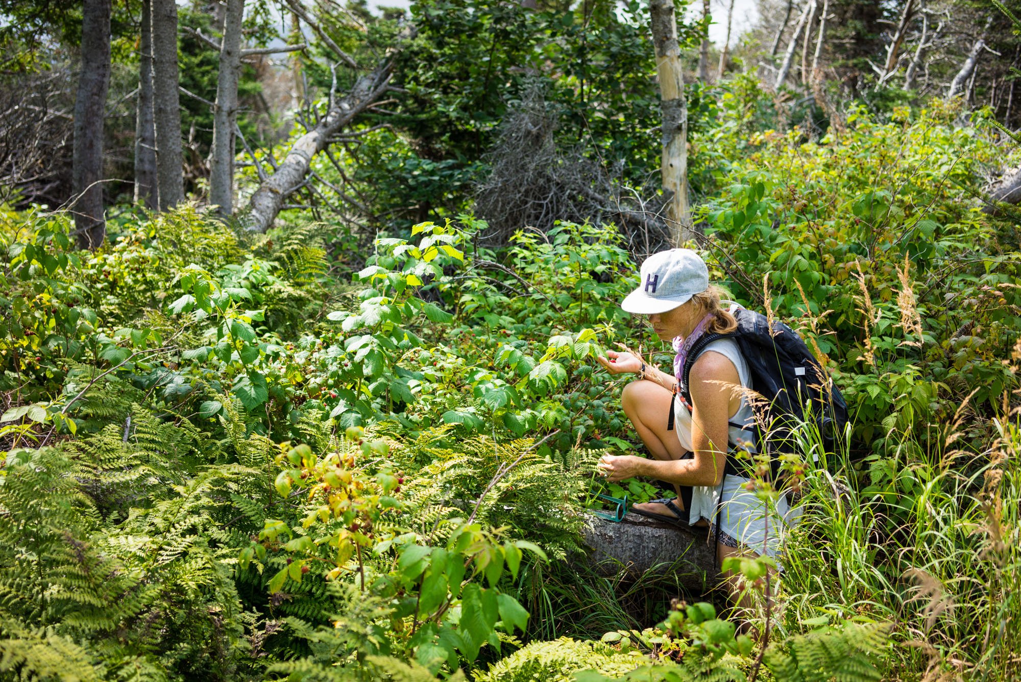
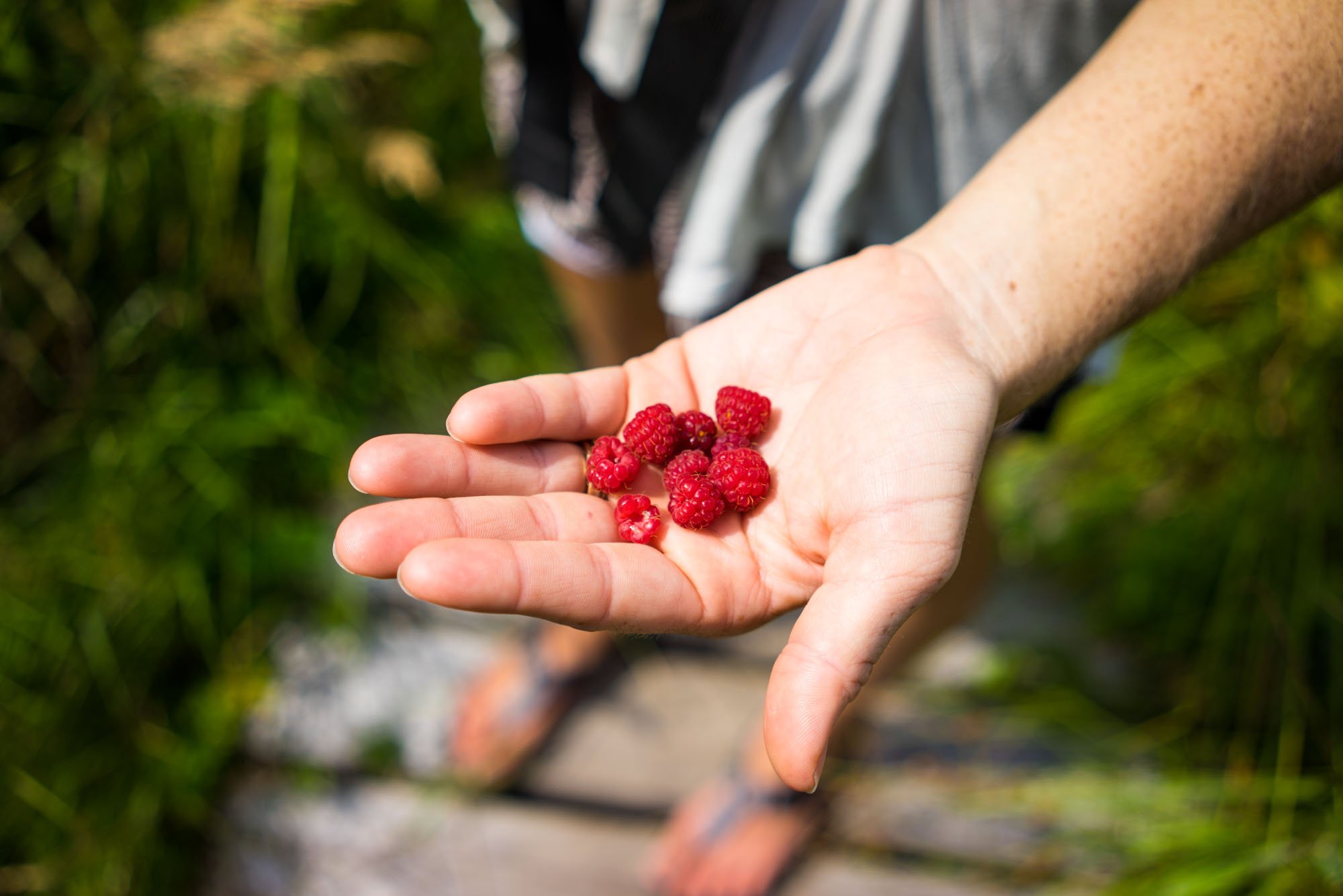
After breakfast and coffee in the parking lot, we set out on the trail around Bottle Cove in hopes of finding the lighthouse we intended on camping at the night before. The trail around bottle Cove was 2km, packed with incredible views and wild berries of which I collected and immediately consumed. While on this hike we met a local couple who informed us that we were pronouncing Newfoundland incorrectly. They said the way to pronounce it is “Newfoundland, understand” (if it rhymes, you’re saying it right). We were gracious for the correction because it undoubtedly saved us from a social faux pas that would inevitably soon follow.

MAK trying to hike out to the light house. We never made it.

This is as far as we made it in our attempt to camp near bottle cove the previous night.
After completing the short loop around Bottle Cove Owen and I wanted to see if we could make it out to the lighthouse. With no service or trail information, we pulled out google maps to see if we could figure out where it might be. With that little information, we pressed far into the woods on a muddy trail that seemed to get worse with every step. After about 45 mins of hiking, we checked our progress on the map only to find we’d barely put a dent in the distance between us and the hypothetical headland we were heading towards. We debated if we wanted to continue on but inevitably decided to turn around. Once we made it back into service we checked to see if we’d made the right decision and turns out it was a wise call to turn around due to distance and trail conditions.
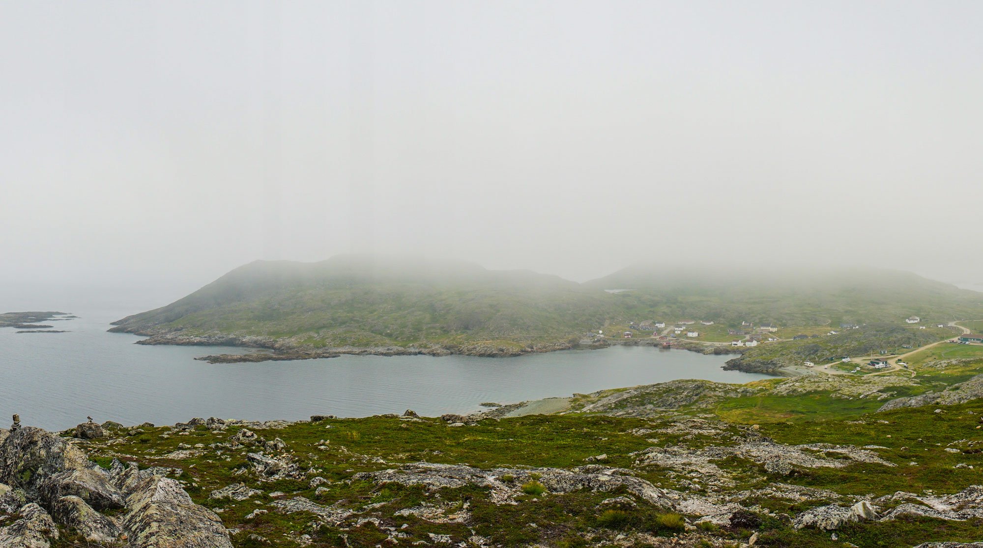
Fogo Island, Newfoundland

The one and only road on Fogo Island
After leaving the Bay of Islands on the west coast we made our way towards the Northeastern coast in hopes of catching a ferry to Fogo Island the next day. We found an abandoned campground on the water down an overgrown road just south of Farewell, the “town” where the ferry leaves from for Fogo Island.
We woke early with hopes of catching the first ferry of the morning. We left camp without eating or making a warm morning beverage but arrived right as it was pulling out of port. We were bummed our “well thought out plan” for some reason was about 10 mins off. Luckily the summer ferry schedule has a ferry leaving every hour, so we just secured ourselves the first spot on the next ferry to leave Farewell. We used the time to make coffee, do a face mask, and watch the horizon for our ride to Fogo.
When we finally boarded the ferry to Fogo, Lando got the best seat in the house for the foggy ride to Stag Harbour.

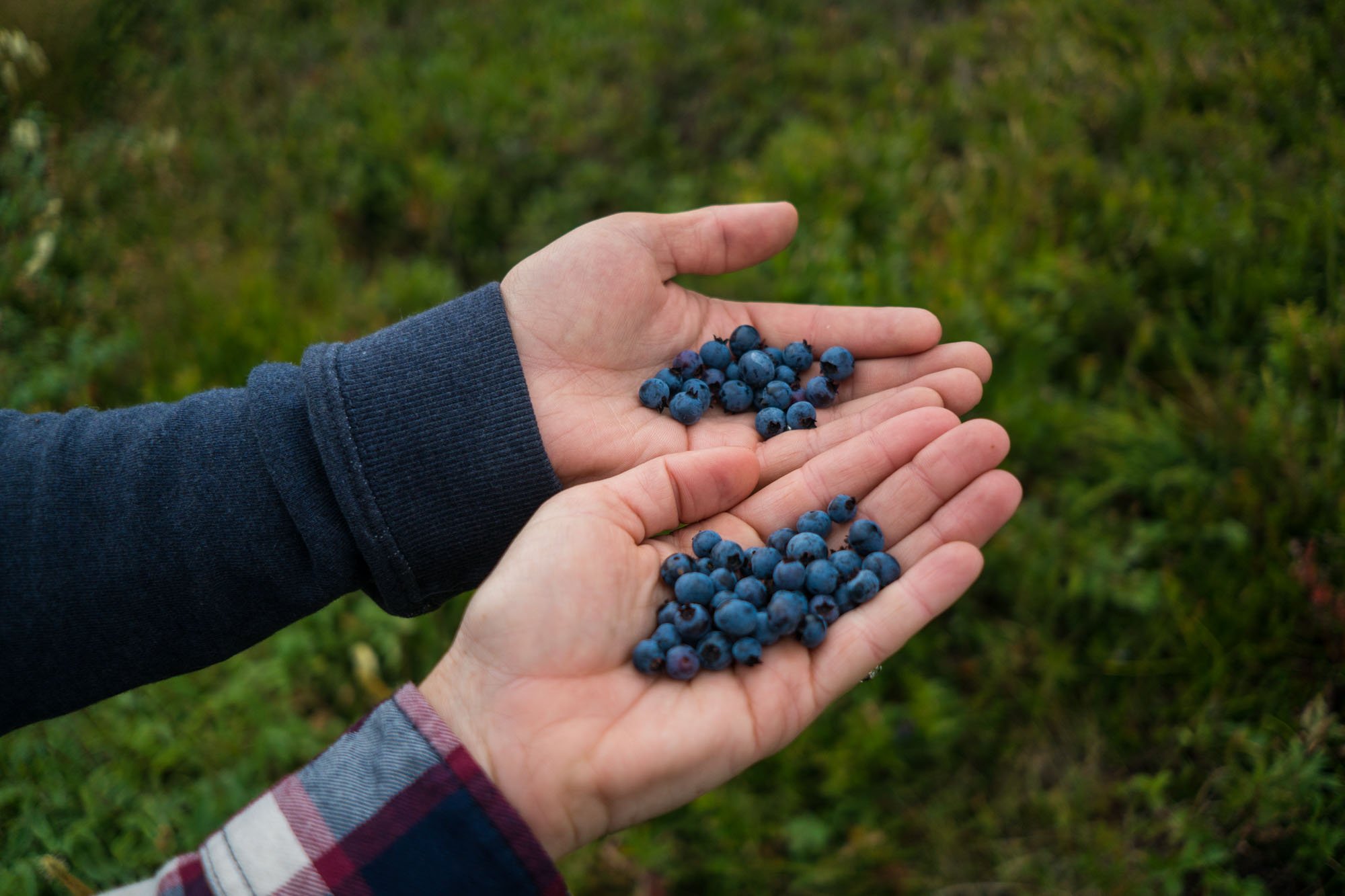
MAK picking blueberries on the hike up to Brimstone Head

The blueberry haul
After arriving in Stag Harbour, we set off on the only road through the island. We found a small park near the water where we made breakfast and then set out to explore the rest of the island. Our first stop was in the town of Fogo.
We found Fogo drenched in fog but went about our plan to hike to Brimstone in hopes of a nice view of the ocean and the town below. The trail was covered in blueberries which made the hiking process slow and delicious.

The view back at the city of Fogo
Lucky for us the fog did clear partially while we were up on top of Brimstone head which gave us the opportunity to snap the above picture of the town of Fogo.
After our quick summit of Brimstone head, we went to the other side of Fogo (the town) to hike to another view on the Fogo Head hiking trail. In total, the trail is about 3.5 km and consists of many stairs that give you a breathtaking view of the coastline.

View looking back at Fogo on the Fogo Head trail
Went we set out on the hike the fog had moved back in and brought the chilly air with it. As soon as we got going the fog cleared and caught Owen and I wearing inappropriately warm clothing for the new mild climate. Sweating profusely we climbed on to the top view point of the trail for the view of the water and town of Fogo (above).
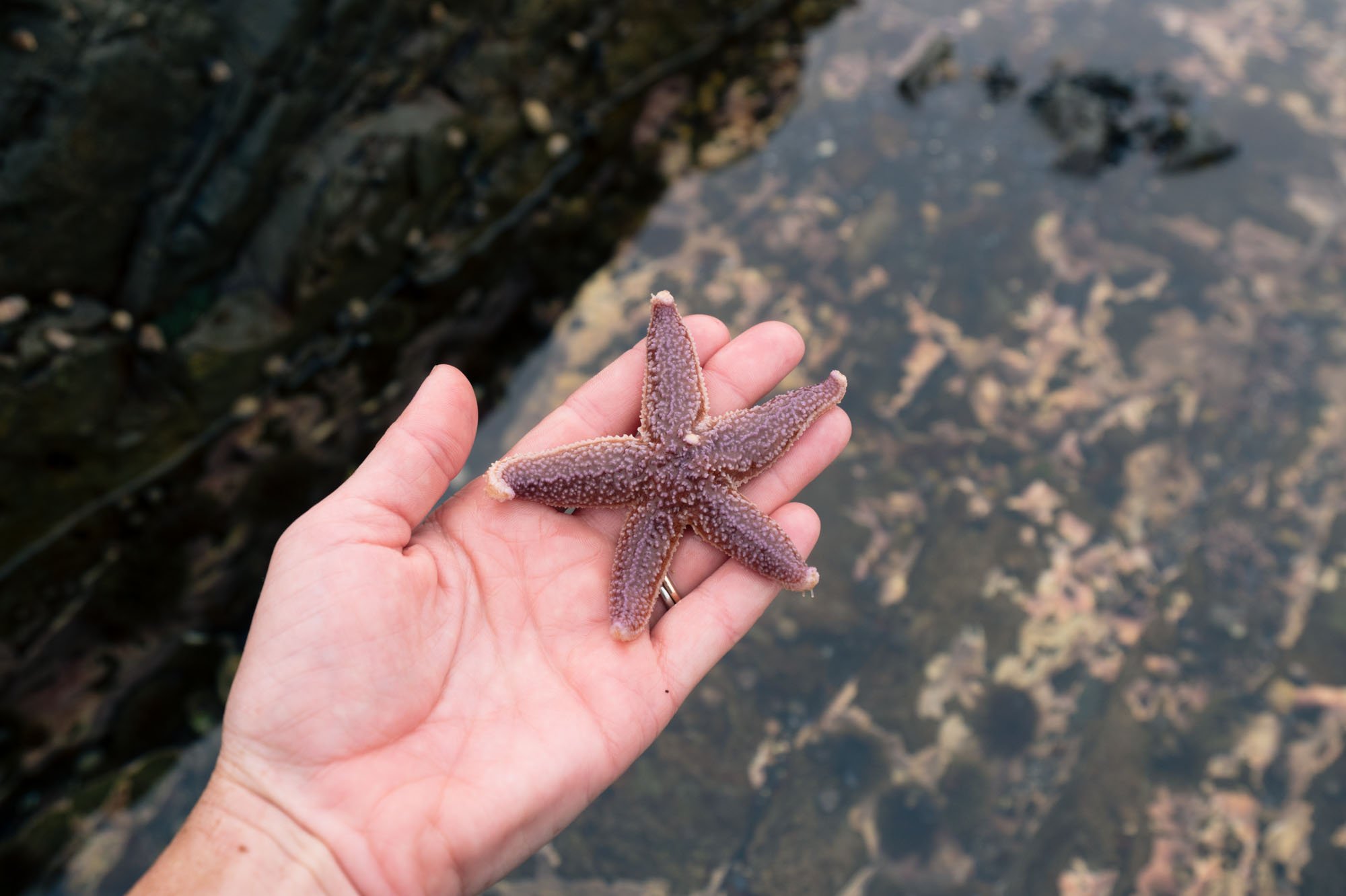
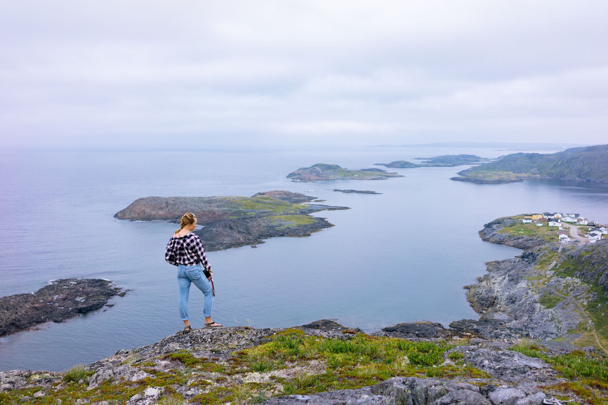

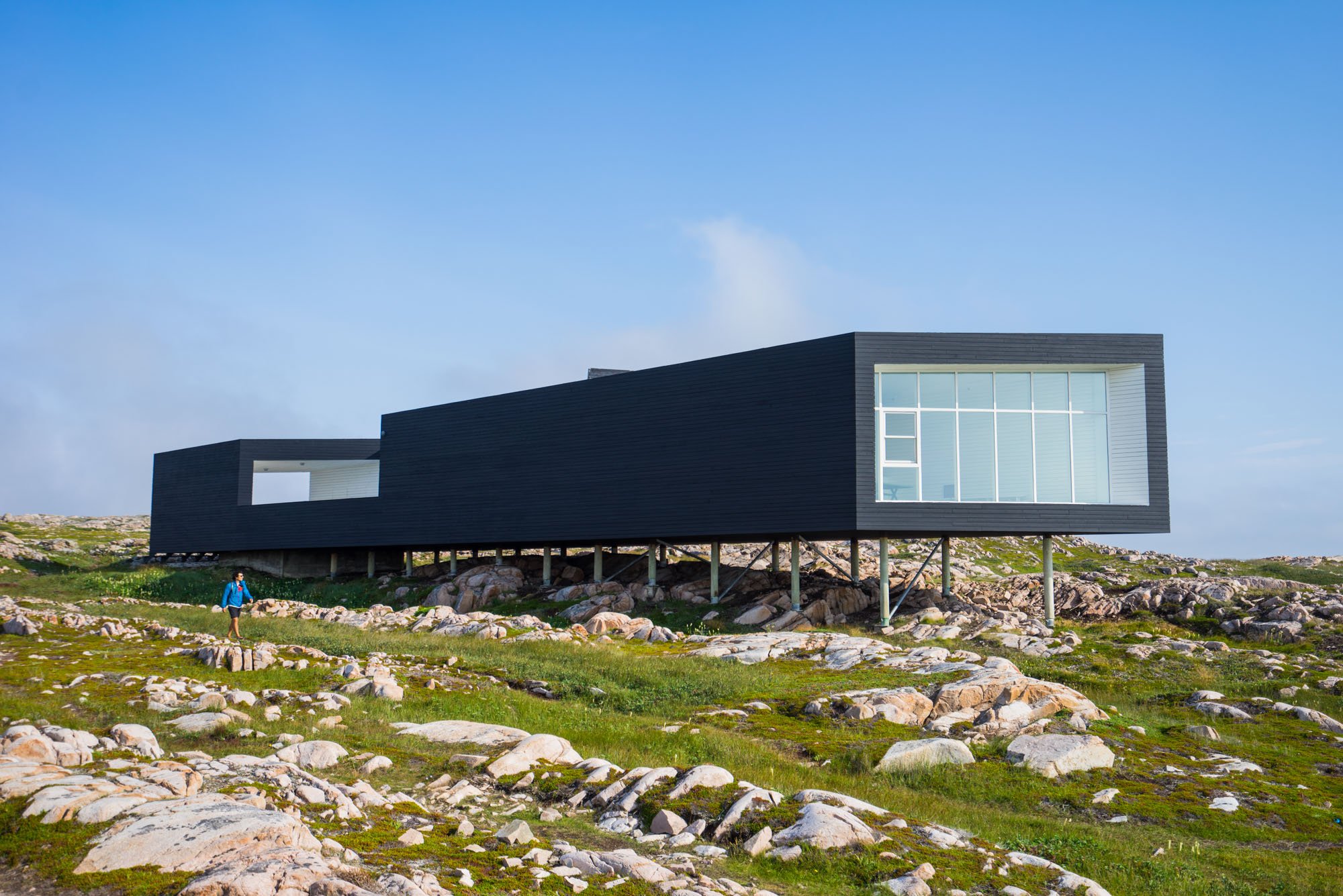
Photo courtesy of azuremagazine.com
After finishing up in the town of Fogo the warm, clear day seemed to be here to stay so we changed into shorts and drove to the town of Joe Batt’s Arm, home of the world-famous Fogo Island Inn.
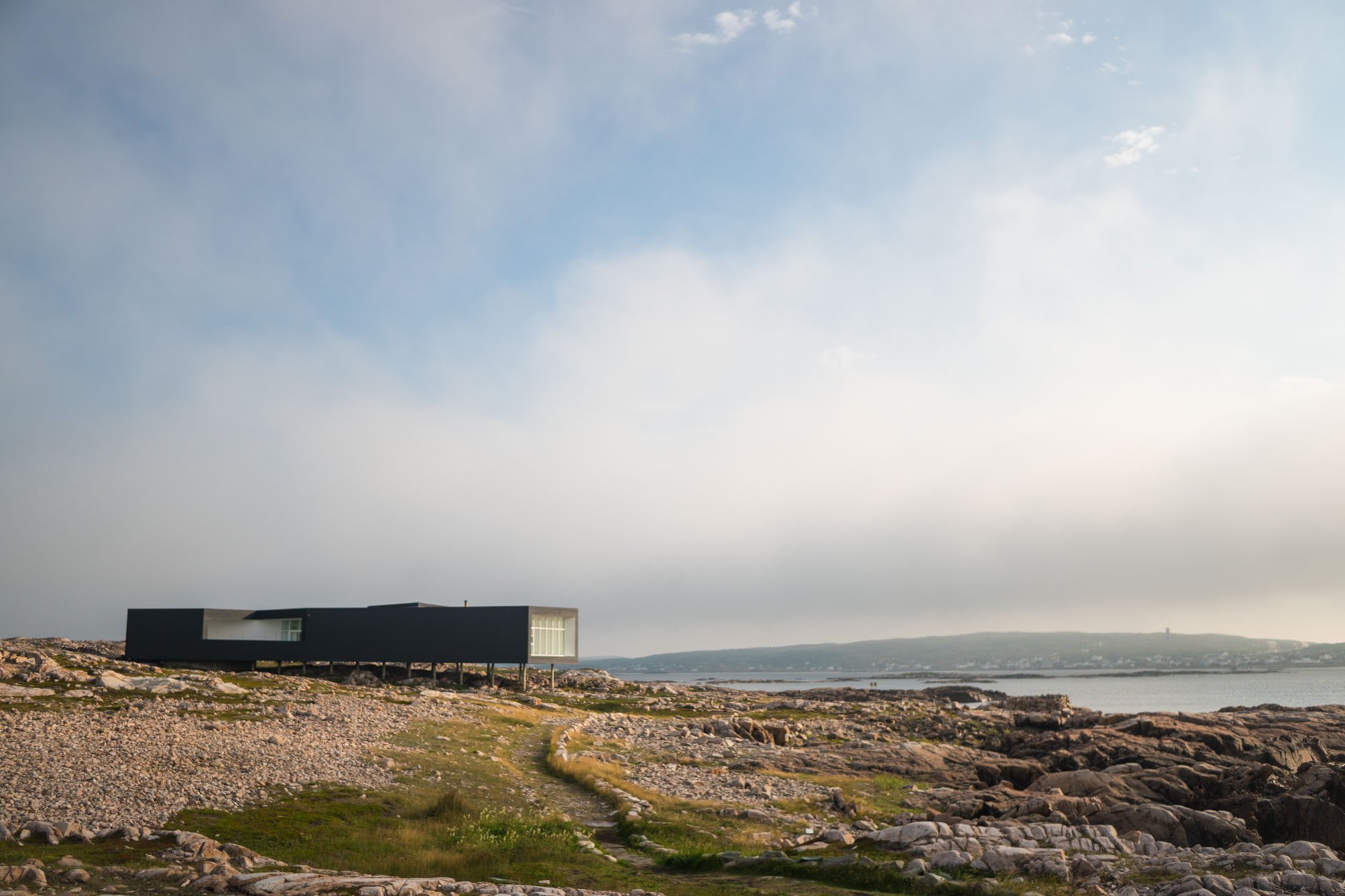
Even though we weren’t able to afford a night at the Fogo Inn, I think it’s important that I make mention of this incredible hotel. The Inn is a luxurious boutique hotel with a rooftop spa, killer restaurant, and has been named the best hotel in all of Canada… and here it is in the tiny town of Joe Batt’s Arm. As we drove past we vowed to return one day to stay at this incredible hotel that fetches an impressive $1000CAD a night. Yes, that is crazy expensive, but people travel from all over the world just to stay here. We had the opportunity to ask a few locals what they thought of the hotel because, in all honesty, it sticks out like a sore thumb. The architecture is different and it’s so expensive most locals can’t afford to stay there. But every local we queried loved it! They said that the hotel brought the unemployment rate of the Island to ZERO after many found themselves out of work due to the declining fishing industry. They also talked of how the head chef at the Inn has since left his post and opened a coffee and sweet shop in the town of Fogo that is delicious and financially accessible to everyone. The rumor was that he did it because he wanted to give back to the island that had taken care of him. It seemed like everywhere we went we overheard locals talking about the new coffee/pastry shop opened by the chef called Bangbelly. We were devastated that it happened to be closed when we were on the island because they take Monday’s off. If you are ever there please go and enjoy it for us. I’m not sure why I’m writing about this so in-depth… but I thought it was just a testament to how great Fogo and its people are.
Ok back to the Joe Batt’s Arm trail.
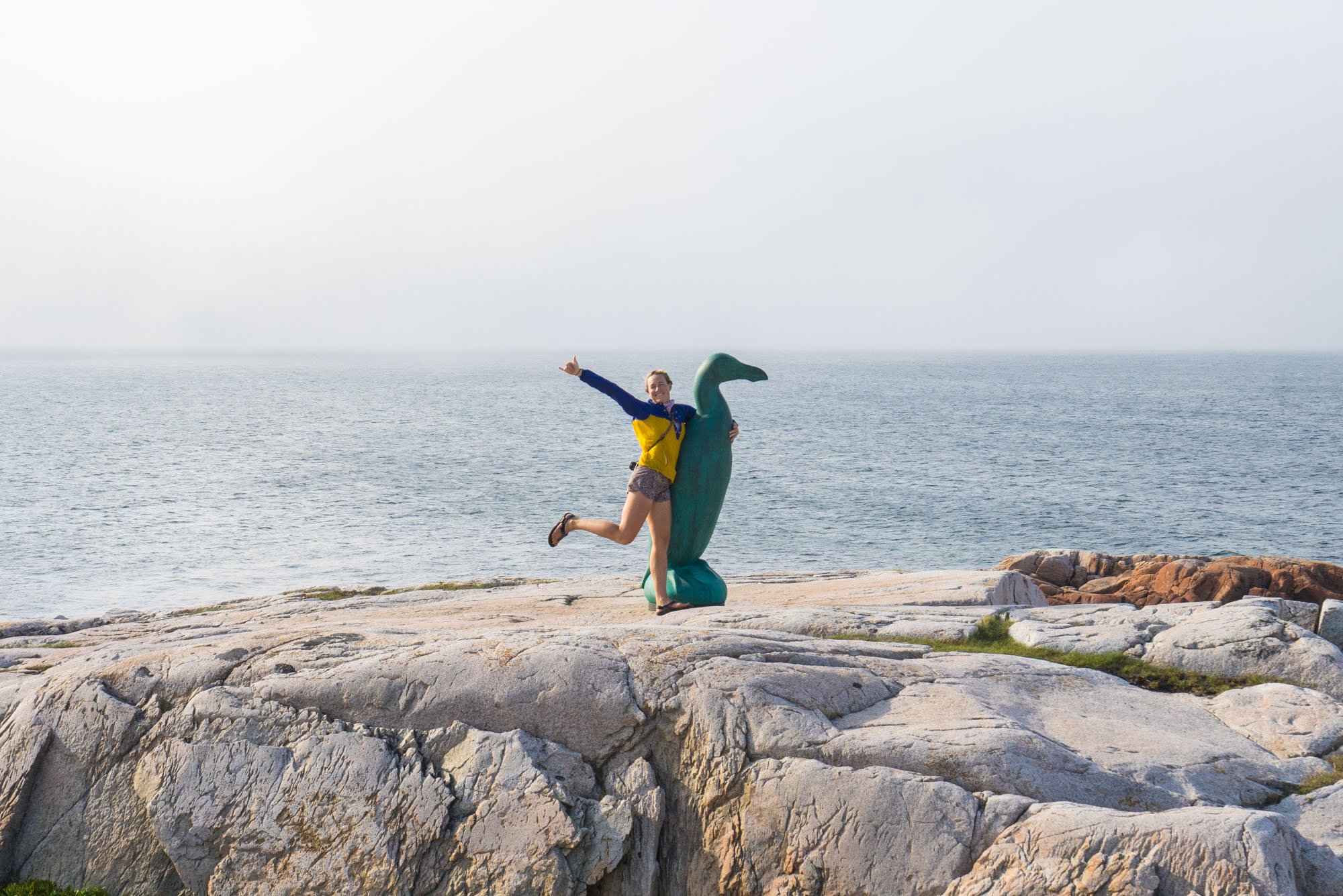
After driving past the Inn we headed straight to the walking trail on the other side of the bay in Joe Batt’s Arm. The trail was a picturesque 4.5km along the Atlantic coastline to the incredible building of Long Art Studio where Owen and I stopped for a good long while to lose our mind over the building and its surroundings. Seriously, if it goes missing, it was me. The trail continued along to ancient bird watching blinds that hunters used when hunting the Great Auk which is now extinct. At the end of the trail is a life-sized statue of these massive birds that once inhabited this coastline. Sadly, the Auk went extinct due to over hunting from the early settlers to this area.
MAK at camp on Fogo Island
After we finished our hike we found camp outside of the last town on Fogo right as golden hour set in on Fogo Island. Over the course of a single day, we had covered the entire island from Stag Harbour to Tilting. That night we made dinner, a small fire, drank some wine, and talked about our day well into the night. Before coming to Fogo we decided to only spend one night there because of how much more ground we wanted to cover in Newfoundland. The plan was to wake up at 4:30 am to make the drive back to Stag Harbour in time to catch the first ferry back to Farewell. That night as a heavy fog set back in we fell asleep to the waves rolling in on the near by beach. Fogo was an absolute dream.
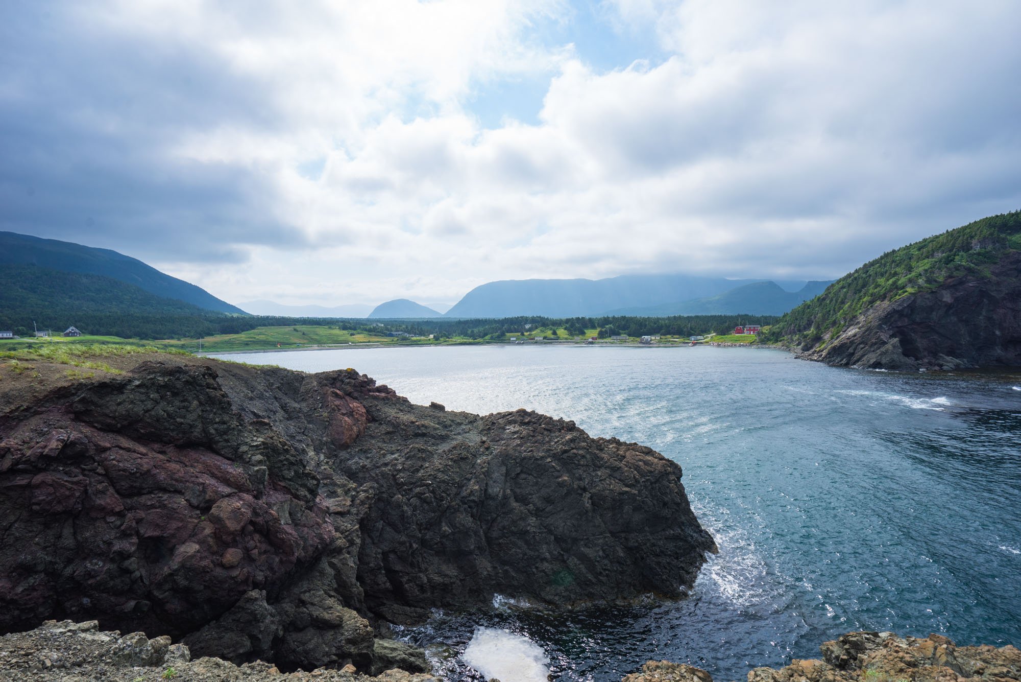
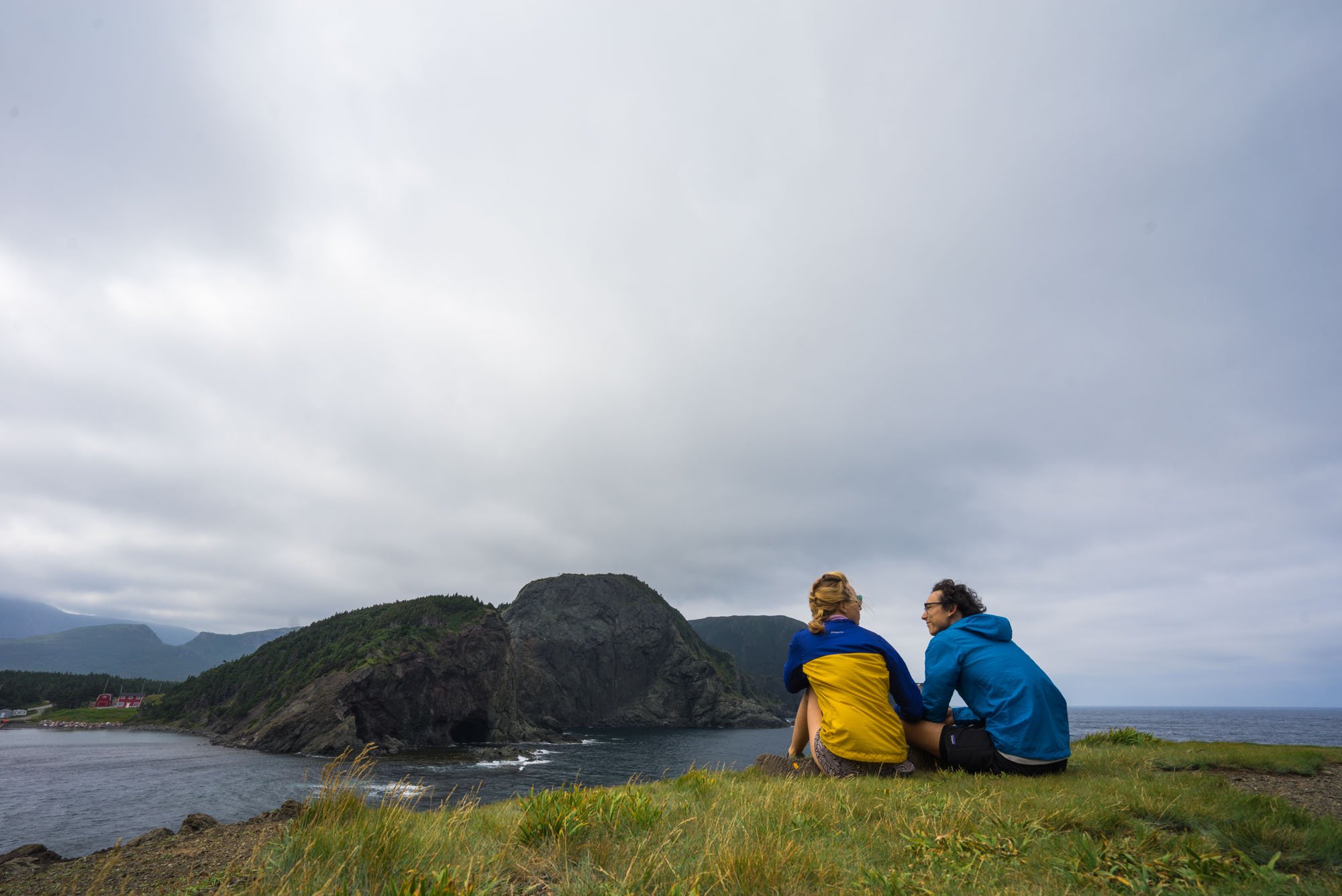
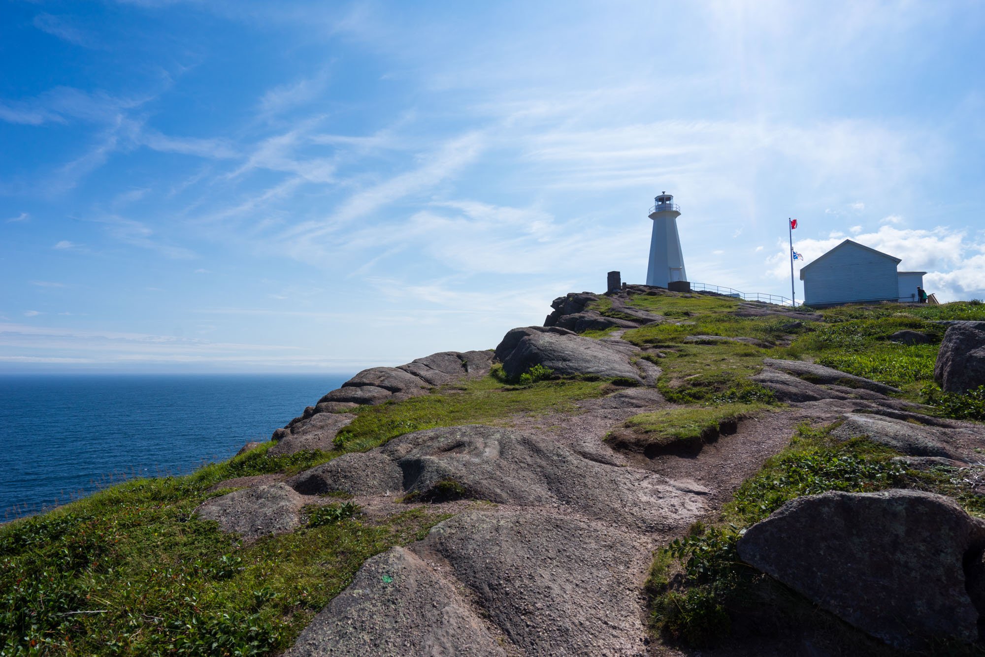
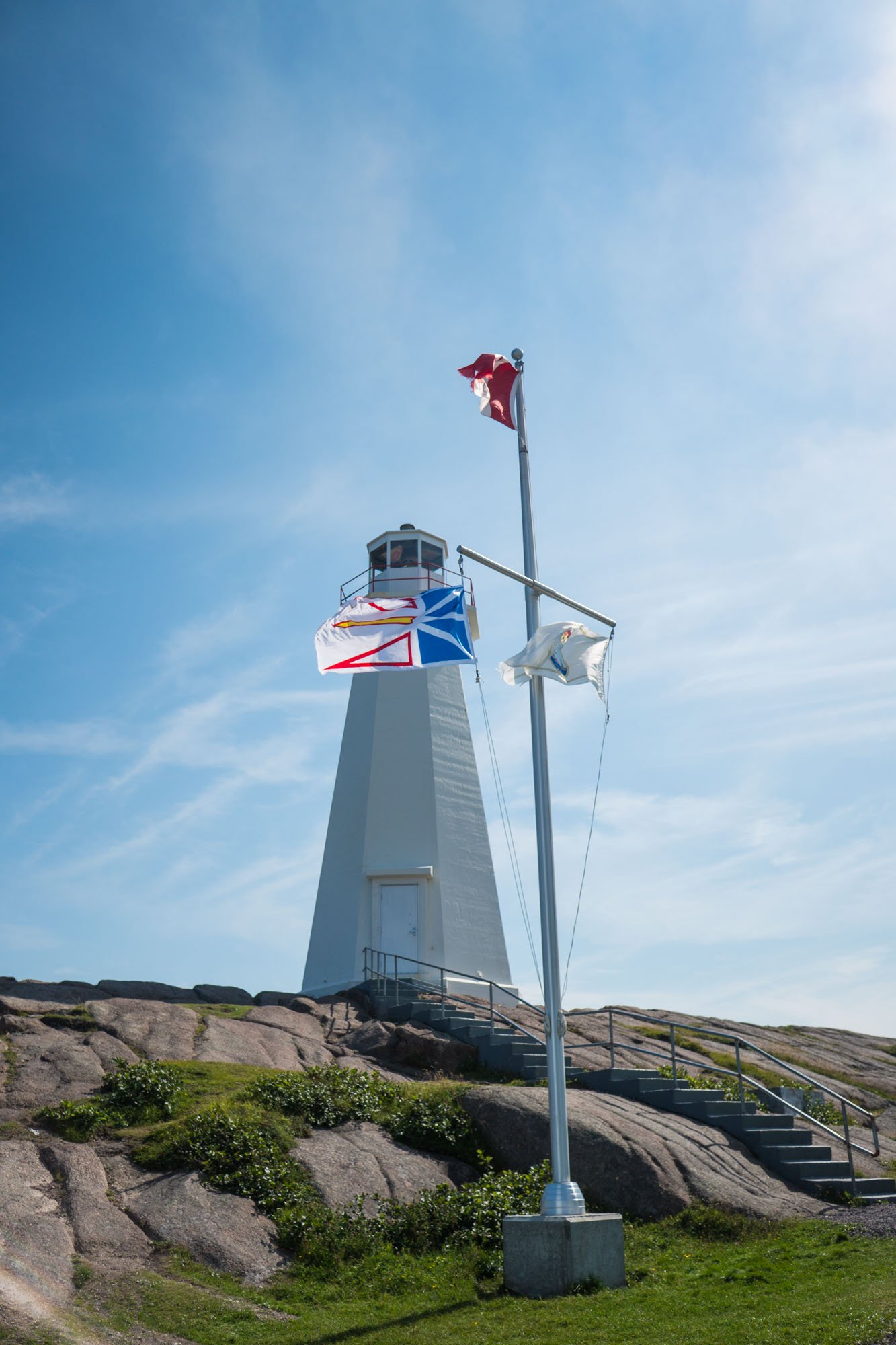
Cape Spear, Newfoundland

Owen and MAK at the Eastern most point in Canada & North America
After an early ferry ride we arrived back on mainland Newfoundland and started to make our way towards St. John’s and Cape Spear to explore the southeastern portion of the island. It was a full day of driving before we reached our destination.
Cape Spear is a Canadian National Park that is the easternmost point in Canada and North America. It’s also home to a lighthouse and an old World War defense battery. For a brief moment on this day we were the easternmost people in North America! We spent a little time exploring the grounds and became a little overwhelmed by the sheer number of people at the park. We made our way back to Lando and came up with a game plan. We decided to head into the capital city of St. Johns to get screeched in.
When people found out that we were heading to Newfoundland we got countless recommendations to take part in a screeching in ceremony, which is a Newfie tradition. Its an elaborate ceremony that concludes in a shot of Screech Rum and kissing a dead cod fish! Apparently back when the fish trade was big in this area the cod would get loaded onto large boats that would then ship the catch to Jamaica. The boat would return with the hull filled with rum. Newfies are into their rum, and thus the Screeching tradition was born. We’re not into rum… but we are into experiencing local traditions. In St. John’s our plan was to go to one of the most famous locations for a Screeching in.
In St. John’s we were met with traffic, congested parking streets, and an even more overwhelming volume of people. We found our way to a parking spot near the down town bar district. We paid for parking and made it one whole block away from Lando before I was stopped dead in my tracks and I couldn’t go another step farther. What I’m about to describe will likely not make sense to most of you, but I will do my best.
I’m not an anxious person, in-fact, I’m very outgoing and enjoy being around people. We used to live in Atlanta proper, and I love cities. After living most of the last three years out in the quiet of nature and living out of a vehicle that contains all of our possessions, cities have become a huge source of anxiety. We feel really vulnerable in cities leaving our car parked on the side of an unknown street and being surrounded by the constant movement of hundreds of thousands of people. In that moment, all of that hit me like a ton of bricks. I wanted badly to walk the 2 blocks that stood between us and being screeched in, but I couldn’t do it. I turned to Owen and I told him I had a bad feeling, and that I wanted to leave. We don’t have a lot of rules, but if one of us wants to leave somewhere and has a bad feeling. No questions asked, we leave.
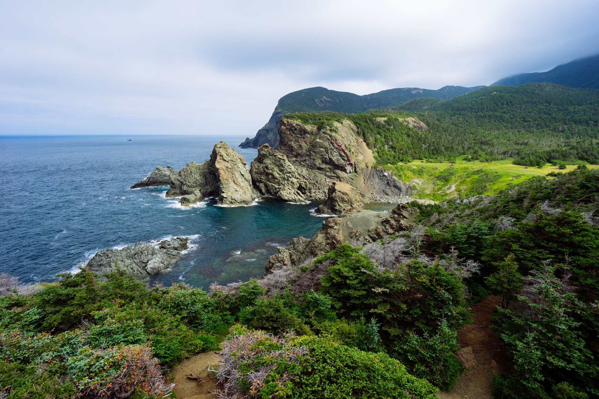
Bonavista Peninsula, Newfoundland
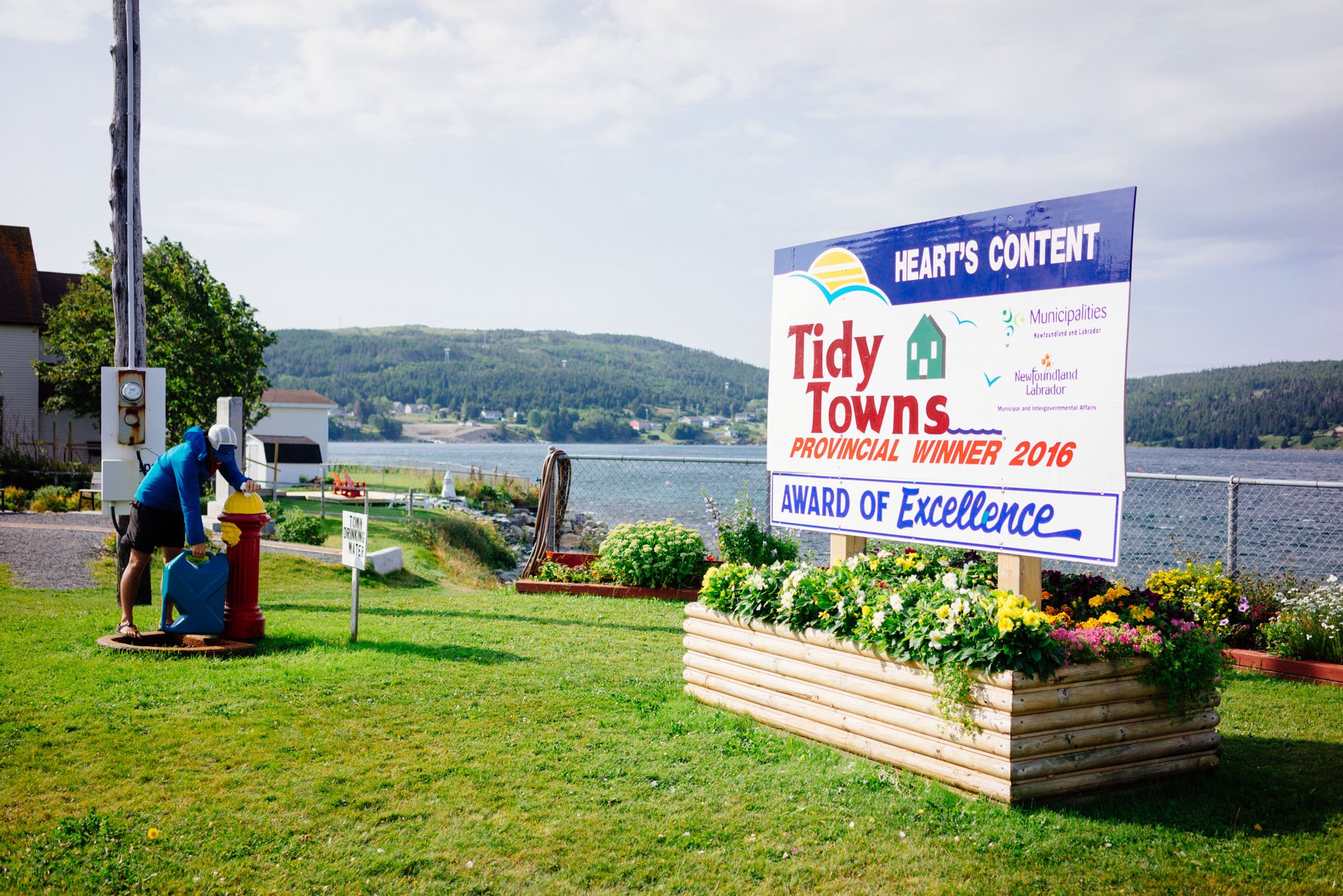
Back at Lando I was wracked with guilt. We had driven one whole tank of expensive gas to be in this part of the island, and we were leaving because of me. Owen found a small town about an hour north of St. John’s with a promising camp spot at the base of a lighthouse, he pointed us north and we drove in silence as I fought back tears and tried to sort through these foreign feelings.

Immediately after arriving in the town of Heart’s Content I got straight to work on dinner in hopes it would take my mind off of how terrible I still felt. I had taken away a potential experience from Owen.
As I worked away a car drove up, and an older gentleman got out and walked directly over to us. I turned to greet him feeling dread in the pit of my stomach. If this man told us we couldn’t stay here tonight, I think I would have melted into a puddle right then and there, but I smiled and asked him how he was doing. The three of us chatted, we asked questions about the town and he asked us where we were coming from. It’s never a simple question for us. After a while his wife got out of the car and yelled through the wind “Have you told them yet?!”, he turned and smiled at us.
Here it comes, he is about to tell us to move along… don’t cry, don’t cry, don't’ cry.
“I happened to see you drive in, and I wanted to come out and say hello. I’m the mayor of this great little town. I wanted you to know how welcome you are to be here, and that it’s an honor that you chose to take the time to come visit us. We’re so lucky to have so many unique people from all over the world come to our small slice of paradise here in Heart’s Content.” He went on to say more about where everything was around town such as the freshwater spring, the store, and his house if we needed anything. He wished us well and presented us with a pin donning the town’s name and it’s famous communication site from WWII. As he turned to walk away he said that he hoped we would carry their town with us everywhere we go.
The minute he turned to head home for the night with his wife, I immediately turned to Owen, pressed my face into his chest and sobbed. I felt so terrible about how the day had gone, guilty over wasted gas and an experience that is unique to this part of the world. Owen hugged me and said that everything went exactly how it was supposed to. We were meant to make our way to Heart’s Content that night.
To this day, this might be one of our favorite moments from the road. Whenever we’re down, something bad happens, or things don’t go according to plan is when the best things happen. We meet people we never would have met otherwise, we experience something even more special than a shot of rum and kissing a dead cod fish. These experiences are the truly special moments that would never happen if things had simply gone according to plan.
We live for these moments, but first we have to live through the hardship, keep our chins up and hearts open so we can experience the gift on the other side.

The next morning Owen and I decided not to make any plans after nothing went according to plan the day before. We leisurely woke up and made breakfast while trying to dodge the strong winds. As we finished up a couple from Wisconsin who was staying around the corner came over as they were about to start hiking the trail behind Lando. They stopped, said hello, and we bonded over meeting the mayor (because they had a similar experience) and we got to talking about our rigs. They had a truck that had a large slide in camper. They offered a tour and we are never ones to say no to a tour! After getting a tour they asked us if we had been over to the town of Trinity yet? They said whatever we do, we had to go today, and we needed to leave within the hour.

Trinity, Newfoundland
You better believe that we immediately hugged, thanked our new friends, and left for Trinity upon their recommendation.
The reason why they said that we needed to leave was because this particular day was the last day of the Rising Tide Theater’s Pageant. The Pageant is a play that covers the history of Newfoundland and the town of Trinity. It takes place all over the town and you follow the actors and actresses through the town as the story unfolds.
We arrived in Trinity with 30 mins to spare before the show began.
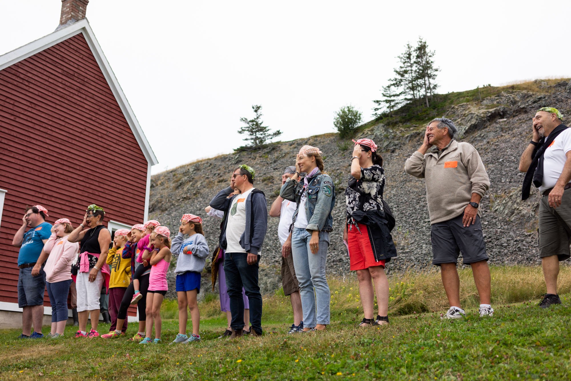
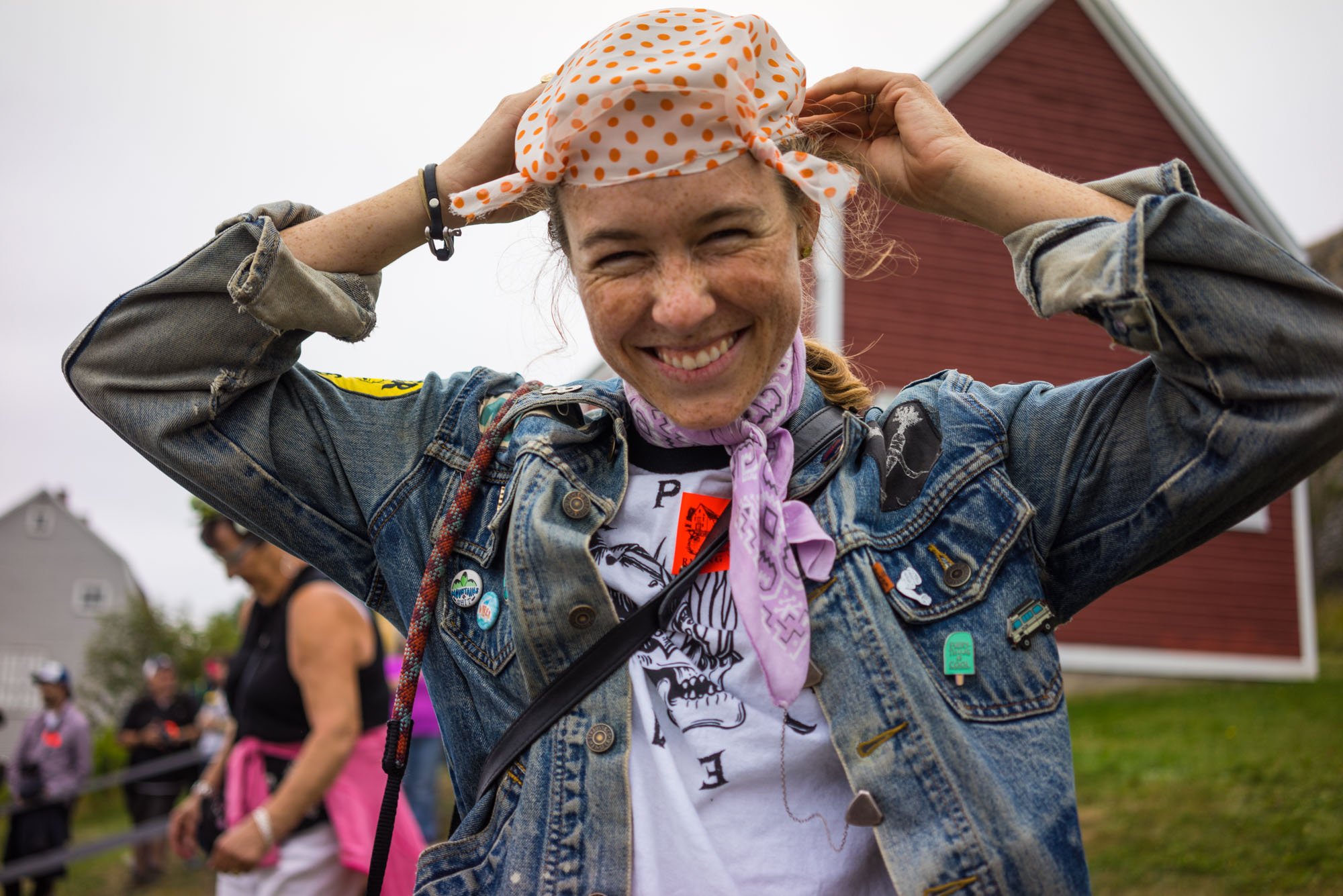
We weren’t able to take pictures of the show other than when I was selected to be a pirate in the show. Do yourself a favor, go to Trinity in the summer and see the Pageant. It was incredible to hear the history while walking the streets of the town and seeing the same views that the people who lived these stories did. Another day of no plans turned wonderful experience in the books.
After the show we made our way to the outskirts of town where we found camp down a steep 4x4 road. I’m not ashamed to say it took me two tries to get up the road. We were rewarded with a view of the Atlantic ocean and the Trinity head lighthouse and didn’t see another soul all night.
However, we woke up to find that Owen’s Bedrock Sandals were missing out from under Lando the next morning. He left them under the truck when we tucked into the bed for the night. I’m a light sleeper and would have woken up if anyone came down the road. The gravel was noisy to drive on and would have for sure woken me up. But alas both sandals were gone and after a long search, they were nowhere to be found. We suspect an animal took them… but why did they take both?!

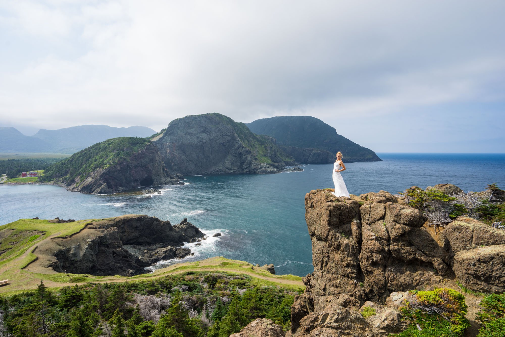
After leaving camp in Trinity with one less pair of sandals than we came with, we headed across the bay in search of Newfoundland’s highest rated hike, the Skerwink Trail. Even though the hike was just a mile or so as the crow flies from our camp it took nearly an hour to round the bay to arrive at the trailhead.
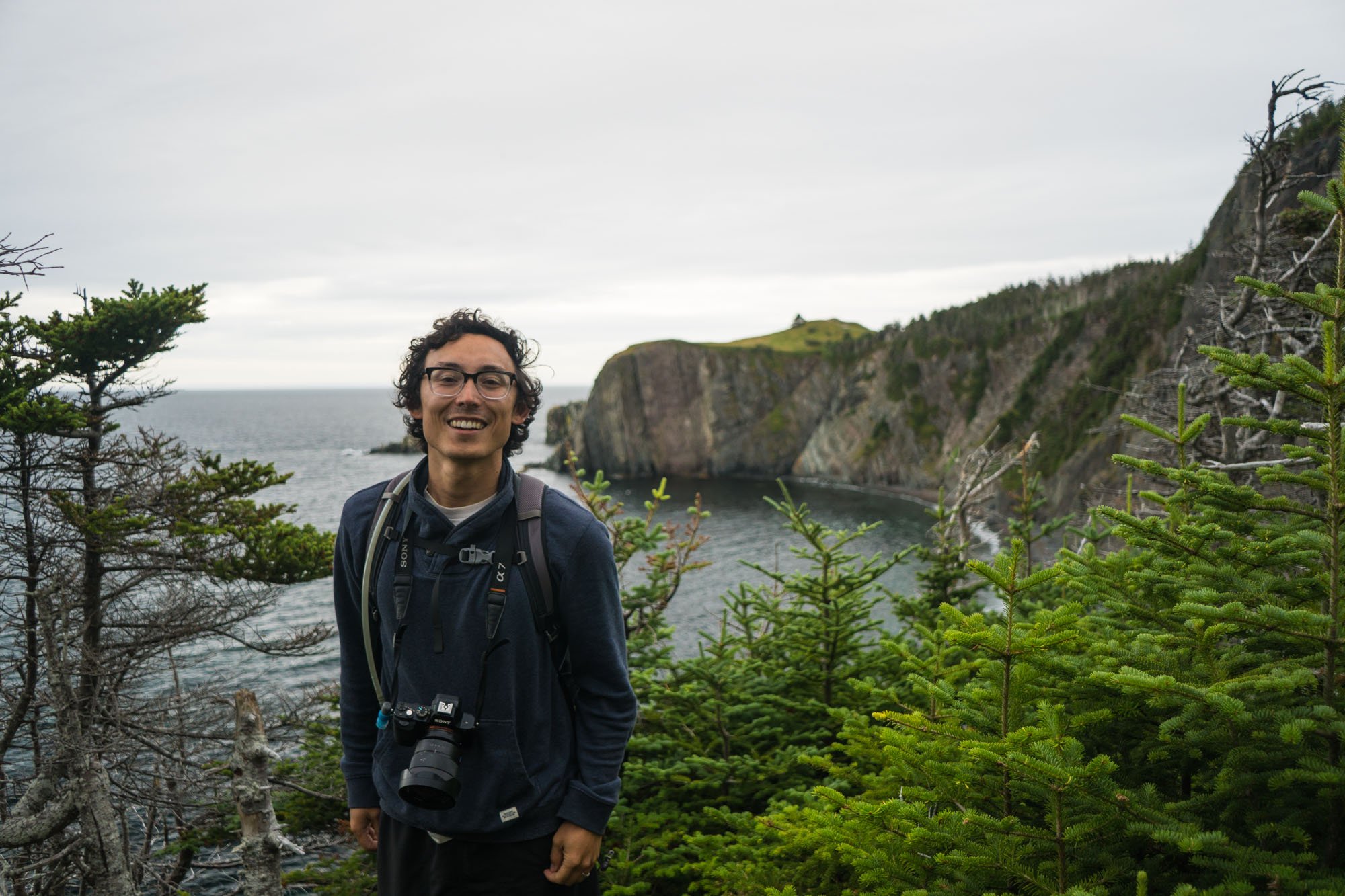
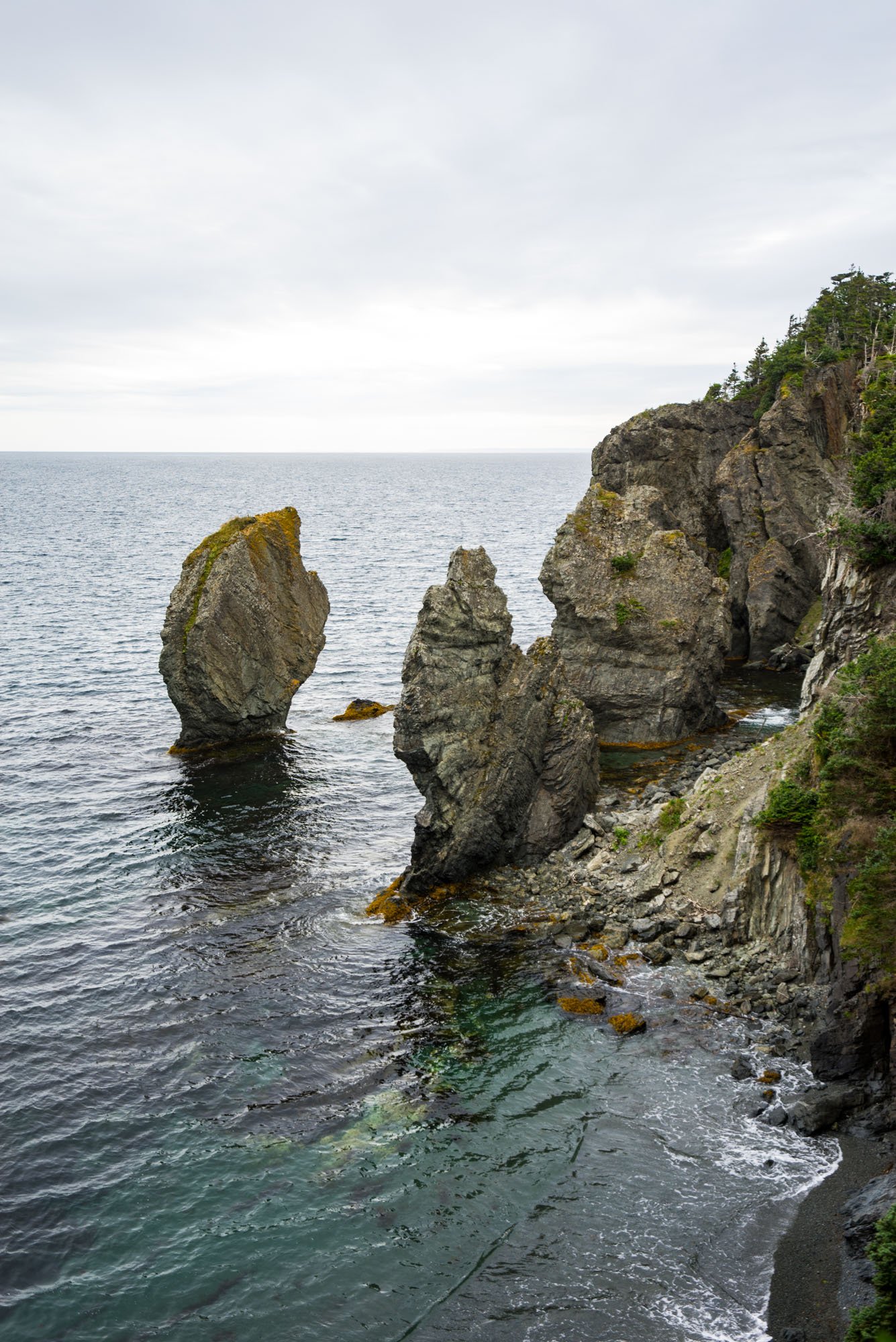
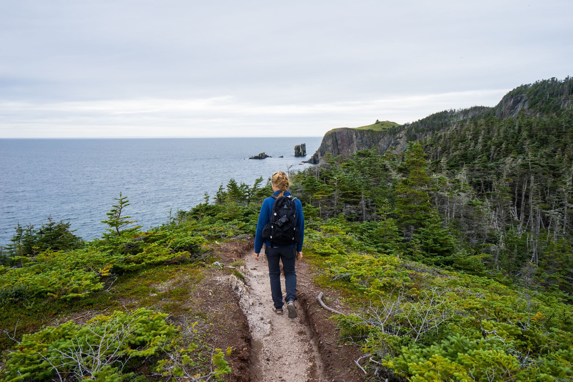
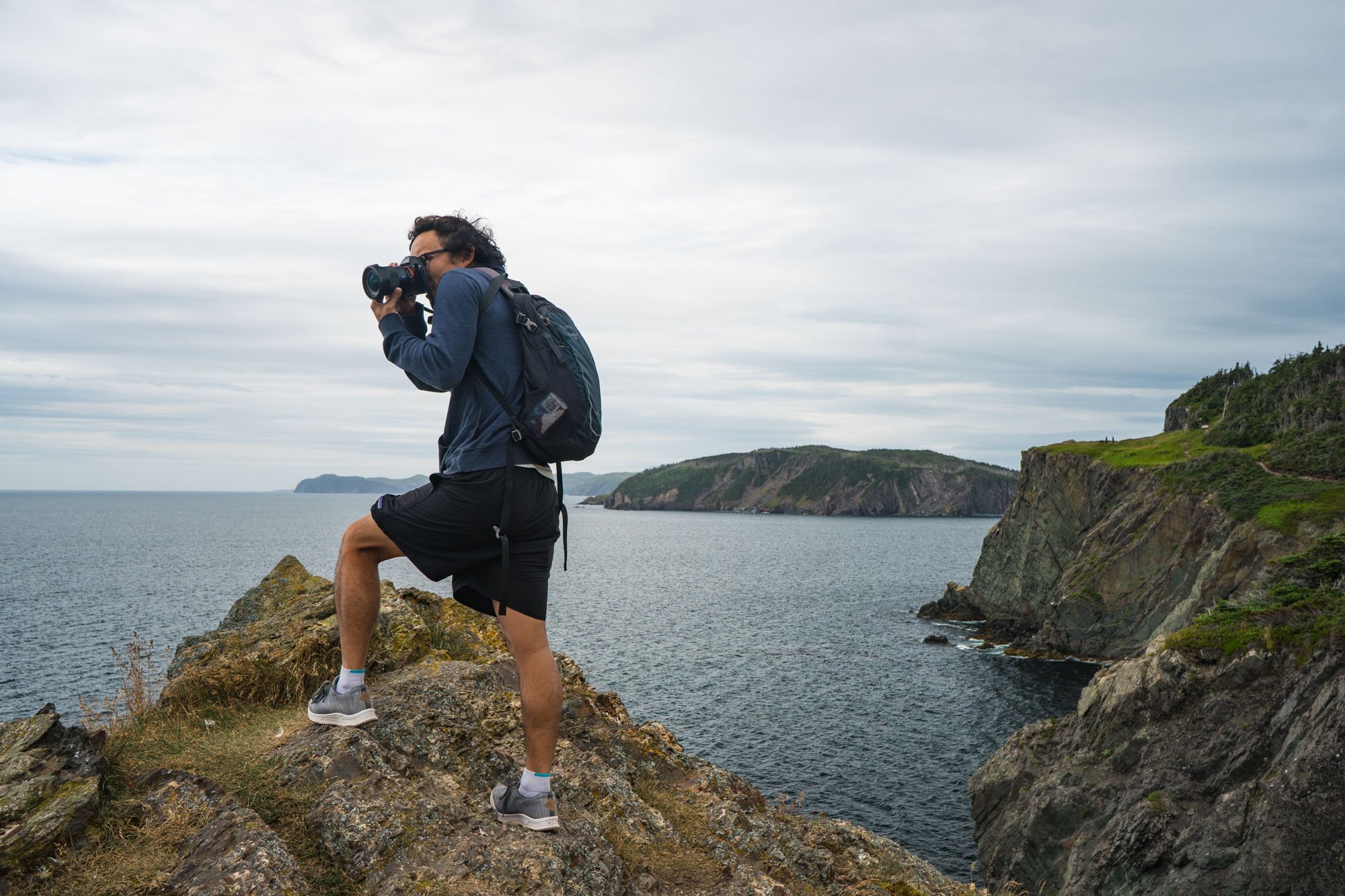
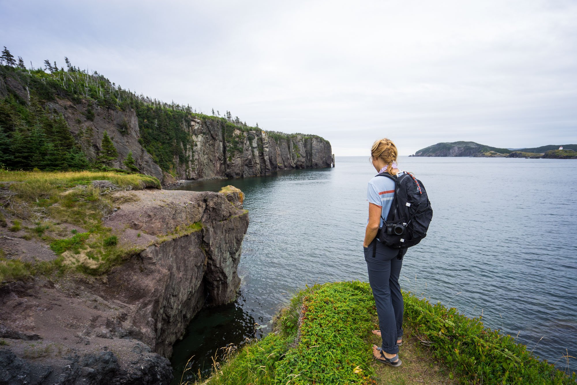
The Skirwink trail is a 5.5km loop that skirts the coastline and goes through some really interesting terrain! The trail was packed with blueberries, sea stacks, crystal clear waters, and steep cliff lines. We loved every minute of this hike. It was really cool to see Trinity from the other side of the bay too.

One of many Newfoundland Rock art pieces we found on Newfoundland. This is the only one we kept for good.

The back of the watermelon rock
On this hike, we found our first of many Newfoundland Rock Art pieces. They’re hand decorated rocks that are scattered to the many corners of the island. We took it upon ourselves to relocate all but one of the rocks we found to different parts of the island. We decided to take this watermelon rock with us because it was just too cute. It has ridden along for every mile since inside the passenger door.
That wraps up a very adventure packed August. Can’t wait to show you what September brought!
Safe travels!
MAK