The Rimrocker Trail
Hey guys! After leaving Buena Vista, Colorado it was officially time for us to start migrating towards Vegas over the next month. Owen did an amazing job of picking an adventurous route to get us there. Our first leg of the journey was the Rimrocker Trail.
The Rimrocker is a 160 mile dirt 4x4 trail that leaves from Montrose, Colorado and goes all the way to Moab, Utah. The trail is named after the miners called “Rimrockers”, who used to work the many mines in Montrose County. The trail was designed to bring tourism to this otherwise seldom visited part of Colorado and was officially opened to the public in 2016.

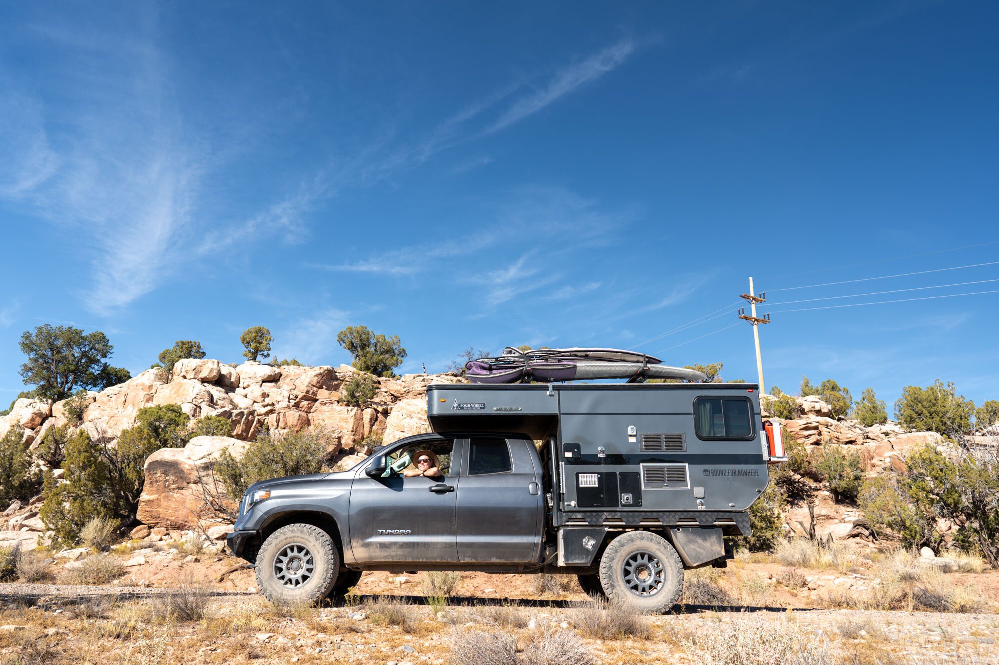
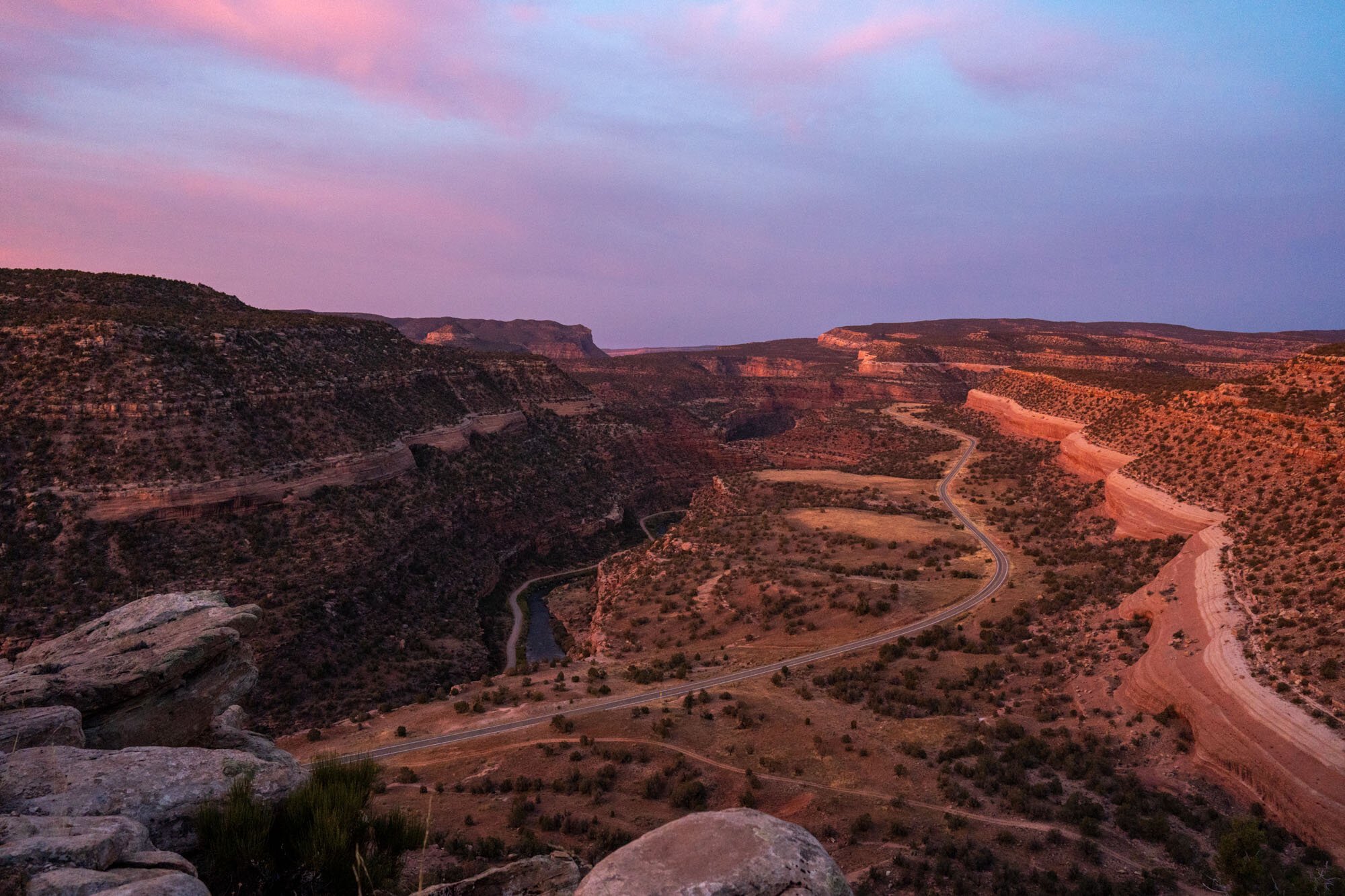
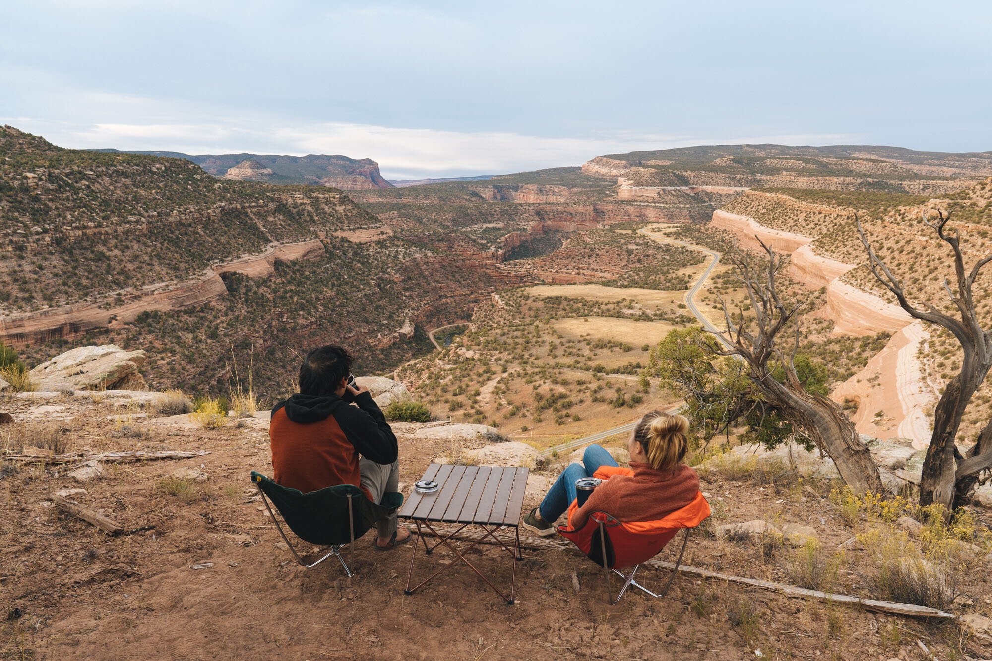
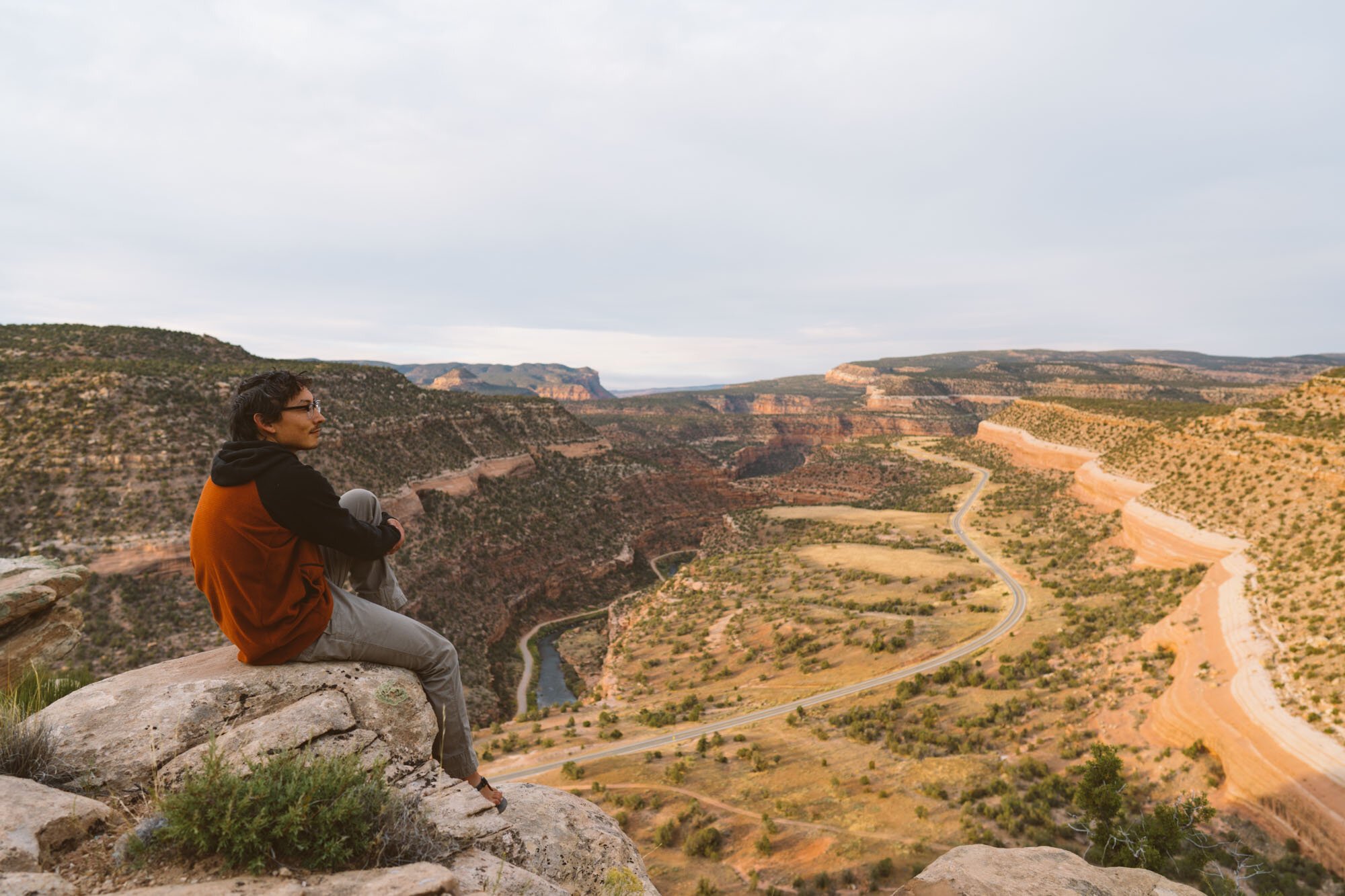
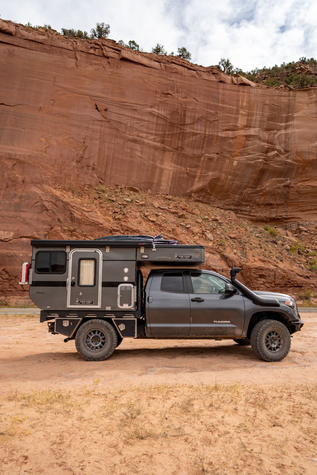
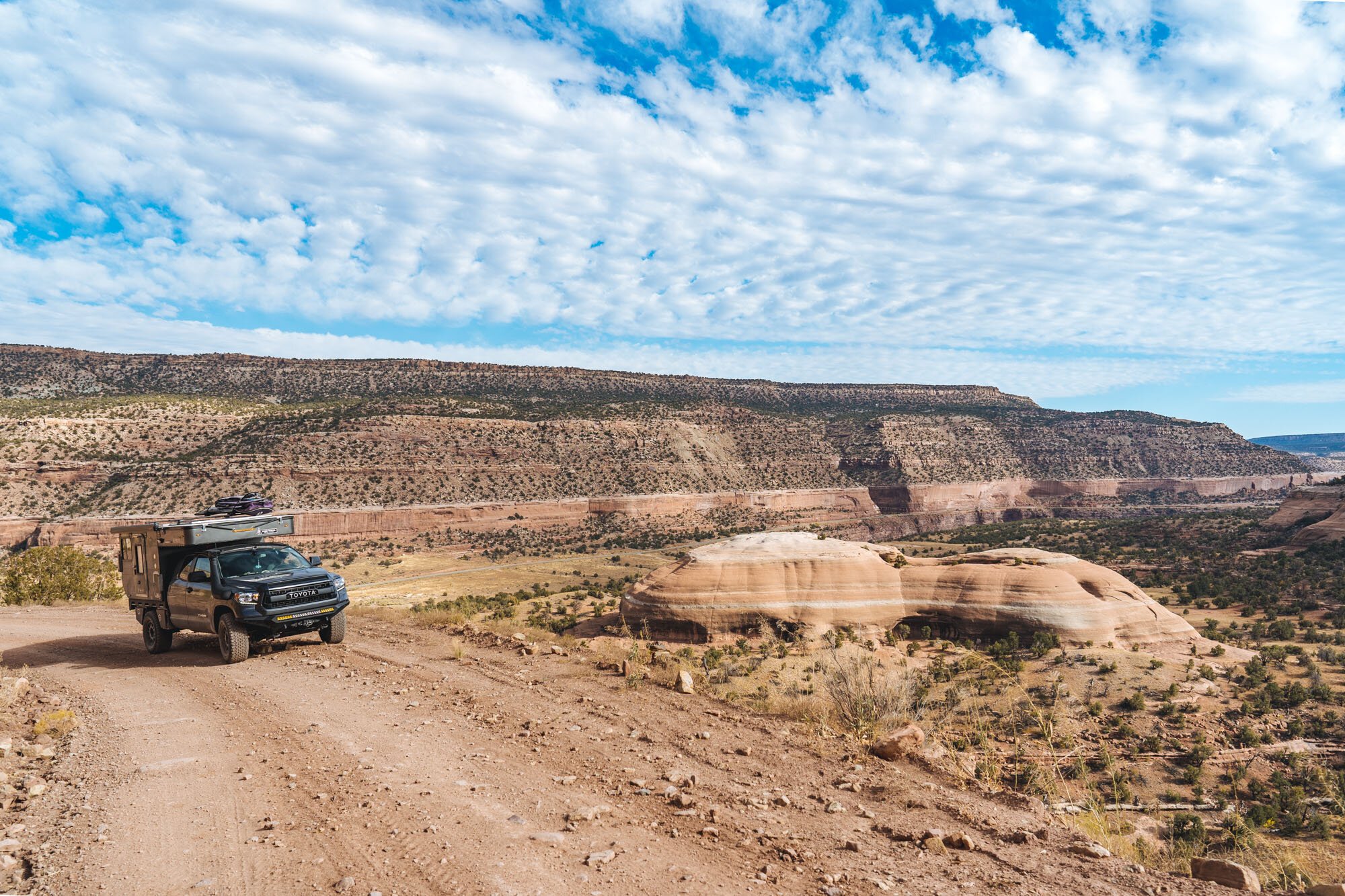
MAK overlooking the San Miguel River Valley
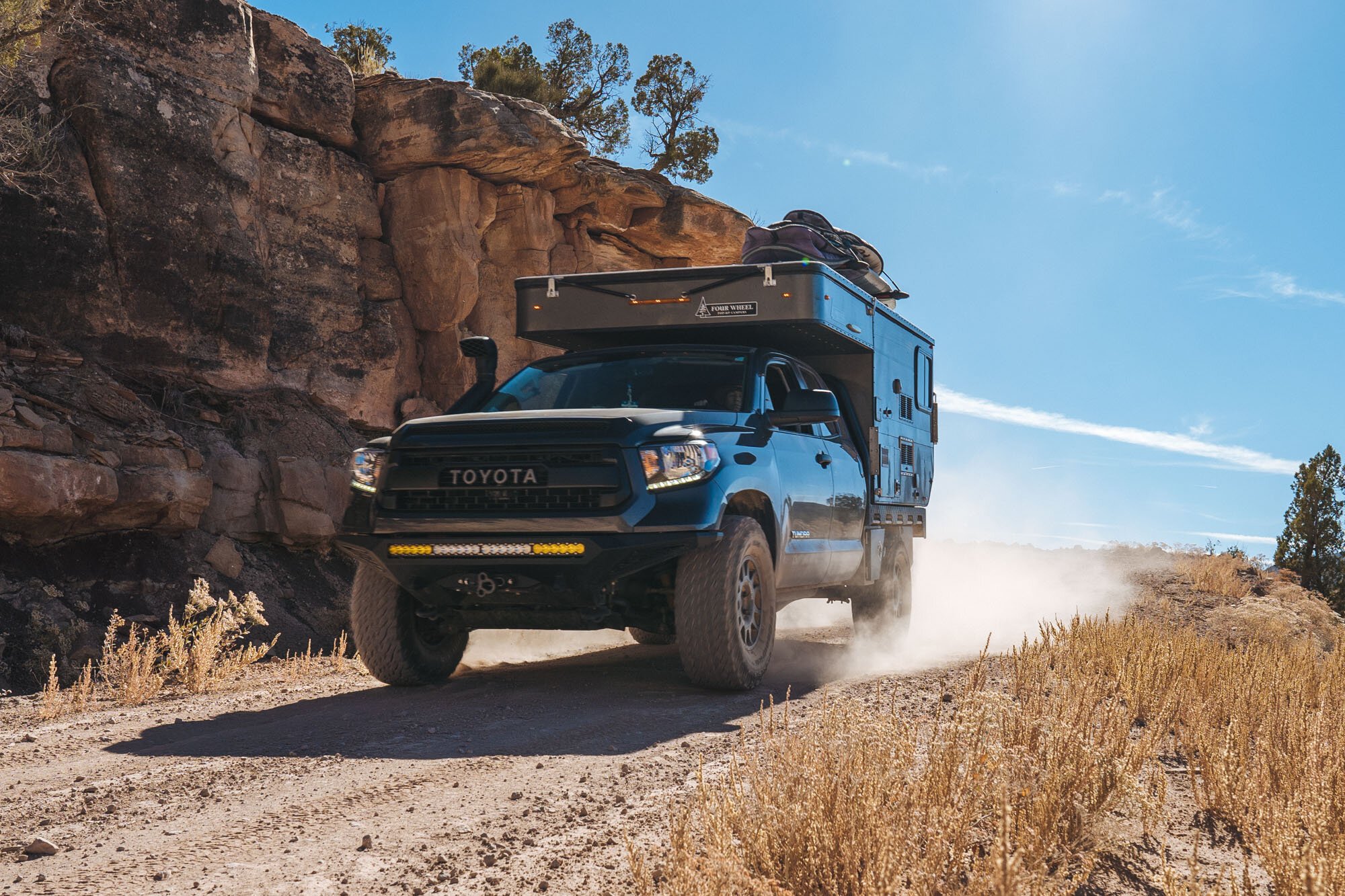
Come to think of it, the Rimrocker is actually the first real “4x4 trail” we’ve ever done. Due to the limitations of our previous vehicles, this was the first time we felt confident enough in our vehicle, driving skills, and recovery equipment to try something like this! Needless to say, we were excited to get started.
Montrose - Nucla

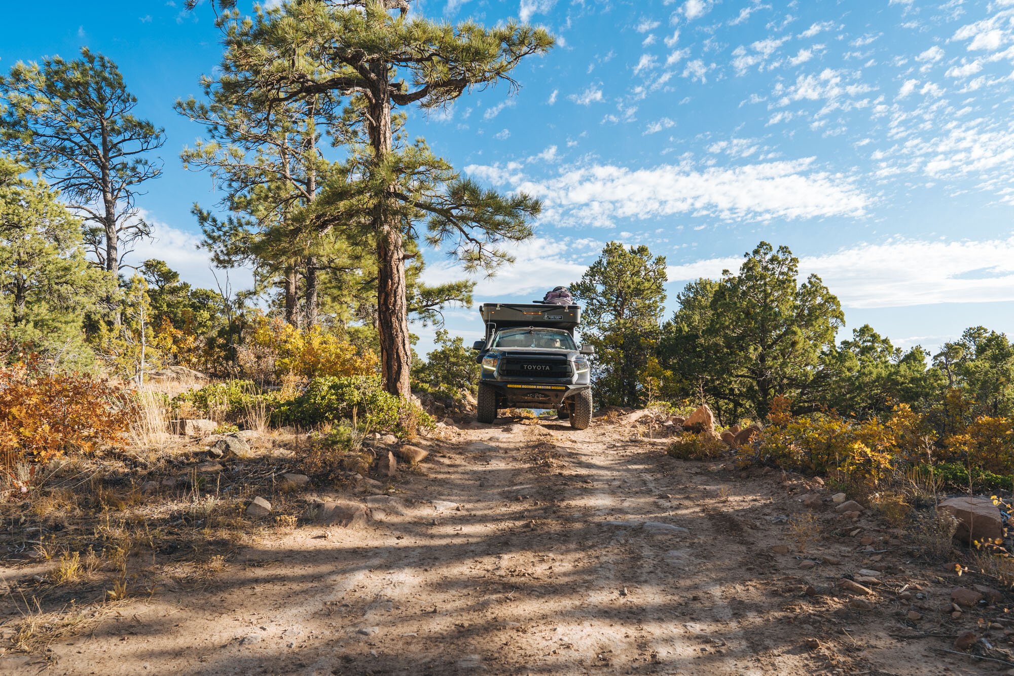
MAK driving towards the start of the Rimrocker trail
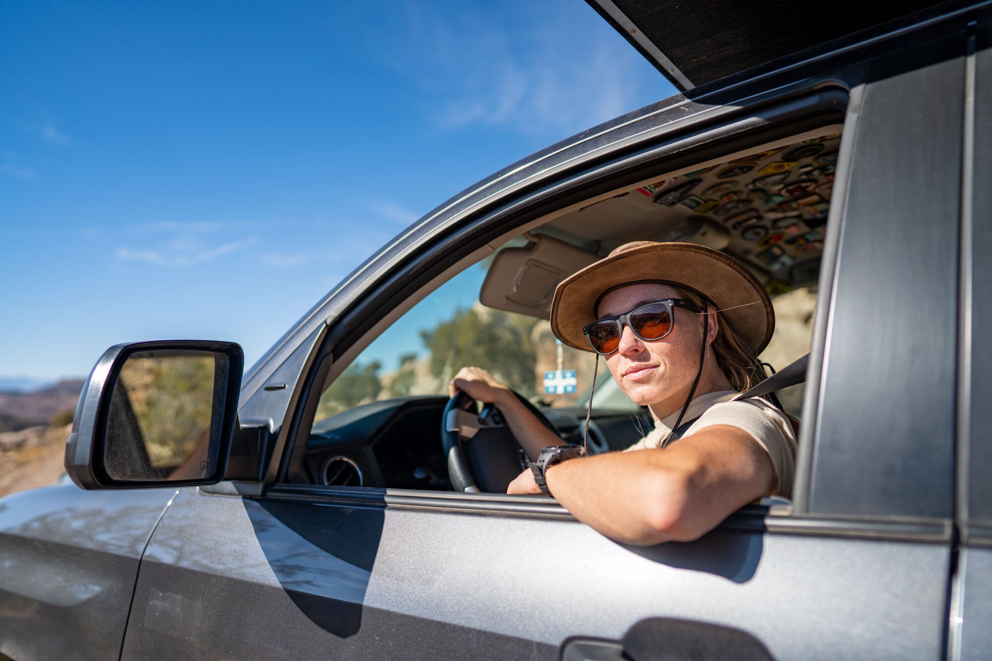
The trail officially starts in the town of Montrose Colorado. We arrived in town first thing in the morning to get an oil change and alignment at the local Toyota dealership before loading up on supplies for the four days we planned to spend on the trail. Sadly, the errands took most of the day, leaving us to start the trail as the sun was setting. Not wanting to miss anything we went a quick 20 miles before pulling into the Iron Spring Campground for the night.
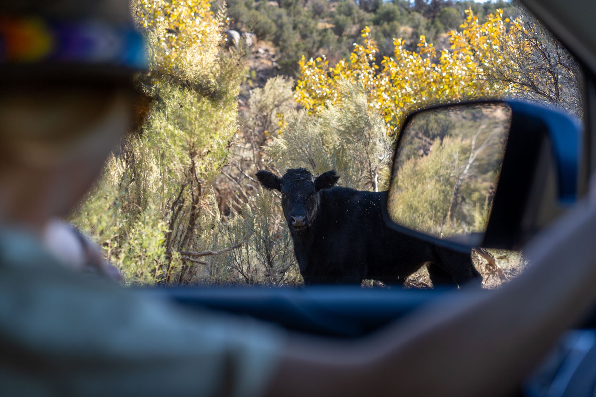
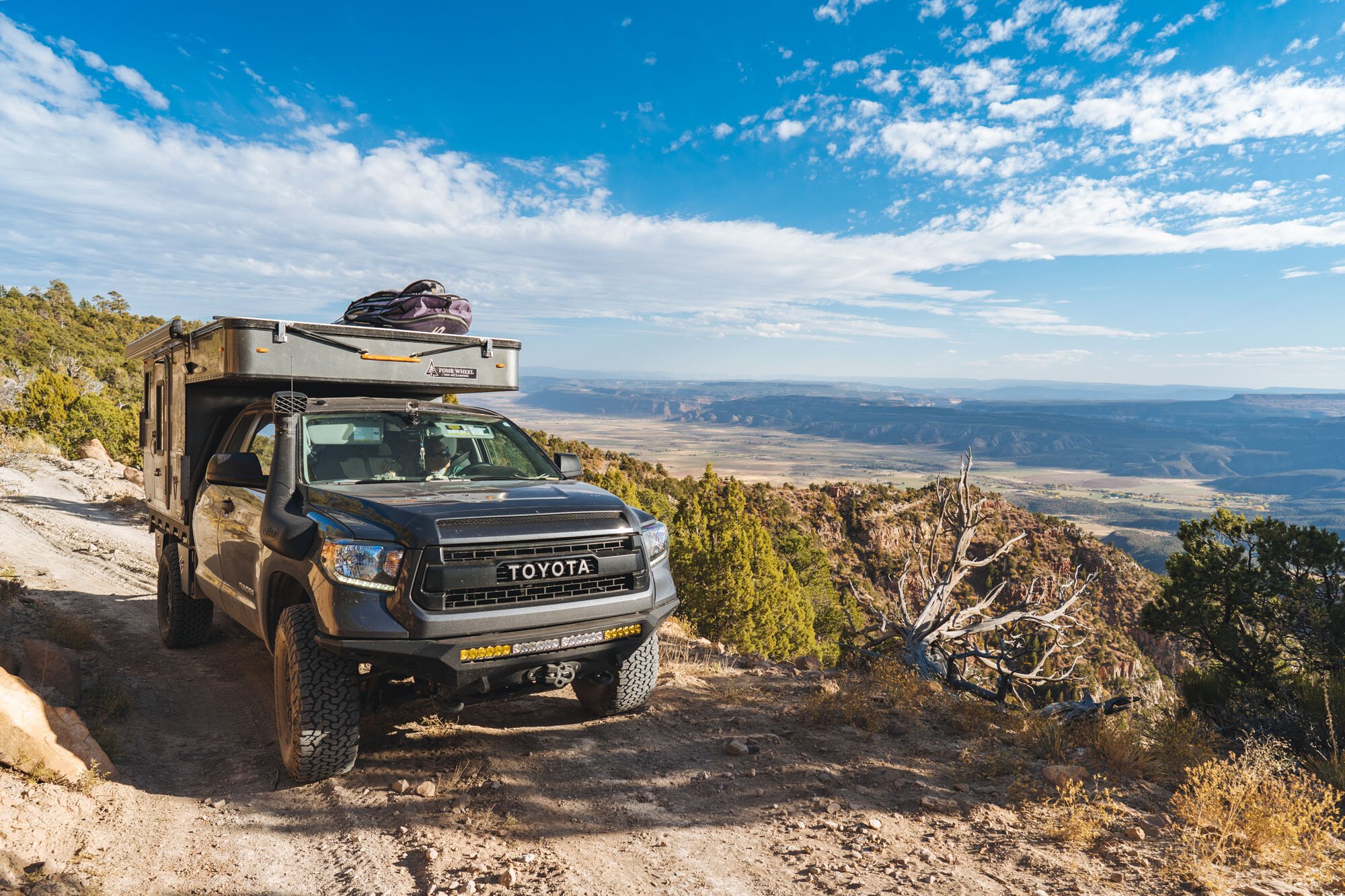
The next morning we woke up and headed out early to make the most of our day. With the Uncompahgre Plateau nearby we decided that could be a good place to stop and make breakfast with a view. The drive was beautiful through the remaining fall colors and we passed many operational logging roads and slack jaw cows as we made our way to the plateau.

The view on the drive to the Uncompahgre Plateau

The view on the drive to the Uncompahgre Plateau

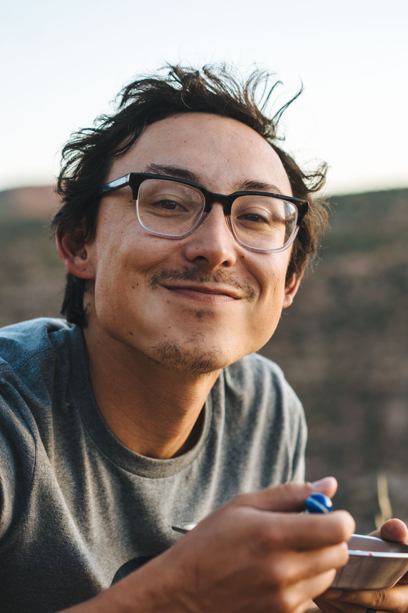
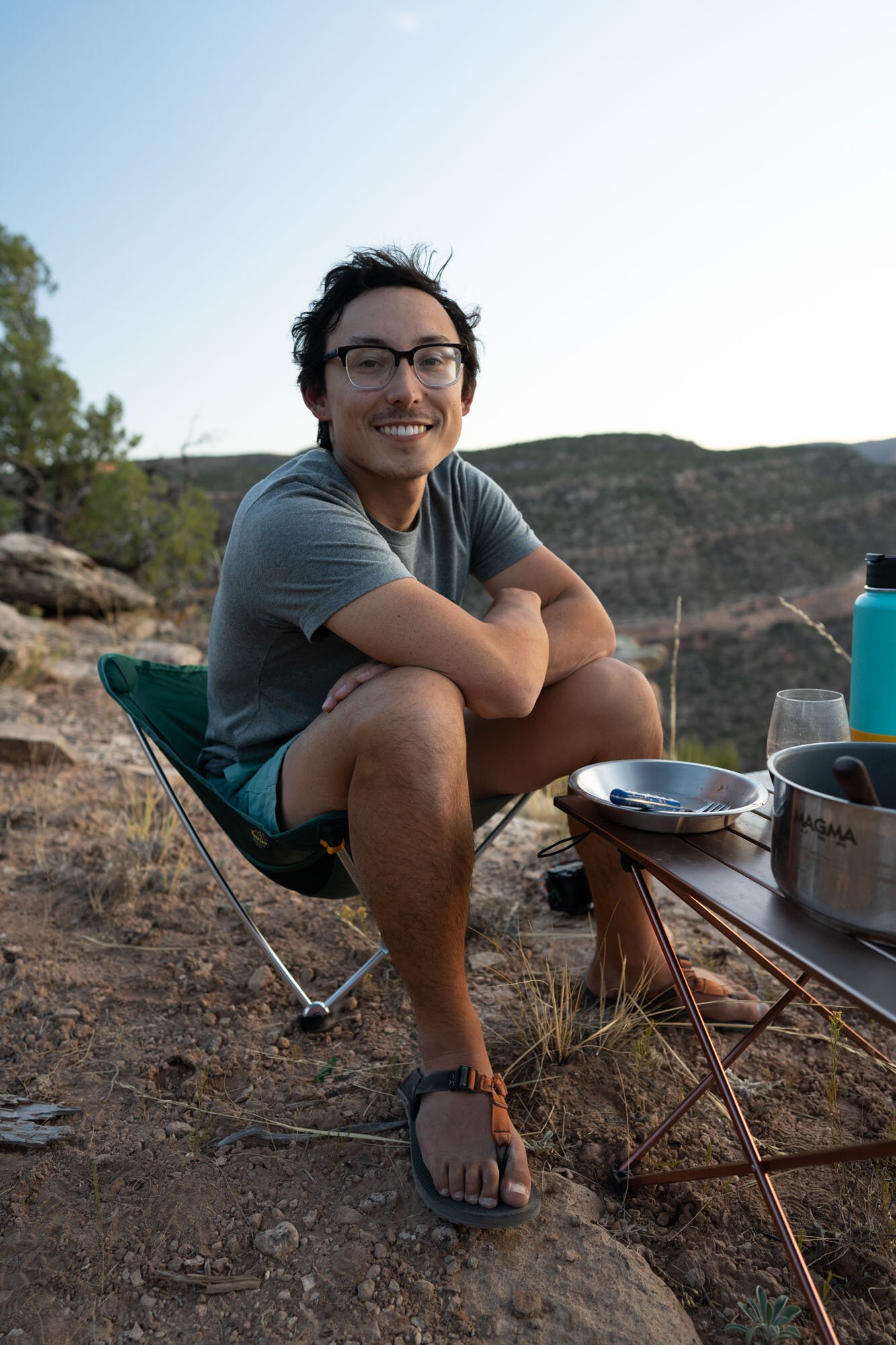
Owen is such a cutie

Breakfast at our overlook
We found a pull off with a view on the descending side of the plateau heading towards Nucla and stopped to make breakfast. Sadly, this is also where our brand new DJI drone stopped working (this is our second and it was having the same problems)! So please enjoy this last image we got from it.

Our breakfast stop/last successful flight of our drone
After our pitstop, we descended into the sleepy, little town of Nucla. We stopped to take a look around before heading to the equally small town of Naturita, which was just a quick detour away from the official trail. Being that we arrived a little early for lunch there wasn’t much keeping us, so we pressed on.
Note: There is no cell service in either town and it’s also the last chance for gas until Utah if you plan on following the Rimrocker past HWY 141.
Nucla - Highway 141
After putting in some more miles, we stopped on the side of the trail to make lunch. We made the mistake of letting Luna walk around before we realized that the only vegetation for as far as the eye could see were plants with thousands of little burrs. After scooping Luna up and putting her in the camper we noticed she was having a hard time walking because the burrs coated her belly, legs, paws, and were even in her mouth. Though she protested, it was in her best interest that we got as many off of her as possible. As you can see, she loved that idea.

Lunch Stop

Trying to get the thousands of burrs off Luna
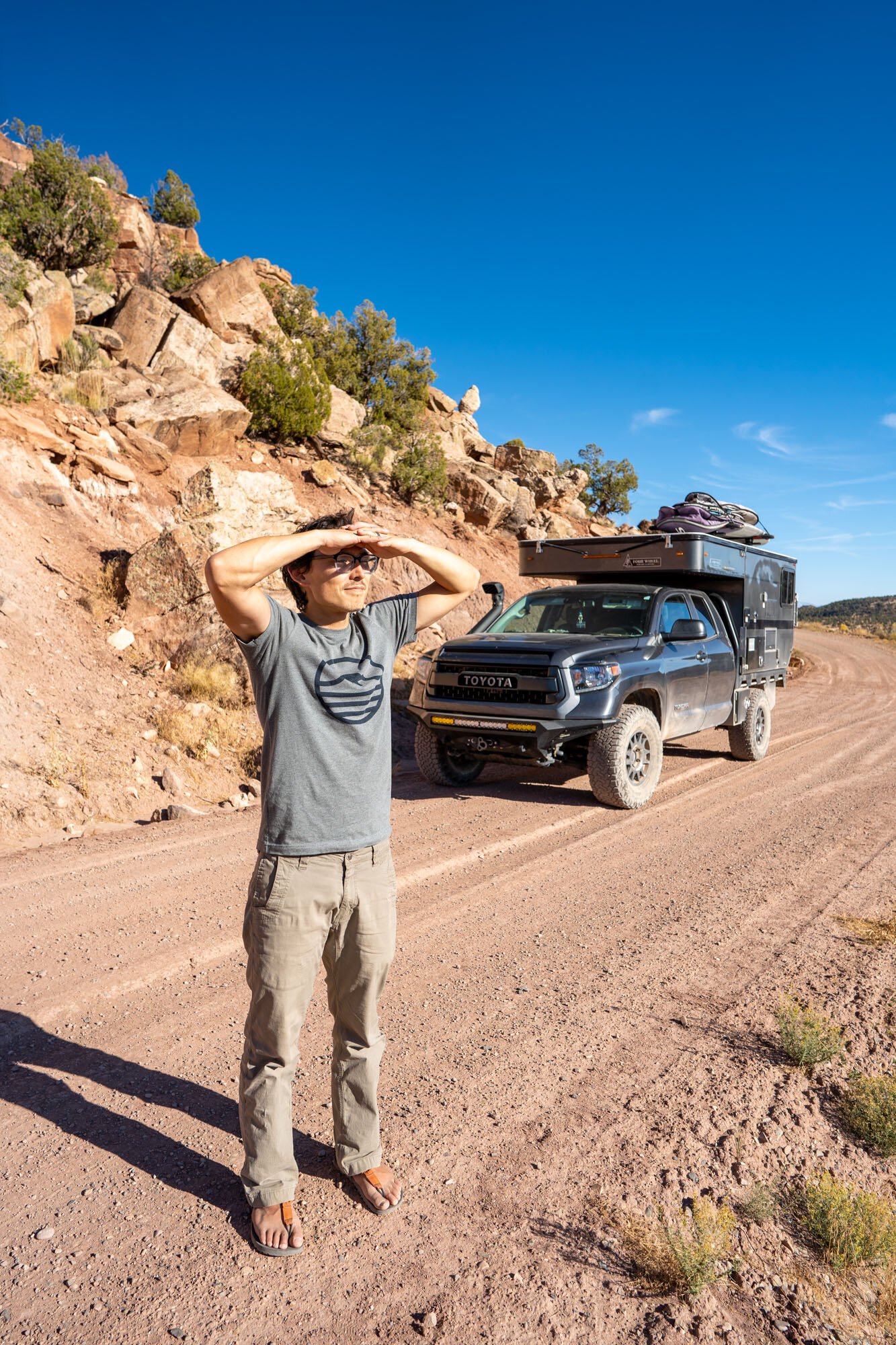
After lunch, we continued down the road and went through some of the most technical, but still pretty mild, sections of trail yet. We eventually came to the rim of the San Miguel River Valley and the official start of the Uravan Mineral belt which is home to over 200 mines. This area is rich in carnotite ore, which contains radium, vanadium, and uranium. The rest of our drive to camp was dotted with mines named Joe, Sandy, Fox, Dolores, Club Sandwich, Last Chance, Big Dick, and Little Dick to name a few.
We spotted a little road that branched off the Rimrocker and decided to see if we could find a camp spot for the night. Sure enough, we found a beautiful spot on the edge of the cliff line overlooking the San Miguel River and the surrounding valley. We also could see four mines that were in direct proximity to our home for the night.

Fancy Feast

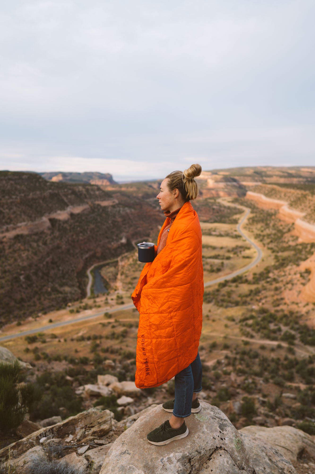
at our campspot
Exhausted from the day of driving, which feels silly to say, we decided to save exploring the area on foot for the next morning and got to work on dinner, Fancy Feast! For those of you who are worried that we’re referring to cat food, it’s actually a little tradition that Owen and I have. It consists of a nice bottle of wine, cheese, charcuterie, some yummy sides, and a beautiful view. With the San Miguel River Valley just below and a dear friend to toast, it felt like the perfect place for a Fancy Feast.
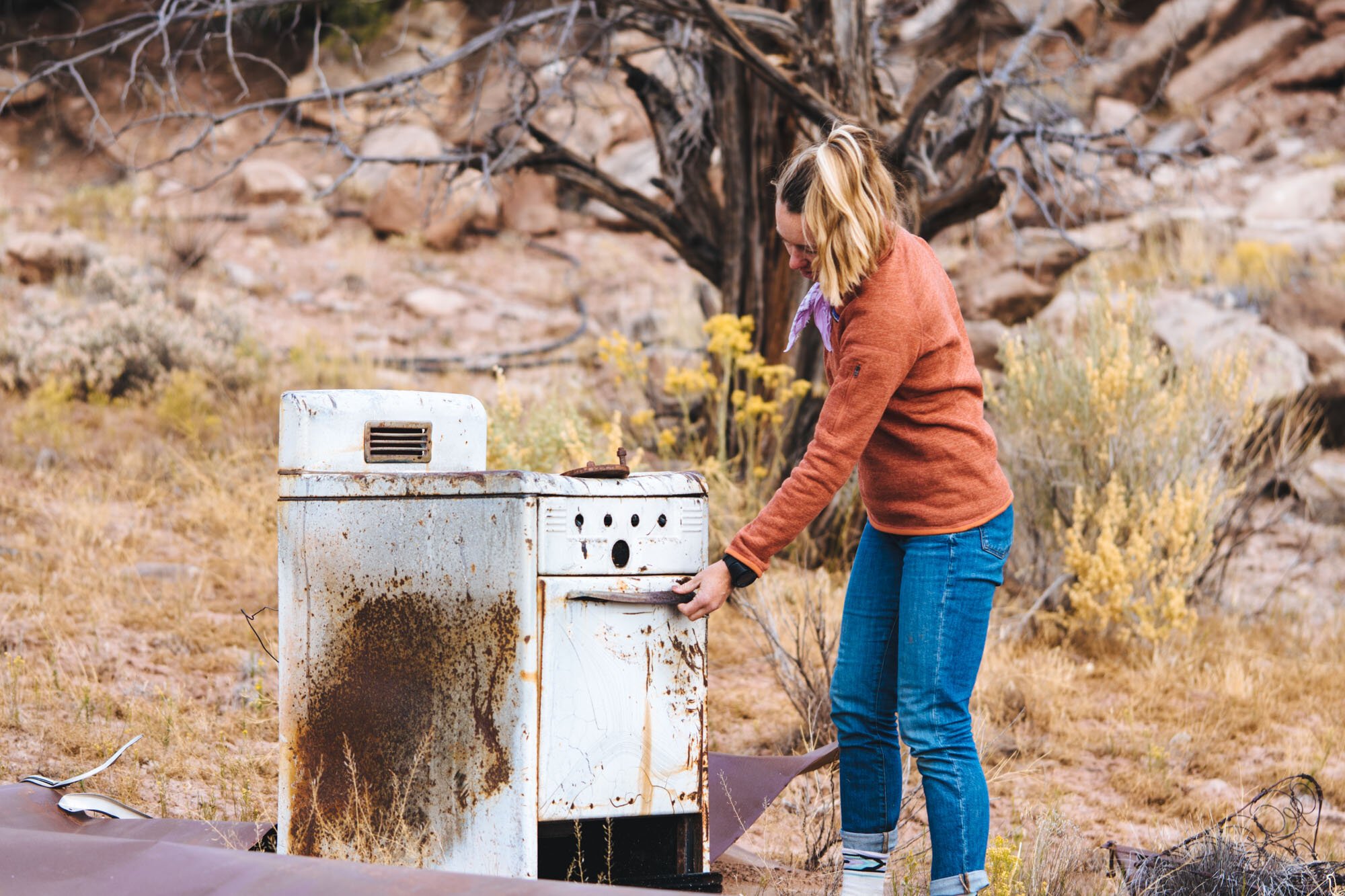
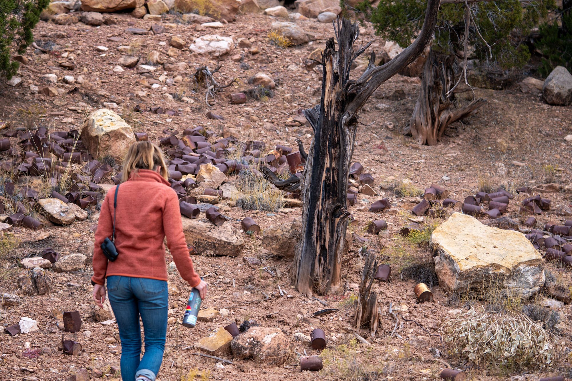
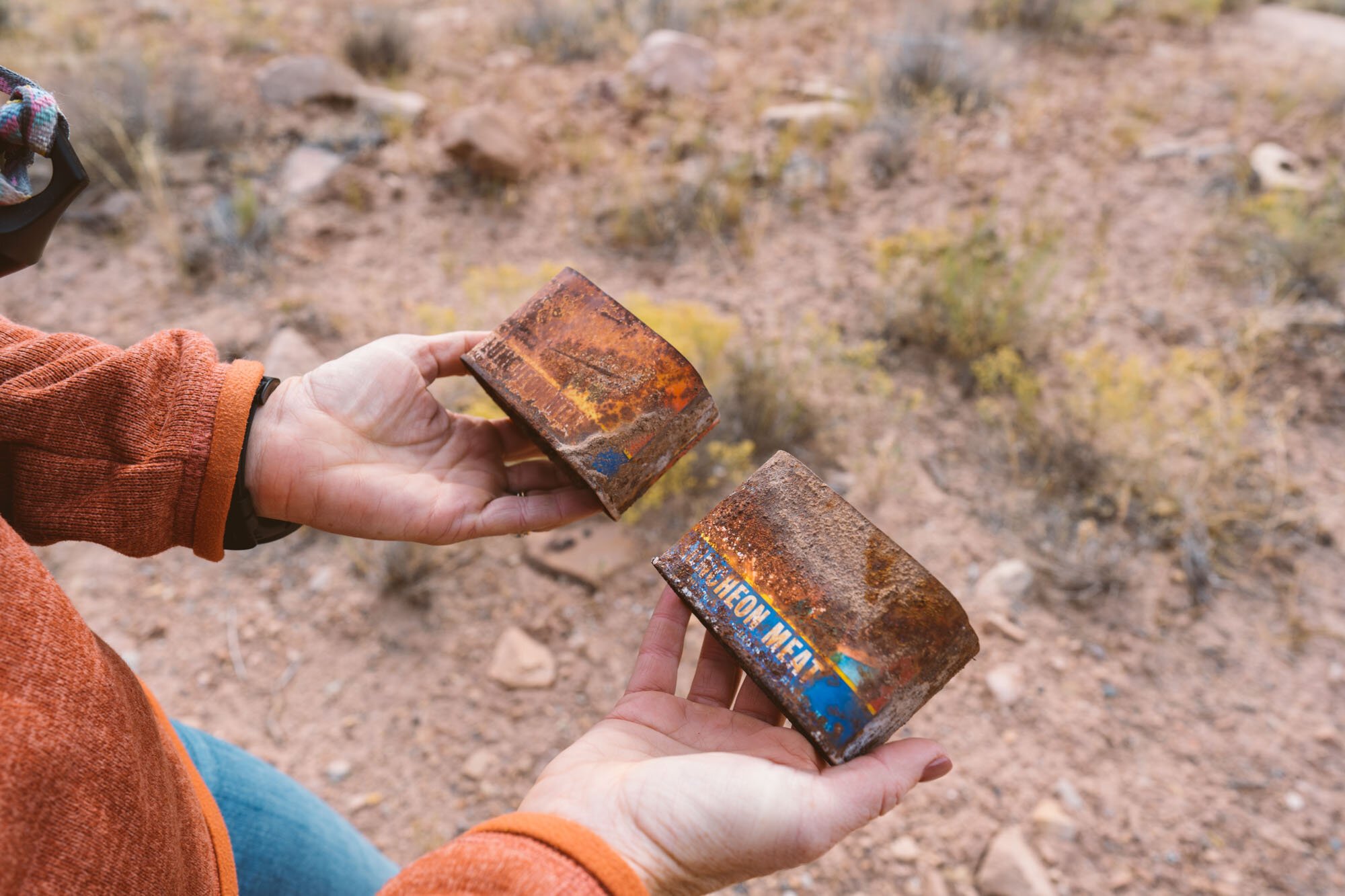
The next morning after we enjoyed our coffee with a view, we went off on foot to explore the nearby mines. Just a quarter of a mile from our camp was where an old miner dwelling perched on the same ridge. We found the old refrigerator, oven, countless tin can meals, and even pieces of old dinner plates among the wreckage. This area is so dry that we even came across a pile of eggshells that have been out there since the days of the mine operation.
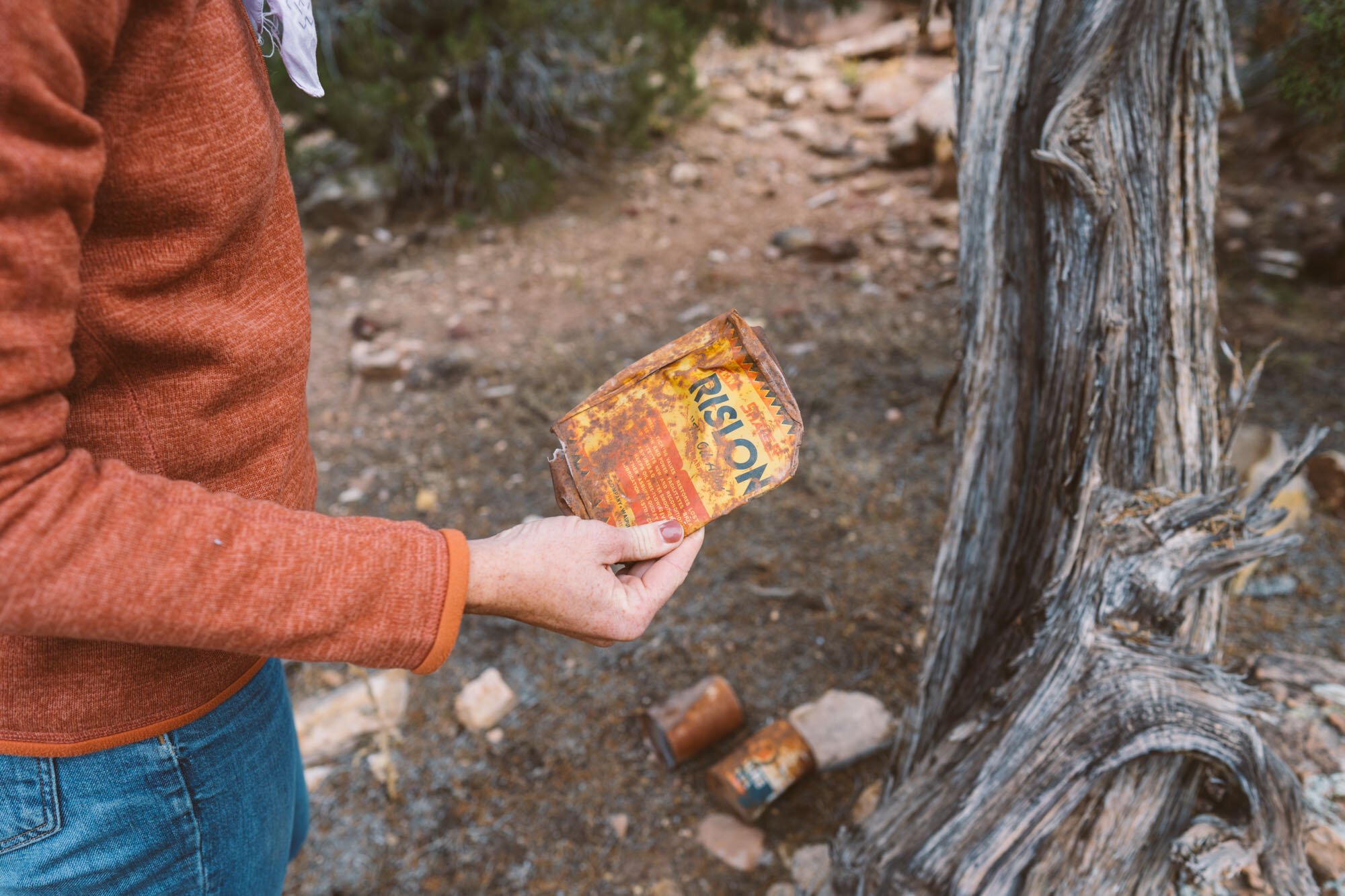
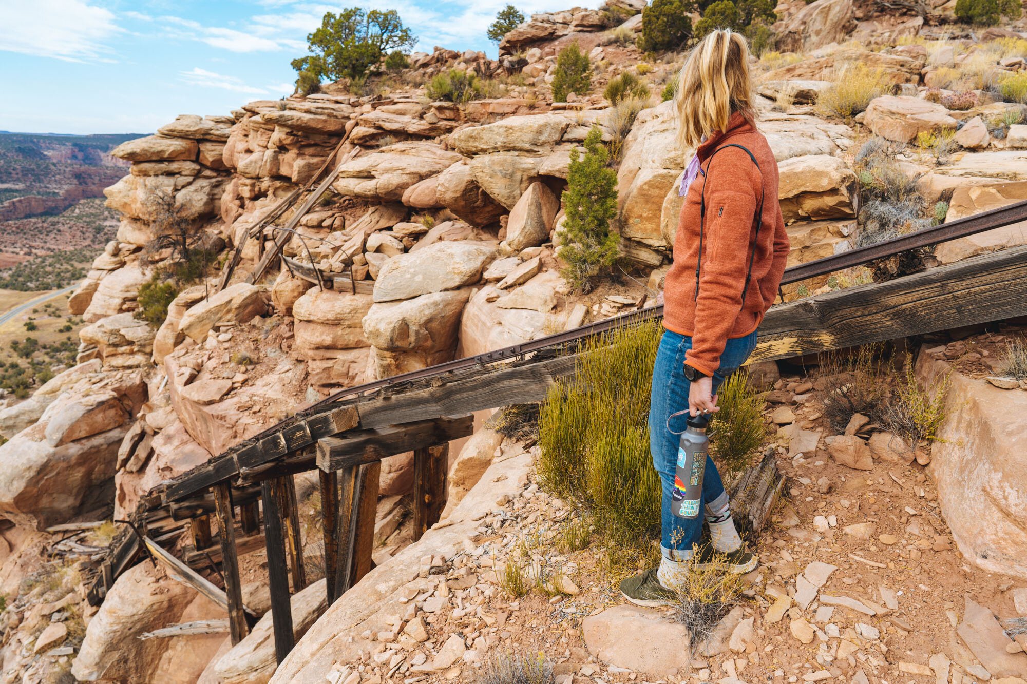
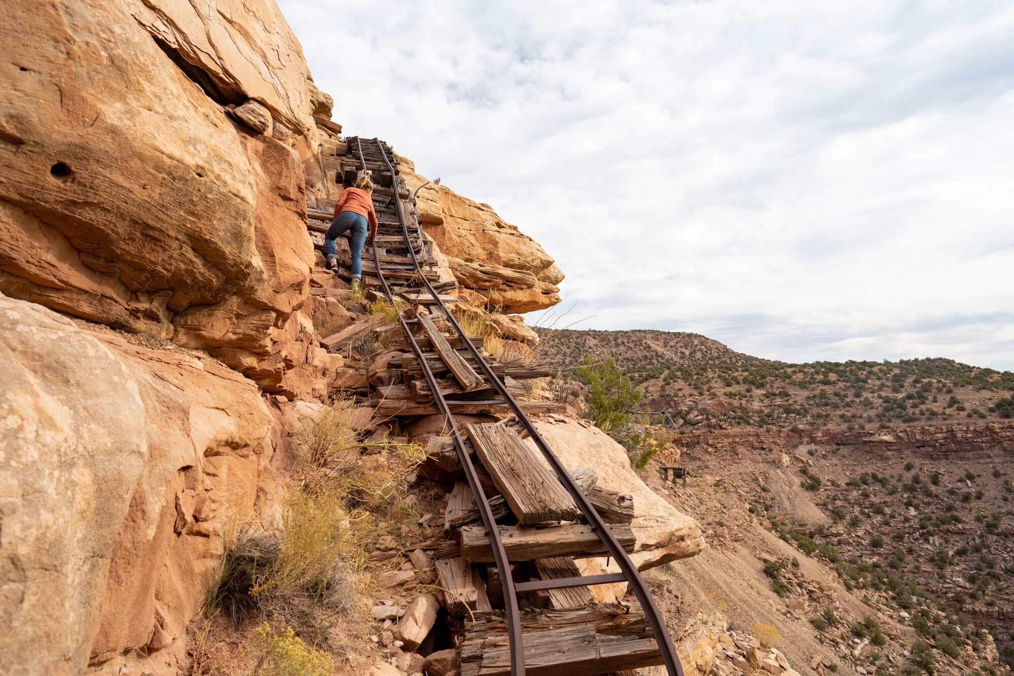
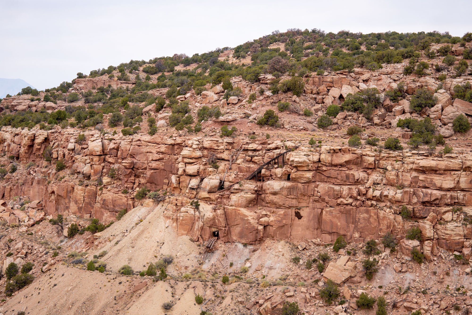
We spotted some rails disappearing over the cliff and decided to check them out. The rails went all the way down into the mine… Ask me how I know that!

Entrance to the mine near camp

View from the mine entrance

The mine entrance
After being confronted by signs stating that the mines are still radioactive, we back-peddled our way to camp where we packed up and headed down the road to Highway 141.
Highway 141
When we intersected the pavement of Highway 141 we decided to make a detour to see a few points of interest that all lie just a few miles off the Rimrocker.
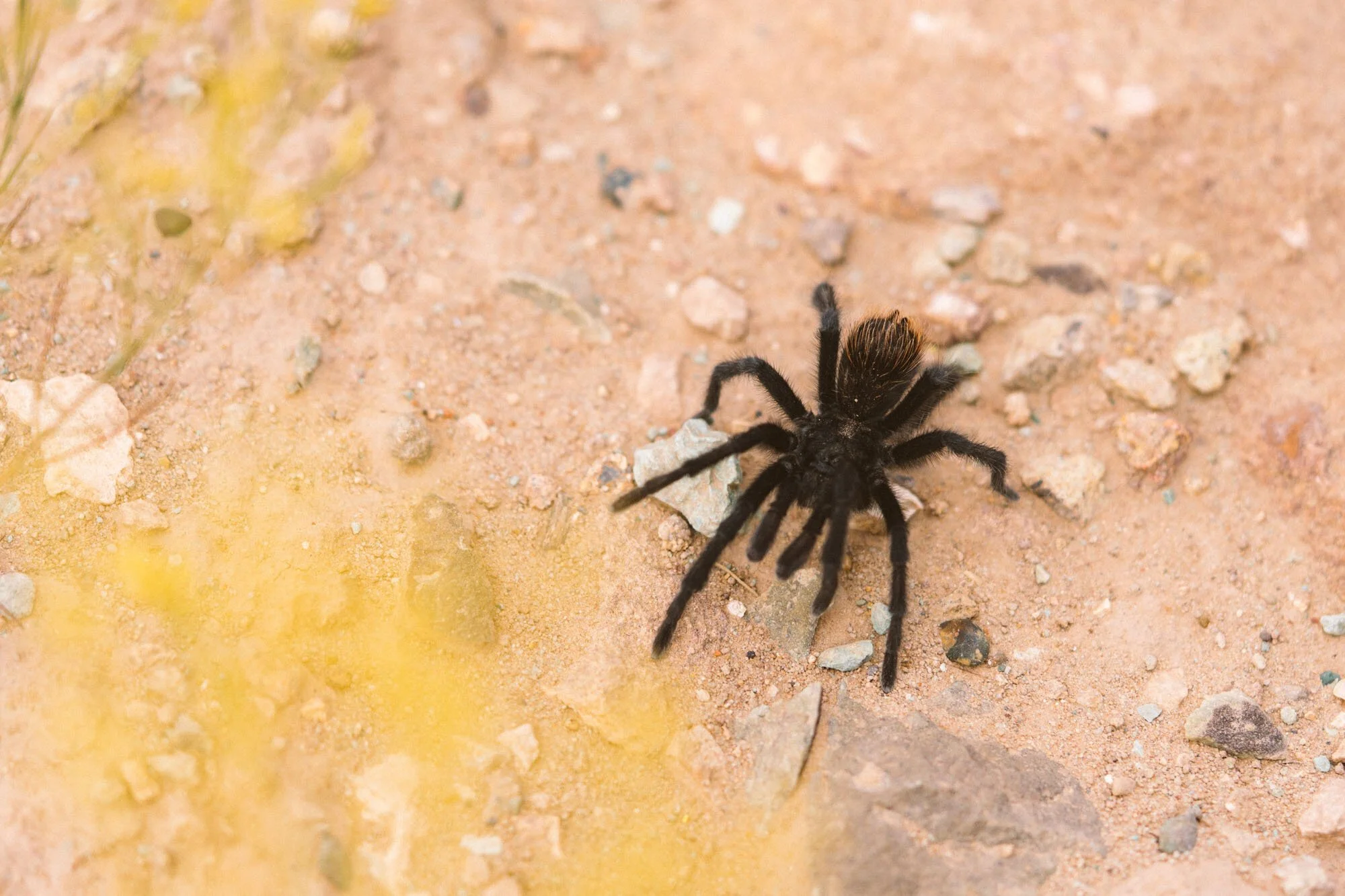
Look at this little tarantula we found!

Coke Oven
The first stop was to the roadside coke oven. Constructed in the late 1800s the oven was used to convert green coal into coke coal, which burns much hotter and produces virtually no smoke.
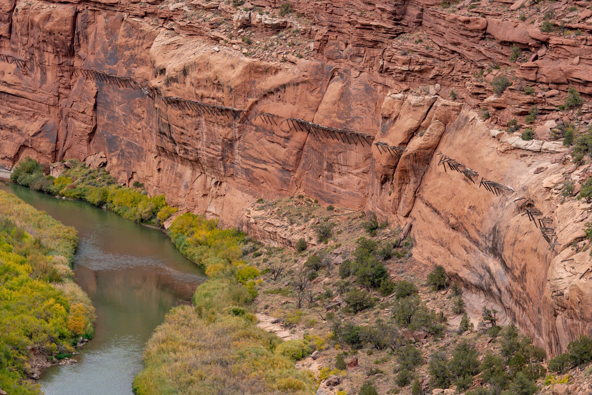
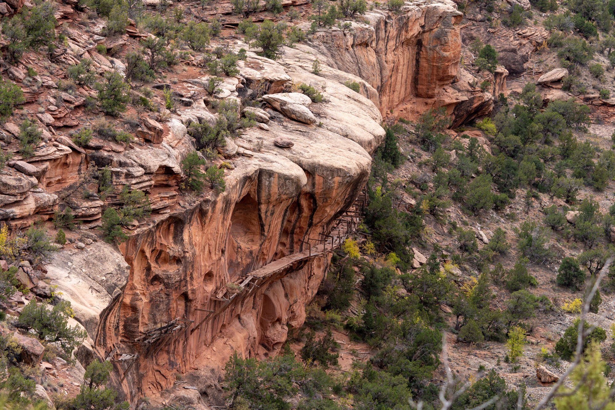
Continuing south on Highway 141, the hills were spotted with more mines on the eastern side of the valley. We stopped at an overlook to see the remains of the Dolores River Hanging Flume. The flume was completed in 1891 and was an architectural achievement that was celebrated around the world. The flume carried water from the Dolores River, upstream more than five miles to the Lone Tree Placer Gold Mine. Sadly, the mine was less successful than the flume and was shut down shortly thereafter. The wood used to construct the flume was sourced from Pine Flat and Carpenter Ridge near Buckeye Reservoir, which we would drive through later that day.

The confluence of the Dolores and San Miguel Rivers
Just another mile down the highway we pulled down an unmarked dirt road where we parked and walked to an overlook of the confluence of the Dolores and San Miguel Rivers. Being that the two rivers are different colors, it was interesting to see the two converge and swirl together as they travel downstream as one.

Sign about the town of Uravan
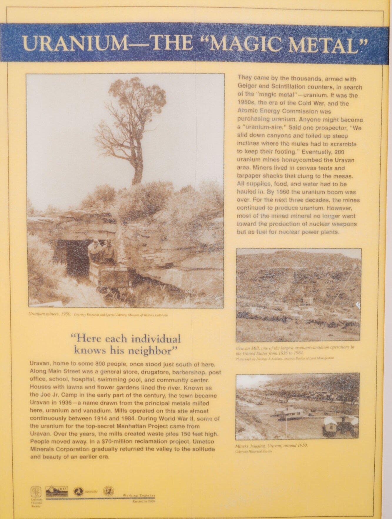
Going just a bit further south on Highway 141, we reached our furthest point of interest, the former town of Uravan. Uravan was a company town established by the Vanadium Corporation in 1936. The entire town of 800 people supported a mill whose sole objective was to process the carnotite ore into uranium oxide, aka yellowcake. The yellowcake was sent elsewhere to be enriched into pure uranium, some of which was used in the atomic bombs that ended World War II. Insane right? The mill remained open until December 1986, but was then closed after the US stopped purchasing uranium, causing the entire uranium industry to go belly up. After the mill was closed for business, a Superfund cleanup began to do its best to remove the radioactive town and mill. Now all that can be seen in the town of Uravan, which is still listed on any map, is fenced off fields warning that the area is radioactive. It’s an incredibly eerie sight to see and left us wondering what became of the miners that worked in a mill that was so radioactive that they’re still cleaning it up today. Nearby there was a sign (provided by the still present Vanadium Corporation down the street) stating their pride in the cleanup efforts to return “the canyon almost as it was before mining operations began”... Minus the many radioactive signs ;)

San Miguel River Valley in all of it’s glory
Side note: Even though Uravan and the surrounding mines kinda gave us the willies*, we HIGHLY recommend spending some extra time to see them. It’s an interesting and seldom told part of our history that is worth knowing about, and the San Miguel River Valley is unspeakably beautiful in its own right!
*We found a few dead cows on our way out to the confluence of the Dolores and San Miguel Rivers.*
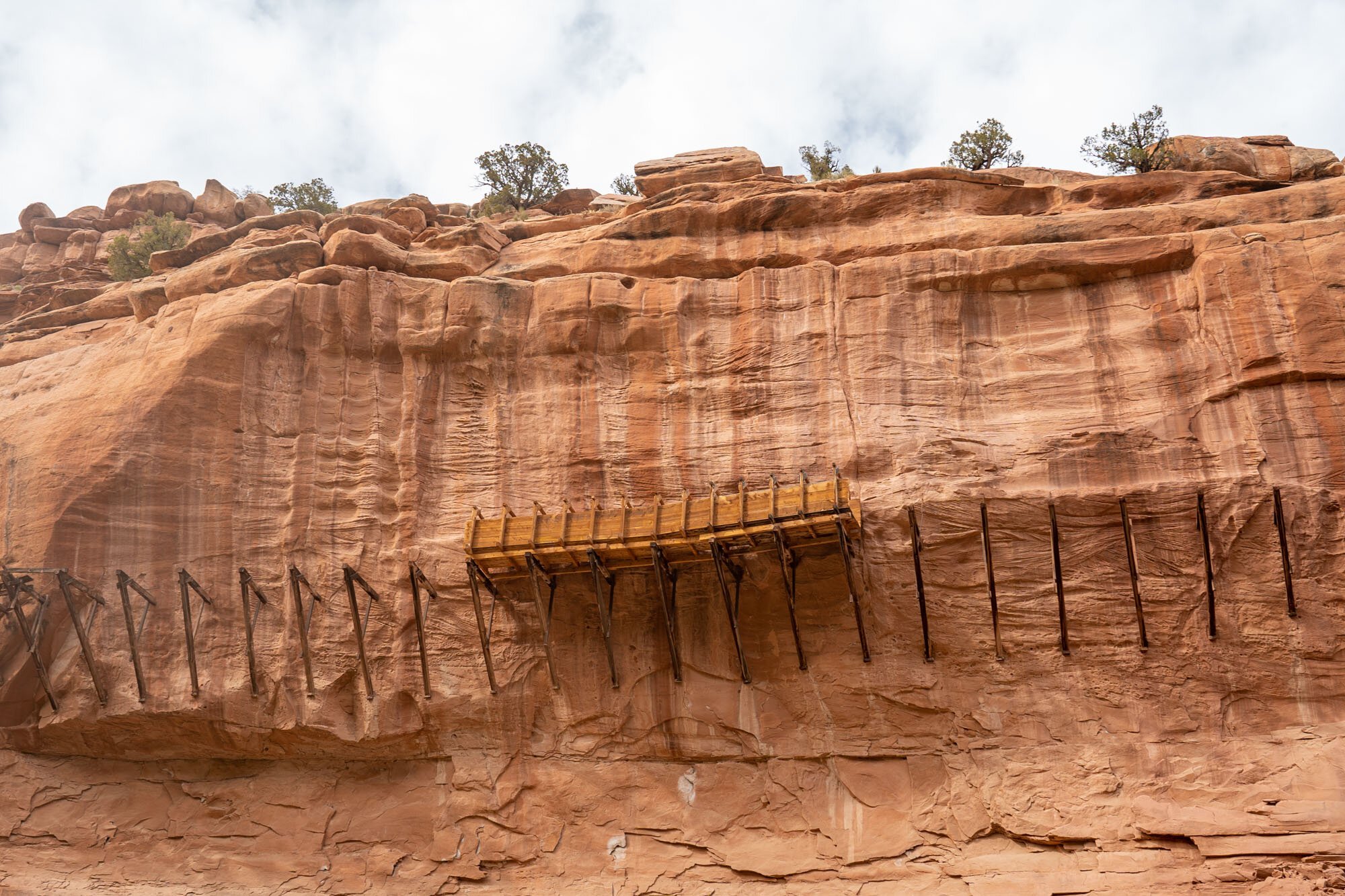
The reconstructed section of the Hanging Flume
After being sufficiently creeped out we decided to make one more stop before heading back towards the Rimrocker. We crossed the Dolores River on a bridge and followed Y11 Road alongside the Dolores to get a closer look at the hanging flume. If you have any extra time, we highly recommend that you explore down Y11 Road. Just a few miles down we came to our destination, a fully reconstructed section of the Hanging Flume. We thought it would be interesting to see the flume in its original state to get a better idea of how it worked. There was a little pull-off at the site where we made and enjoyed our lunch on the banks of the Dolores River.
After spending the vast majority of the day wandering the San Miguel River Valley we surmised that we could spend several days exploring this area and still not see everything we’d like! Despite that, we made our way north and back to the Rimrocker.
141 - Two Mile Road
The road climbed steeply up the side of the San Miguel River Valley past biscuit rock. We drove alongside more mines (which we believe were radium mines because they were named Radium King and Radium Queen) until we reached Pine Flat. The flat was some of the most forested sections of the trail thus far and is the home to the wood sourced for the Hanging Flume. For a while, the road was made up of deep sand before we turned onto the side of the flat to get sweeping views of the valley below.

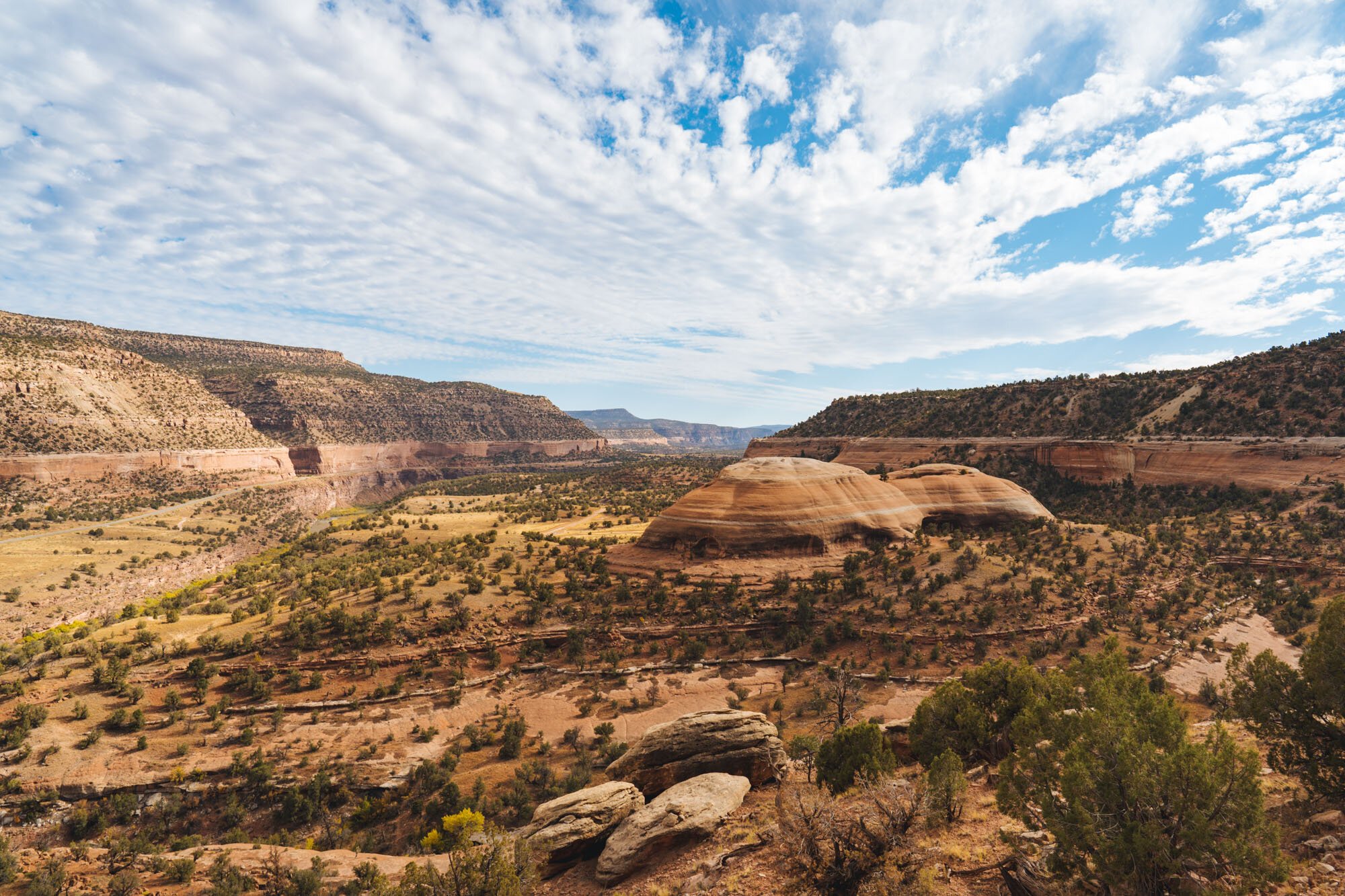
View of Paradox Valley
Paradox Valley was strikingly beautiful and got its name from the Dolores River which “paradoxically” runs across the valley instead of with it. Fascinatingly, the valley was created from water flowing beneath an ancient salt dome. The flow of water eventually dissolved a subterranean layer of salt causing the weak sandstone above to collapse forming a valley where there was previously a dome. Nature is crazy you guys!

Roxy at camp
From there we continued towards camp. As we traced the cliff line of the Paradox Valley the road had some technical features and a sharp drop off on the left-hand side. A short while later we came to Buckeye Reservoir and Recreation area where we planned to camp for the night. Since it was late fall, there was only one other family camped in the entire area and made for a nice quiet night. To that point, we’d only seen a single person on the Rimrocker Trail since leaving Nucla!
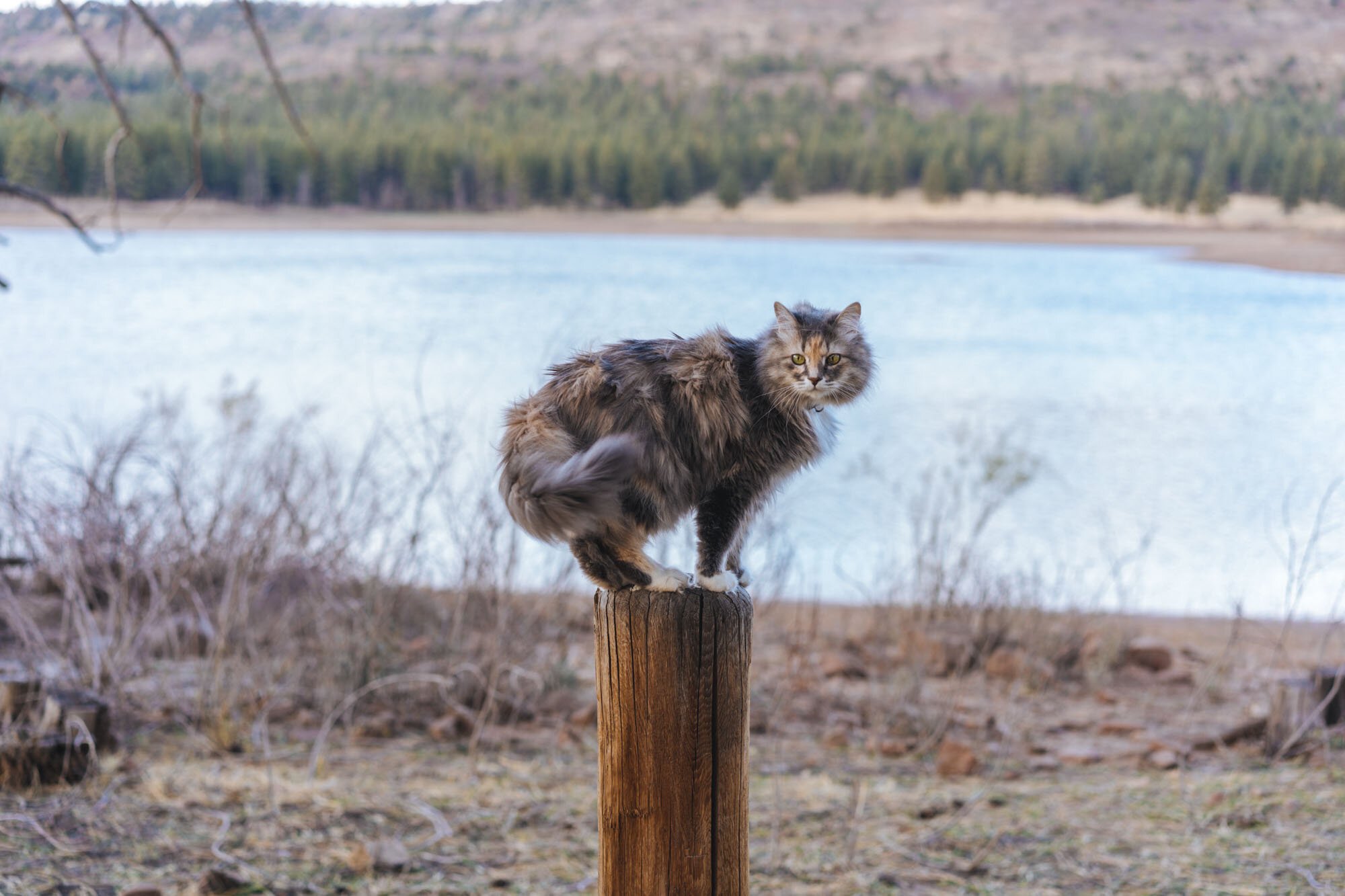
Luna at Buckeye Reservoir

Roxy at camp
Luna loved walking around the lake and staring daggers at the free-range cows that called the lake home. From our camp spot, we had a vault toilet to ourselves and uninterrupted views of the La Sal Mountains off to the west.
The next morning we woke up for our last day on the Rimrocker. After coming around the far side of the reservoir we came to the Colorado and Utah border, which marked our last stretch of road before we would be exiting the trail at Two Mile Road.

We caught a few of the last yellowing Aspens shortly before leaving the Rimrocker
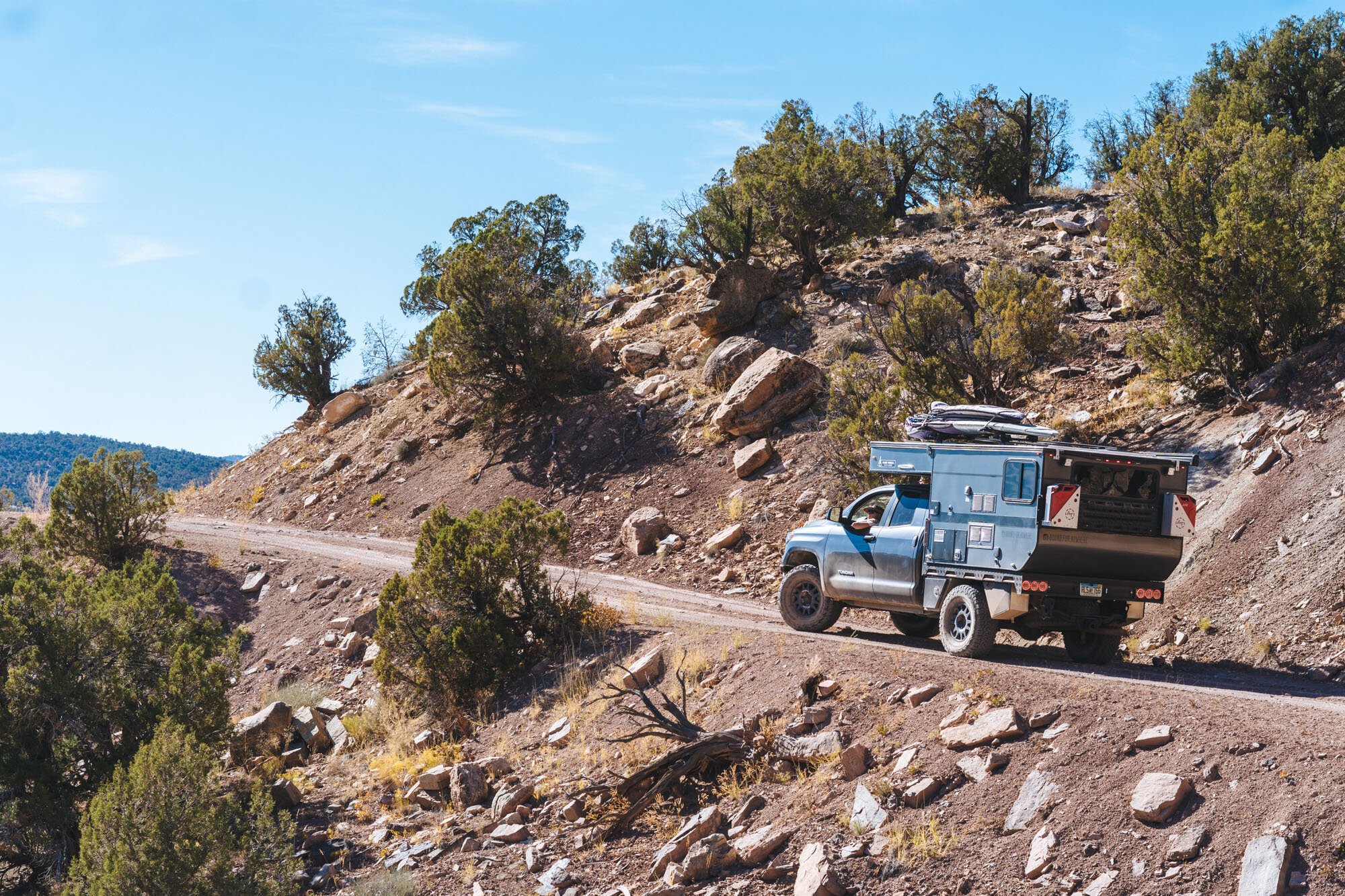
The vast majority of the driving was on easy roads that took us through many different ranch lands. The La Sals got a fresh blanket of snow the night before making for a very picturesque drive through the last of the yellowing aspens. Before we knew it, our exit off of Two Mile road arrived and we hit pavement for our last stretch towards Moab.
The Rimrocker does continue all the way to Moab but we read that the last bit is “an overly rough cobblestone street” and gets really narrow. We read this from people who were traveling in Jeeps, which are much narrower than we are. We opted to exit to save our paint and because we didn’t want to give our cat shaken baby syndrome.

View of the La Sal Mountains from the Rimrocker
We really loved the Rimrocker Trail. We felt that it was a great “first time trail” that also features tons of history and interesting waypoints to get you out of the car along the way! I know that after reading this a lot of you will be curious if your vehicle could successfully do the trail. There is one river crossing after Nucla and before HWY 141 that gets deep during the spring run off. At times it can be totally impassible. By going in the fall, the creek was entirely dried up. We could have easily done the entire road in 2WD if we wanted to, but in areas of sand and uneven rocks 4WD is really nice for peace of mind and control. There are just a few spots of technical driving that are easy to navigate. Overall any stock 4WD vehicle should be fine on this trail. Even a capable 2WD would probably be okay. If you’re concerned about the capability of your vehicle or unsure of your skill level driving, we highly recommend that you do the trail with someone else so that you’ll have backup if needed. Otherwise, this is a great entry-level trail and we highly recommend it!
Thanks so much and we hope you enjoyed!
MAK & Owen
Resources
Maps:
https://rimrockertrail.org/wp-content/uploads/2018/04/159729-MC-RimRocker-Trail-Map.pdf
Trail Resources:
https://www.jeeptheusa.com/rimrocker-east-20.html
https://expeditionportal.com/overland-routes-the-rim-rocker/
We’d like to dedicate this post and our time on the trail to Cicero Greathouse. You are a true friend and an inspiration that we will forever carry with us. You will be profoundly missed.